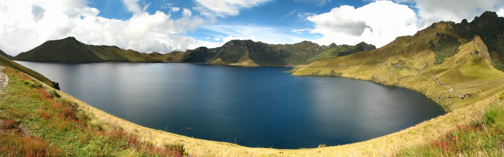
Accurate information on spatial rainfall patterns is crucial for many hydrological applications and for water resources planning. For the Water Resources Management Planning Program of the Provincial Government of Tungurahua in Ecuador this information is required to design appropriate and sustainable strategies for agricultural water management in the area and the planning of new developments. For this study, several TRMM satellite products were combined with existing observations of rainfall and detailed vegetation index (NDVI) time series to derive detailed temporal and spatial rainfall patterns for the sub-basins of the province of Tungurahua.

Accurate information on spatial rainfall patterns are crucial for many hydrological applications and for water resources planning, but are rather sparse, principally due to the limited number of weather stations in certain parts of the basins. Despite its importance, obtaining this data remains a challenge especially in high mountain areas, where the number of weather stations is often even more limited.
For the Water Resources Management Planning Program of the Provincial Government of Tungurahua in Ecuador this information is required to design appropriate and sustainable strategies for agricultural water management in the area and the planning of new developments. These policies require more accuracy at a higher resolution than what is possible with precipitation ground measurements. Too many data gaps are present in the rainfall time series recorded by weather stations and there is a lack of a well-established hydro-meteorological network.
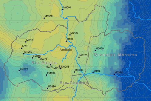
FutureWater has extensive experience in data processing and the generation of high-resolution precipitation estimates to quantify the spatial variability of water resources. The recent advances of the TRMM satellite data has opened a door to obtain reliable estimates of the spatial patterns of precipitation, especially in high mountain areas. For this study, we will combine several TRMM products with existing observations of rainfall and detailed vegetation index (NDVI) time series for the sub-basins of the province of Tungurahua.
Related publications
2013 - Remote Sensing of Environment
 Hunink, J.E., W.W. Immerzeel, P. Droogers. 2013. A High-resolution Precipitation Two-step mapping Procedure (HiP2P): development and application to a tropical mountainous area. Remote Sensing of Environment 140: 179-188X
A High-resolution Precipitation Two-step mapping Procedure (HiP2P): development and application to a tropical mountainous area
Hunink, J.E., W.W. Immerzeel, P. Droogers
2013 - 11th International Precipitation Conference
Hunink, J.E., W.W. Immerzeel, P. Droogers. 2013. Estimating the spatial distribution of precipitation using remote sensing proxies and observed data in a tropical mountainous region. Abstract for the 11th International Precipitation Conference, Wageningen, Netherlands, 30th of June – 3rd of July 2013XEstimating the spatial distribution of precipitation using remote sensing proxies and observed data in a tropical mountainous region
Hunink, J.E., W.W. Immerzeel, P. Droogers
2013 - FutureWater Report 125
Hunink, J.E., W.W. Immerzeel, P. Droogers. 2013. Análisis de Patrones Espaciales de Precipitación en la Provincia de Tungurahua. FutureWater Report 125XAnálisis de Patrones Espaciales de Precipitación en la Provincia de Tungurahua
Hunink, J.E., W.W. Immerzeel, P. Droogers
2010 - Environmental Modelling and Software
Quiroz, R., C. Yarlequé, A. Posadas, V. Mares, W.W. Immerzeel. 2010. Improving Daily Rainfall Estimation from NDVI Using Wavelet Transform. Environmental Modelling and Software 26: 201-209XImproving Daily Rainfall Estimation from NDVI Using Wavelet Transform
Quiroz, R., C. Yarlequé, A. Posadas, V. Mares, W.W. Immerzeel
