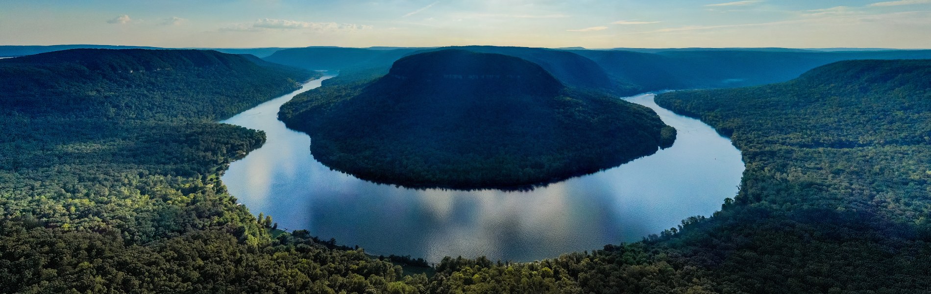
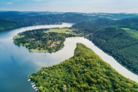
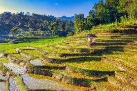
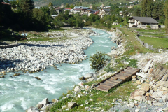
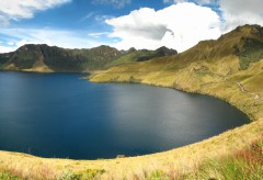
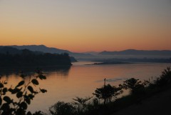
Challenge
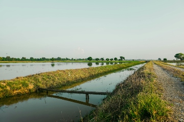
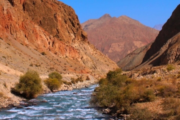
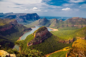
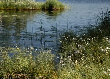
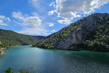
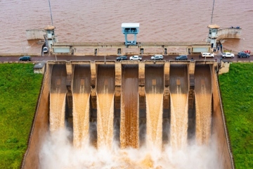
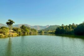
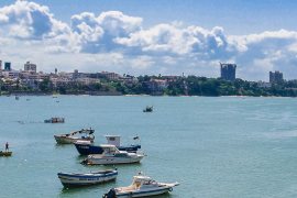
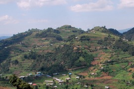
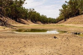
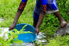
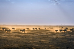
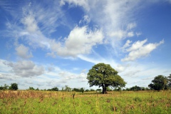
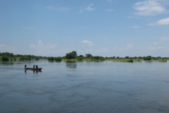
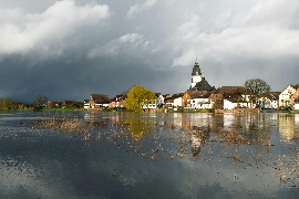
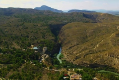
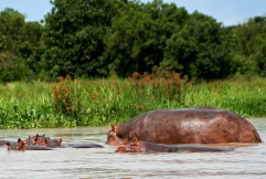
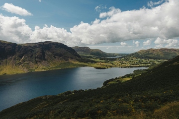
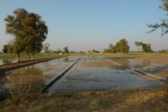
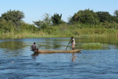
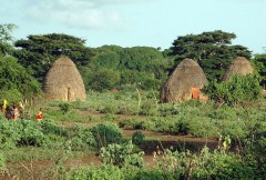
River basins are the natural unit of area in which to manage water resources. With intensifying water use, climate change, and land use changes, achieving sustainable water management on the river basin scale is becoming more and more challenging. Water needs to be allocated between different sectors such as irrigation, industry, drinking water supply, power generation and nature. Basin-scale plans for distribution of water and prioritization of water uses under stressed conditions need to be implemented to achieve this. A range of environmental, social and political issues need to be considered to achieve a sustainable supply of water, of the right quality and quality, to the correct location, at the right time. With water demands already exceeding availability in many regions, changes in climate patterns (often leading to prolonged droughts and more extreme rainfall events) are expected to further enhance complexities faced by decision makers. National governments, (transboundary) river basin management authorities, regional water boards, and NGOs increasingly require decision support tools and advice that address the issues related to water demand vs. water supply discrepancies, in order to ensure adequate supply of fresh water to all water users in a basin, now and in the future.
FutureWater approach
FutureWater is experienced in providing solutions for sustainable water management on a river basin scale. Our projects are managed through cooperation and participation with stakeholders such as governments, water managers and farmers, to ensure the uptake of local knowledge in our decision support systems and consultancy reports. By employing leading international experts in the fields of water resources management and hydrology, FutureWater can support clients in various ways:
Basin-wide water availability under changing conditions
FutureWater makes use of a variety of tools and simulation models designed for quantitative assessment of water availability on different spatial scales. These tools are deployed for baseline assessments as well as scenario analyses, in order to accommodate a range of future projections (climate, demography, land use, water resources development) to allow the decision maker to anticipate on future conditions. Crunching of Big Data associated with elaborate scenario analyses, into understandable and intuitive outputs, is part of the core expertise of FutureWater. Scenarios are typically developed in close collaboration with clients and other relevant stakeholders in the basin.
Optimizing river basin planning and water allocation
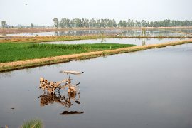
For river basin planning purposes, it is essential to relate water availability to water demand in space and time. Optimal water allocation rules need to be defined to achieve water management policies that are resilient to changing patterns in both supply and demand. This relates to both human water use and environmental flow requirements. By working with well-established water allocation optimization tools, FutureWater supports governments and river basin organizations in formulating water allocation policies and identifying opportunities for further, sustainable water resources development. Typically, concept-based decision support models are coupled to physically more advanced water resources availability models (see above), to provide the full, basin-wide picture.
Integrated planning based on the water-food-energy-ecosystems nexus
In the context of complex river basins, looking at water flows alone is not enough to achieve sustainable management of water resources. FutureWater has many years of experience in the development and application of tools for spatiotemporal assessment of crop production, potential for hydropower energy, and a range of water-related ecosystem services. By providing insight into the benefits to be had from basin water resources under different scenarios, FutureWater allows decision makers to account for the full water-food-energy-ecosystems nexus in river basin planning.
Our Solutions
Hydrological Modelling
SPHY is a spatial water balance model that integrates hydrological processes and is flexible in scale and time. We apply SPHY in various projects, such as understanding hydrological changes, watershed management, irrigation management, runoff forecasting, land degradation and restoration, energy assessment and hydroclimatic extremes research. The model can be adapted to different climatic conditions and uses different input data.
Water Allocation and Planning
We provide advice to water managers on different time scales, from day-to-day operational management to strategic decision making in river basins. We use models and tools such as WEAP and SPHY to simulate water supply and demand, and in this way we have built WEAP models for the Segura catchment area in Spain and investigated irrigation investments in Asia.
Related projects
-
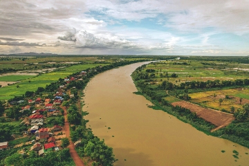
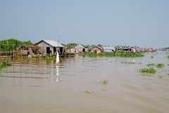
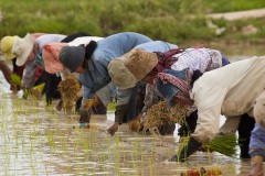
Cambodia Resilient River Basin Masterplan – Phase 1: Tonle Sap River Basin Group
The Cambodia Resilient River Basin Masterplan supports a more integrated, evidence-based, and climate-resilient approach to water resources management in Cambodia, starting with the Tonle Sap River Basin Group. The project responds to increasing pressure from climate change, land-use change, socio-economic development, seasonal floods, and dry-season water scarcity, while addressing the...
-
Water Accounting for the Indus Basin, Punjab and Sindh Province in Pakistan
The project aims to develop a comprehensive water accounting system for the Indus Basin and the provinces of Punjab and Sindh; thereby strengthening Pakistan's capacity to assess water resources, demands, and uses across multiple scales and sectors. In collaboration with the Food and Agriculture Organization of the United Nations (FAO)...
-
Regional Training on REWEFe and the WEFE Nexus for ASEAN Member States
In April 2026, FutureWater delivered a four-day regional training in Manila, Philippines, on the application of the Rapid Evaluation of the Water, Energy, Food and ecosystem toolkit (REWEFe) and the Water–Energy–Food–Ecosystem (WEFE) Nexus in the context of Integrated River Basin Management (IRBM). The training was organised under the GEF/UNDP/ASEAN project...
-
Support to Develop a Climate Adaptation Investment Plan (CAIP) in Lao PDR and Timor-Leste
The assignment applies ADB’s CAIP TA framework and involves conducting strategic Climate Risk and Adaptation assessments (CRAs) and developing a bankable pipeline of adaptation projects for public and private financing. For both Lao PDR and Timor-Leste, the CRA and CAIP are developed with a strong emphasis on IWRM and involve...
-
Technical Assistance for the Implementation of the European Water Resilience Strategy
FutureWater supports the European Commission as part of a consortium providing technical input for the European Water Resilience Strategy. Specifically, FutureWater contributes scientific and policy-relevant analysis on water scarcity and drought, water efficiency, and water security. This includes responding to ad hoc requests by delivering assessments on topics such as...
-
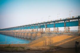
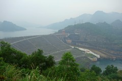
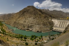
Water Supply-Demand Gap analysis for Rogun Dam
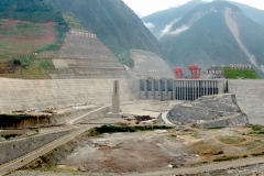
The Rogun Hydropower Plant Project (HPP) is a large project (3,780MW) under construction located on the Vakhsh River located about 110 km East-Northeast of Dushanbe, the capital of Tajikistan. It is a Project that will have a large reservoir capable of providing seasonal regulation. It will supply firm energy during...
-
WE-HARP: WEAP Permits Tool for ARA-Sul
FutureWater is carrying out an assignment to improve the WEAP-Permits Tool: WE-HARP, which supports ARA-Sul in evaluating water use licenses in the Pequenos Libombos area. This project builds on earlier efforts, refining the tool based on feedback from ARA-Sul’s technical professionals. By embedding the tool within ARA-Sul’s operations, FutureWater aims...
-
Assessment of the Water-Energy-Food-ecosystem Nexus in Selected River Basins in Southeast Asia
FutureWater is tailoring the REWEFe toolkit to support assessment of the WEFE Nexus by quantifying a set of indicators relevant to the key issues in seven selected river basins in Southeast Asia. This is part of a broader baseline assessment of competing uses and users of water in the current...
-
WatNEX: Water Accounting Engine for Supporting WEFE Nexus Decision-making
Effective decision-making in water resource management is often impeded by the fragmented use of diverse approaches among different sectors (water, energy, food and environment). This fragmentation leads to inconsistent data, inefficiencies, conflicting results and challenges in integrated planning. To overcome this, FAO Regional Offices for Near East and North Afri+ca...
-

Water Accounting in Mongolia
Water Accounting offers data-driven insights into water availability, use, and allocation, helping policymakers balance demands across sectors like agriculture, industry, and urban development. It supports sustainable growth by ensuring efficient water use while protecting resources for the future. By accounting for different interventions and projections, it offers climate-resilient water resources...
-
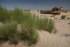
Water Allocation for Biodiversity Conservation in the Lower Amu Darya
The objective is to increase water supply to ecosystems upstream in the Amu Darya delta, upstream of the Aral Sea. The project consists of water allocation analysis and develop water supply scenarios for irrigated agriculture and biodiversity conservation, through consultations and water allocation modelling.
-
SPHY QGIS Plugin for Hydrological Modeling
SPHY (Spatial Processes in Hydrology) is a conceptual, spatially distributed (raster-based) “leaky-bucket” type water balance model. Developed by FutureWater, with the support of national and international partners, SPHY has emerged as a robust, user-friendly tool for undertaking operational and strategic water resource management decisions. It stands out for its physical...
-
Monapo Catchment Water Allocation Model in Support of ARA-Norte in Mozambique
The aim of this project is to advance water system analysis for ARA-Norte, the regional water administration authority in Mozambique, focusing on the Monapo Catchment. In collaboration with ARA-Norte's hydrologists, we're crafting a Water Allocation Model employing the Water Evaluation And Planning (WEAP) system.
-
Model Development and Hydrological Assessments to Inform Ecosystem-based Adaptation Solutions in Lao PDR
The GCF project “Building resilience of urban populations with ecosystem-based solutions in Lao PDR” aims to test an alternative approach to flood control in urban Laos, moving away from a traditional focus on grey infrastructure, such as dams and concrete drainage systems, and towards Ecosystem-based Adaptation (EbA). A consortium led...
-
Updating the Operational Water Allocation Model for the Pequenos Libombos Reservoir for ARA-Sul
This project supports ARA-Sul (Administração Regional de Águas do Sul) in the licensing of water users in the Pequenos Libombos Reservoir area, FutureWater, in a project commissioned by Blue Deal Mozambique, updated the operational WEAP water allocation model, originally developed in 2014, to reflect the 2023 water demand and hydrological...
-
Sustainable Water Resources Management in Mongolia
In Mongolia, the continental semi-arid to arid climate of most of the territory results in low water availability, with the southern region particularly affected by a lack of perennial rivers and reliance on fossil groundwater reservoirs, where recharge is negligible. Climate change and increasing water demand are further threatening future...
-
Megadroughts in Europe’s Watertowers – From Process Understanding to Strategies for Management and Adaptation
Megadroughts are rare and poorly understood hazards. They are defined as exceptionally severe, multi-year, prolonged (>5 years) periods of drought that impact severely large areas and different sectors of the economy and the environment (Cook et al., 2022). They are generally caused by the concurrence of extreme events of dryness...
-

Capacity Building on Water Accounting Under the Water Scarcity Program in Lao PDR
The capacity-building program on water accounting in Lao PDR focuses on enhancing participants' understanding of the status of water resources in the Nam Ngum pilot basin and enabling them to quantify the fluxes using various tools, including remote sensing.
-

Catchment Assessment for Water Stewardship Plan
Highly productive berry farms and water scarcity are causing conflicts with the environmental assets and values of the Doñana National Park, Spain. There is growing interest in the agricultural sector to reverse this situation by implementing a water stewardship program. A catchment assessment is needed to produce baseline information to...
-
Scientific Support for a Watershed Investment Program for Addis Ababa
Addis Ababa's water supply is under threat caused by the complex interaction of rapid population growth, increased water demand, intensive groundwater development, natural resource degradation, and climate change. A comprehensive Watershed Investment Program should return this situation and secure water supply for the future. An in-depth study is performed to...
-
Pre-Feasibility Work to Identify Nature-based Solutions for Multiple Catchments in Nigeria
This project will involve working across two fee-for-service engagements with the Coca Cola Corporation and Diageo in Nigeria. The identification and prioritisation of NbS for implementation will be achieved through the development of three key products: two prefeasibility analyses for Ogun and Oshun catchments, and a high-level country-wide strategic assessment...
-
RoSPro: Roadside Spring Protection to Improve Water Security in Nepal
The mid and high-altitude areas of the Himalayas face a critical water scarcity issue, making them one of the most vulnerable regions in the world. Springs are essential lifelines for millions of mountain communities, serving as the primary source of domestic water and local food security. Unfortunately, the flow regimes...
-
Capacity Building on Water Accounting Under the Water Scarcity Program for Asia-Pacific
Growing water scarcity continues to threaten the agricultural sector in Asia. In order to address this critical issue, FAO and partners have been developing a comprehensive Asia Pacific Water Scarcity Programme (WSP) since 2019. Under this program, a series of trainings on water accounting will be held in Indonesia, Vietnam...
-
Development of Environment and Climate Change Chapters of the Mekong State of the Basin Report 2023
As part of this assignment, FutureWater undertakes data analysis and is responsible for the presentation of each indicator and monitoring parameter of the Enviroment and Climate Change dimensions of the MRB-IF. Relevant supplementary data and information to illustrate basin conditions and trends are identified, and data gaps are addressed where...
-

Integrated Water Resources Management in Tajikistan
Given the abundant freshwater resources in Tajikistan, water plays a crucial role in the country's socioeconomic development. However, the rising population, economic growth, and the growing impacts of climate change pose significant challenges to ensure water availability and accessibility. This project aims to address the aforementioned information gap by improving...
-
GLOW: Global Water Availability Forecasting Service to Support Water Security
The GLOW project aims to pilot an operational service that provides timely and easy access to current and forecasted water availability and demand across the entire Maputo River and the Black Umbeluzi River Basins.
-
WE-ACT: Water Efficient Allocation in a Central Asian Transboundary River Basin
The WE-ACT project’s overall goal is to demonstrate a Decision Support System (DSS) for water allocation in a Central Asian transboundary river to increase shared benefits and foster the adaptation of water resources management and planning to climate change.
-

Enhancing IWRM and Climate Resilience in Vulnerable Urban Areas of the Mekong River Basin
This project implements a set of measures that span across three key outputs: 1) Inclusive assessment of water-related climate risks completed in the priority river basins. 2) Enabling environment for gender-responsive climate risk-informed integrated water resources management developed. 3) Funding proposal for priority risk reduction measures developed To accomplish this,...
-
Strategic Climate Adaptation Planning for the Amu Darya Basin in Uzbekistan
Uzbekistan's water resources depend to a large extent on those provided by the transboundary Amu Darya river which are fully allocated and highly sensitive to climate change and water demand and management changes. Especially the agricultural sector, but also the energy and urban water supply sector need to transform into...
-
Hydrological Assessment for the Lunyangwa Dam
The Lunyangwa Dam is prone to overtopping during the wet season. Raising the spillway crest and/or installing gates on the existing crest will allow an increase in the retention level. In order to determine the height of the redesigned spillway, a flood analysis was conducted for several return periods in...
-
SOS-Water: Water Resources System Safe Operating Space in a Changing Climate and Society
The SOS-Water Project endeavours to set out the boundaries within which the Earth’s capacity to provide life-support systems for humanity is not endangered, and humanity’s capacity to adapt to environmental changes is not overburdened. Crossing such thresholds or tipping points in the complex Earth system could result in abrupt and...
-

Data Generation and Reporting to Support MRC Mekong State of the Basin Report 2023
The Mekong State Of the Basin Report (SOBR) is published by MRCS every five years. It provides information on the status and trends of water and related resources in the Mekong Basin, from an economic, social and environmental perspective. This project involves the hydrological and satellite-based analyses concerning spatiotemporal dynamics...
-
Integrated Strategic Water Resources Planning and Management for Rwanda
Rwanda recently published its “Vision 2050” which sets out the national long-term development strategy, stating new objectives for urbanization, energy production, irrigation and water resources development. The Rwanda Green Fund (FONERWA) in collaboration with the Rwanda Water Resources Board (RWB) with financial support from the World Bank undertakes the consultancy...
-
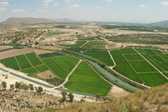
Groundwater Recharge in the Campo de Cartagena Quaternary Aquifer
This project (1) provides a critical review of previous results generated, and a SWOT analysis of hydrological simulation tools used in the area. (2) improve and update the quantification of the main water balance components, including vertical and lateral fluxes, at the basin scale in recent times (2000-2020 period) through...
-
Advancing the Monitoring of Water-Related SDGs in Myanmar: an Issue Brief
This assignment entails the write-up of an issue brief on SDG 6 monitoring in Myanmar with Earth Observation (EO) technologies. Based on the status of data availability in Myanmar and the potential of innovative technologies and datasets, examples are given of how current knowledge gaps can be addressed. In addition,...
-
Training on Real Water Savings for FAO’s Regional Water Scarcity Program
The Regional Office for Asia and the Pacific (RAP) of the Food and Agriculture Organization of the United Nations (FAO) has recently secured funds to continue a program of training on ReWaS, which is a simple tool to estimate the potential for generating real water savings from various agronomic, water...
-
Technical Coordination for the Norfolk Water Fund
FutureWater provide support and technical expertise to The Nature Conservancy and Water Resources East in the creation of a Water Fund for Norfolk, in the East Anglia region of the UK. This work identifies Nature-based Solutions (NbS) to be implemented accross the county, aiming to leverage blended finance to fund...
-

Water Risk Assessment for Private Farming in North Spain
This project aims to support a due diligence processs by reviewing and auditing water-related factors of risk for orchard fruit farming in including availibility and access, climate change impact, water quality, and potential conflicts and competence among water-demand users.
-
Technical Annexes on Nature-based Solutions for Water Security
The Nature Conservancy (TNC) is producing technical modules and guidance documentation to enable water sector actors and their funders to invest in Nature-based Solutions for Water Security (NbS-WS). Part of the material being developed is a module on technical options, which will include annexes with key information for each of...
-
Evaluating the Extent of Salinity Intrusion and the Riverine, Estuarine and Coastal Habitat Conditions in the Lower Mekong Basin
Within this project, detailed methodologies are developed for periodical implementation of regional studies on the extent of salinity intrusion in the Mekong Delta; and the condition of riverine, estuarine, and coastal habitats in the Lower Mekong Basin. A literature review is conducted to identify successful approaches from the Mekong Region...
-

Bio-Physical Assessment and Hydrological Analysis for Mukungwa and Akagera Lower catchments in Rwanda
FutureWater will conduct the bio-physical assessment and hydrological analysis for the Mukungwa and Akagera Lower Catchments in Rwanda. The project will be the basis for two catchment plans to be developed through the “EIWRM Project”, funded by the Government of the Netherlands and implemented by a consortium led by the...
-

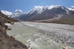
Development of a Glacio-Hydrological Model and IWRM Plan for the Uttarakhand subbasin in India
The Swiss Agency for Development and Cooperation’s (SDCs) Global Programme Climate Change and Environment (GP CCE) India is supporting the operationalization of climate change adaptation actions in the mountain states of Uttarakhand, Sikkim and Himachal Pradesh through the phase two of the “Strengthening State Strategies for Climate Action” (3SCA) project...
-
Design Study for the Mombasa Water Fund
A design study for the Mombasa Water Fund is performed by assessing biophysical, financial, economic and socio-economic benefits, and identifying potential governance and financing models. The Fund should improve the quantity and quality of source waters for Mombasa City by channelling investments into source protection and catchment conservation measures of...
-
Improved Watershed and Forestry Activities to Secure Hydropower
This study supports Gabon in preserving Hydrologic Ecosystem Services in a river basin which faces challenges due to planned hydropower and forestry operations. It will evaluate various watershed management scenarios which may improve hydrological flow conditions and hydropower options. FutureWater analyzes hydrological ecosystem services provision in the Komo basin through...
-
Tailor-made Training on River Morphology and Flood Risk using State-of-the-Art Open Satellite Data and Processing Tools
The main objective is to enhance the capacity of DWIR staff in using innovative data and tools to analyze water resources and support water management. The training is organized with a very practical approach and strongly built upon the ‘learning-by-doing’ principles. Participants use freely accessible satellite-derived data to gain insight...
-
Baseline Assessment for the Identification of Landscape Restoration Options in Kyrgyzstan
To identify and prioritize degraded lands in Kyrgyzstan for landscape restoration in order to reduce reservoir sedimentation and enhance sustainable water and energy resources. Remote sensing and data geospatial data analytics has been applied with an aim of prioritizing degraded areas of land in Kyrgyzstan and determining where restoration interventions...
-

HiHydroSoil v2.0: Global Maps of Soil Hydraulic Properties at 250m Resolution
In 2016, FutureWater released a new dataset: HiHydroSoil v1.2, containing global maps with a spatial resolution of 1 km of soil hydraulic properties to support hydrological modeling. Since then, the maps of the HiHydroSoil v1.2 database have been used a lot in hydrological modeling throughout the world in numerous (scientific) projects. A few examples of...
-
Tailor Made Training for the Rwanda Water Resources Board (RWB) on Water Allocation Modelling and Remote Sensing Analysis
FutureWater will provide a Tailor Made Training to water professionals at the Rwanda Water Resources Board (RWB) on Water Allocation Modeling and Remote Sensing Analysis. About 20 participants of the RWB are thought to work with the Water Evaluation And Planning model WEAP and the Remote Sensing platform of Google...
-
WAT4CAM: Mekong-Bassac Hydrological and Hydraulic Study
The WAT4CAM program aims to apply IWRM and ISWM principles towards achieving the strategies of the government of Cambodia. This project (WAT4CAM subcompoment 3.1) supports this objective by performing a detailed hydraulic and hydrological modelling study, of which the outcomes will be used in the implementation of Prek rehabilitation works....
-

Training in Hydrology and Water Allocation Modelling for Kenyan Water Resources Professionals
This course on hydrology and water allocation modelling is organized for the Kenya Water Resources Authority (WRA) and funded by the Blue Deal program of the Netherlands. The first four-week course block introduces the participants to the main concepts in hydrology, hydrological modelling and data collection, including remote sensing. Exercises...
-
Future Evapotranspiration in the Souss-Massa Basin
In this project, FutureWater used the outputs of the bias corrected "EuroCordex" RCM ensemble generated for IMWI in a previous work package. Using temperature and precipitation trends from this dataset for both past and future, an application of the Budyko methodology combined with the Modified Hargreaves approach was implemented to...
-
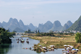
Climate Risk Assessment for the Li River in China
The Li River basin in China is a basin that is prone to floods because of its mountainous character, narrow floodplains and extreme rainfall events. In 2020, large floods have occurred in this basin when enormous amounts of precipitation were observed in just a few days. A total of 272...
-
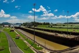
Robust Decision Making for Land Use Planning in the Panama Canal River Basin
A Land Use Plan will be prepared for the river basin that belongs to and provides water for the Panama Canal. The regional plan (PIOTA) will set the framework, vision and direction for strategic planning and land use in the basin. For this purpose, the Panama Canal Authority and stakeholders...
-
Hydrological Assessment for Hydropower in the Lukhra River
The objective was to develop a hydrological assessment for a planned run-of-river hydropower plant in the Lukhra river basin in Georgia. There is no observed river discharge data available. Hence, the assessment was developed based on hydrological simulations of the basin using the SPHY model (Terink et al., 2015) and...
-
CAREC: Developing the Water Pillar for Central Asia
For the Central Asia Regional Economic Cooperation (CAREC) Program, a scoping study was commissioned to develop a framework for the Water Pillar: an investment vehicle for water infrastructure and capacity development that generate regional benefits. The objective of the study is to develop the scope of the Water Pillar Framework...
-
Integrated Catchment Management in the Cagayan River Basin
The Ridge to Coast, Rain to Tap: Sustainable Water Supply Project (R2CR2T) is an integrated approach to addressing flooding in the Cagayan River basin on Mindanao in the Philippines. FutureWater was hired to support the R2CR2T project and their local team on the development and application of a Decision Support...
-
InfoSequia-4CAST: Forecasting and Quantifying Risks of Crop and Water Supply Failures Using Machine Learning and Remote Sensing
InfoSequia-4CAST combines historical and up-to-date observations of satellite-based meteorological and agricultural drought indices with climate variability indices, to generate seasonal outlooks of water supply and crop yield failure alerts. These impact-based indicators are computed using a simple, robust and easily understandable statistical forecasting-modelling framework. By making use of multi-sensor, state-of-the...
-
G3P: Development of a Global Gravity-based Groundwater Product
Groundwater is one of the most important freshwater resources for mankind and for ecosystems, and has been declared as an Essential Climate Variable (ECV) by GCOS, the Global Climate Observing System. However, the Copernicus Services do not yet deliver data on this fundamental resource, nor is there any other data...
-
Flood Risk Assessment of a Water System Under a Future Climate
In 2009, the former Velt en Vecht Water Board (now part of the Vechtstromen Water Board) and in consultation with the municipalities of Emmen, Coevorden, Hardenberg and Ommen concluded an agreement in which agreements were made about the scope and interpretation of the development of storm water retention areas. This...
-
Boundary Demarcation and Ecosystem Services Mapping of Inle Lake Region, Myanmar
The assignment supports the newly established Inle Lake Management Authority (ILMA) by developing up-to-date, spatial datasets, which are to be included in the ILMA geodatabase. More specifically, the existing Inle Lake MAB boundary and zoning are confirmed and updated. Maps of land-use and different ecosystem services are produced and validated...
-
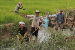
Transboundary water management between Thailand and Cambodia
Transboundary projects aid the development of effective water resource management (WRM) by helping to limit competition over resources and in creating a dialogue for the transferral of beneficial lessons between the countries. This project takes an integrated approach to support the development of a water resource management plan for a...
-
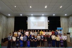
Tailor-Made Training for water professionals in Myanmar
This tailor-made training enhanced capacity of Yangon Technological University (YTU) educational staff in using Google Earth Engine to analyse water resources and support water management. Technical staff of Department of Meteorology and Hydrology (DMH) and the Department of Water resources and Improvement of River systems (DWIR) also participated to gain...
-
Training Package and Technical Guidance for Water Productivity and Real Water Savings
The overall project objective is to compile an inventory of agricultural field interventions and develop a training package to evaluate Real Water Savings from irrigated fields, to systems and basins. A guidance document is developed for agricultural field interventions by compiling a literature database containing published experiences and results of...
-
Water Resources and Eco-hydrological Assessments of Tonle Sap and Mekong Delta Basins
The overall project objective is to support MOWRAM to make more informed, evidence-based water resources management and irrigation investment decisions through better understanding of water resources and ecosystems of two river basin groups: the Tonle Sap and the Mekong Delta. The project concerns (i) rapid water resources assessment of the...
-

Glacio-hydrological Assessment for Hydropower in the Nakhra River
The objective was to develop a glacio-hydrological assessment for planned run-of-river hydropower plant locations in the Nakhraa river basin in Georgia. The availability of observed river flow data is limited. Hence the assessment was developed based on hydrological simulations of the basin using the SPHY model (Terink et al., 2015)....
-
Glacio-hydrological assessment for hydropower, Mestiachala river, Georgia
The objective of this project was to develop a hydrological assessment for two potential hydropower plant locations in the Mestiachala basin in Georgia. The availability of observed river discharge data is limited. Hence the assessment was developed based on hydrological simulations of the basin using the SPHY model (Terink et...
-

Application of the Decision Tree Framework in the Chancay-Lambayeque Basin, Peru
The Chancay-Lambayeque watershed faces the challenges of rapid population growth and economic development in the presence of inadequate water supply, flood risk and environmental degradation. The study applies a step-wise approach, i.e. the World Bank’s Decision Tree Framework (DTF), to identify most important climate and nonclimate vulnerabilities for the system...
-

Thought Leader Convening on Water Towers
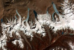
Scientists from around the world have assessed the planet’s 78 mountain glacier–based water systems and, for the first time, ranked them in order of their importance to adjacent lowland communities, as well as their vulnerability to future environmental and socioeconomic changes. These systems, known as mountain water towers, store and...
-
Improved catchment management for small hydropower
This study assessed the impacts of various investment portfolios for catchment management activities on the cost-benefits of small hydropower schemes, in two case study catchments in Kenya and Tanzania, and analyzes the return-on-investment for the hydropower developers. Catchment degradation trends, climate change impacts and socio-economic changes increasing competing water use...
-
Climate Risk Assessment: Yanji City China
Jilin Yanji Low-Carbon Climate-Resilient Urban Development in China is supported by the Asian Development Bank. In the context of this investment project FutureWater will undertake a Climate Risk Assessment (CRA). The CRA will be based on the bottom-up approach where climate models (GCMs) are not the guiding boundary conditions, but...
-
Review of the Kisii Water Supply project
A large water supply project is being planned in the Lake Victoria region, Kenya, potentially providing reliable and clean water to around 500,000 people. The Dutch Government supports this project. An Environmental and Social Impact Assessment (ESIA) was made by the developer. This ESIA needed to be reviewed by a...
-
Hydrological and water resources assessment for the Muhazi Dam
The current infrastructure at the outlet of the large Muhazi Lake in Rwanda is highly unstable and causes a risk to the surrounding and downsteam inhabitants. The authorities want to improve this situation by building a new dyke. A feasibility and detailed designs study was performed for this new structure....
-

Agricultural Water Consumption in the Australian Border Rivers Catchment
FutureWater was hired to use satellite-derived data to provide a preliminary spatiotemporal assessment of water consumption across the Border Rivers catchment, one of the MDB catchments where excessive agricultural water use is an urgent issue. For relevant specific lots / properties, monthly water consumption dynamics were evaluated. This study is...
-
Hydrological assessment for two potential sites for run-of-river hydropower, southwestern Georgia
A hydrological assessment was carried out for two sites where run-of-river hydropower plants are planned, in the southwestern part of Georgia. Only very limited streamflow data were available, so the assessment was based mainly on hydrological modelling of the basin upstream of the points of interest. Principally global datasets were...
-
MRC Mekong State of the Basin Report 2018: China and Myanmar
The Upper Mekong Basin has seen rapid economic development, radical land use changes and extensive hydropower development on the mainstream. FutureWater was hired by the Mekong River Commission to evaluate hydrological, environmental, economic and social indicators of the Upper Mekong Basin in China and Myanmar. Current status and trends in...
-

NL-RIA: Satellite-based altimetry data for hydrological assessments
A Dutch consortium has joined in the project “Dutch network on small spaceborne radar instruments and applications (NL-RIA)”, led by TU Delft. The objective is to bundle the radar-related knowhow available in The Netherlands, and fill the knowledge gaps, in order to boost SmallSat radar-based Earth Observation technology. The task...
-
Hydrological pre-feasibility assessment for a potential hydropower plant, North Sumatra, Indonesia
Following the successful development of hydropower facilities in Indonesia, a new project was established to study the potentials for the development of a hydro-electric power plant in the Tripa Basin, North Sumatra, Indonesia. To make a go/no-go decision of a more detailed feasibility study, a pre-feasibility study is undertaken to...
-

Lower Mekong: Development State of the Basin Report
The Mekong State of Basin Report is updated every 5 years serving as an important reference for the cyclic updating of the Mekong River Commission (MRC). This consultancy is supporting the development of the 2018 report focusing on the hydrology, environment and climate change chapters. The Mekong River Commission Secretariat...
-

Building Climate Change Resilience in Asia’s Critical Infrastructure
Critical infrastructure in South Asia and Southeast Asia needs to become more resilient to climate change. A Technical Assistance project, supported by Asian Development Bank (ADB), looks at three key sectors: transportation, transport and water. FutureWater is responsible for the assessment of the water sector which will aim to increase...
-
Pre-feasibility study of run-of-river hydropower plant, Georgia
There is great potential for hydropower in Georgia. Critical is to conduct accurate feasibility assessments for hydropower generation at the different potential sites of interest. This pre-feasibility assessment delivered daily flow estimates at several locations in Georgia. These flows were used as input into an economic analysis.
-
HERMANA: Tool for Integrated Water Management
HERMANA aims to foster the development of an integrated water management decision support system (DSS) that supports daily, tactical and strategic decision-making related to water resources in Colombia, and specifically in the Cauca Valley Basin. The HERMANA tool will be a comprehensive system able to provide valuable, relevant, and reliable...
-

LAUREL: Land Use Planning for Enhanced Resilience of Landscapes
Deforestation, population growth, and climate change are only some of the challenges to sustainable landscape management in Madagascar. Severe impacts of land degradation on crop production, water availability and biodiversity are already observed and expected to exacerbate in the future. To address these challenges, the World Bank is supporting the...
-
Hydrogeological modeling of groundwater discharge to the Mar Menor lagoon
The groundwater discharge of irrigation return flows to the Mar Menor lagoon (Murcia, SE Spain), the largest coastal lagoon in Europe, is among one of the possible causes that would explain the high levels of eutrophication (hypereutrophication) and the several algal blooms accounted in this lagoon ecosystem in the last...
-
Leapfrogging Delta Management: Showcase operational rainfall monitoring
Significant decisions are to be made to manage and engineer the water systems in Myanmar and to develop large structural and non-structural projects (e.g. hydropower dams, urban water use, industrial development, extension of irrigation capacity, operational quantity and quality management, etc.). The Myanmar and Dutch governments have agreed to cooperate...
-
Impacts of climate change and sustainable land management investments on the Upper Tana
As part of the WISE-UP to Climate project FutureWater evaluated the impacts of climate change on investments in sustainable water and land management in the Thika/Chania watershed. The previously built SWAT model for this area was used to assess the impact of land management interventions under six different climate scenarios....
-
Catchment Study: Water Balance and Allocation Modelling in Rwanda
In an effort to introduce integrated land and water management, the Government of Rwanda, through Water for Growth Rwanda, commenced the development of catchment plans. FutureWater supported this effort by using the WEAP framework to develop catchment models for four selected demonstration catchments. Subsequently, the WEAP framework was used to...
-
Training in Water Resources Modelling for ARA-Sul
A Tailor-Made Training on Water Resources Modelling was required to equip the staff of the water agencies in Mozambique (ARAs) with additional knowledge to have a stronger advisory role towards policy and decision makers, and people living in the area. FutureWater provided this training to ARA-Sul and ARA-Norte. This training...
-

Hydrological Evaluation and Ecosystem Valuation of the Lukanga Swamps
The Lukanga Swamps in Zambia are an important biodiversity area and serve as a major hydrological component of the Kafue basin. FutureWater was contracted to assess the value and contribution of the Lukanga Swamps to the Kafue Basin. FutureWater applied a combined approach of (i) remote sensing, (ii) SWAT hydrological...
-
Hydropower Development Assessment for the Tamakoshi River Basin
The overall objective of this project is to improve the understanding of the expected impacts of climate change on water availability in the context of potential hydropower development in the Tamakoshi River Basin. Specifically, the project aims to (i) Understand the current baseline hydrological regime of the Tamakoshi River Basin,...
-
Improved watershed practices for hydropower in Mbé River
It is essential for Gabon to identify sustainable financing mechanisms for the long-term conservation of its protected areas. The development of economic instruments such as Payment for Environmental Services (PES) that take into account the non-market value of ecosystem services is considered one promising response to the challenges of linking...
-
Development of a Water Allocation Model of the Incomati River Basin
Two water allocation models were developed in this project as a tool to support policy evaluation and improve strategic and operational decision making procedures of ARA-Sul. WEAP (Water Evaluation And Planning) was chosen as modelling framework. Different scenarios were implemented in WEAP to show the impacts of possible changes and...
-
System-Risk: A large-scale systems approach to flood risk assessment and management
System-Risk is a Marie-Skłodowska-Curie European Training Network which aims on developing and implementing a systems approach for large-scale flood risk assessment and management and provides a framework for training and career development of 15 Early Stage Researchers (ESRs). In collaboration with the Royal Meteorological Institute (KNMI), FutureWater is the hosting...
-

Flying Sensors for Ultra-High Resolution Flood Risk Identification at Local Scales
The outputs of this project can be summarized as providing real time dike and levee information at local scales (up to 10,000 ha) that is collected, analysed and used at the same local scale. The output is divided into two components. First, the Flying Sensor information will be used for...
-
Economic assessment of management alternatives in the protected areas of LAG Campoder
This project aims to advertise about the environmental assets found in the LAG Campoder at the Murcia Region (SE Spain), and to quantify using social and economic techniques the degree in which these assets are perceived by local population. FutureWater is responsible for the characterization and description of three representative...
-
Feasibility study for a Payment for Watershed Services Scheme
This project pilots a Payment for Watershed Services (PWS) scheme in the Rwenzori Mountains National Park (RMNP) in Uganda. The goal of the pilot is to study the feasibility of the PWS scheme in the watersheds of the Mubuku and Nyamwamba rivers and supporting nature conservation and a healthy watershed...
-
Strategic Basin Planning Ganga River Basin
The World Bank has assigned Deltares and its partners AECOM India and FutureWater to carry out the project ”Analytical Work and Technical Assistance to support Strategic Basin Planning for Ganga River Basin in India”. The key objectives of this project are (i) Significantly strengthen the capability of relevant central and...
-
Training in Water Resources and Allocation Models
A Tailor-Made Training was provided to three ARAs in Mozambique, being ARA-Centro (Beira), ARA-Centro-Norte (Nampula), and ARA-Norte (Pemba). The provided Tailor-Made Training focused on learning to work with a Water Resources and Water Allocation Model, and apply them to a catchment in Mozambique. Emphasis was put on how these tools...
-
Erosion assessment for Lake Tanganyika, Tanzania
The purpose of this study is to support The Nature Conservancy in its effort in a first level scoping assessment on erosion levels in the Tuungane project area in Tanzania. Hydrological modelling is used to quantify erosion patterns and its relations with land use and management in a number of...
-

Review Climate Change Hindu-Kush-Himalaya
FutureWater provided a comprehensive review study on climate change and the impacts on cryosphere, hydrological regimes and glacier lakes in the Indus, Ganges, and Brahmaputra river basins. This review study was done in the context of future hydropower development in the region.
-
Demonstration of Remote Sensing Information for Integrated Reservoir Management in the Red River Basin in Northern Vietnam
In 2011 the Vietnamese and Dutch government signed a Memorandum of Understanding on the establishment of a Government to Government (G2G) program for improved integrated planning and monitoring of water resources for transboundary water management and disaster risk management. This project was formulated as part of the G2G trajectory towards...
-
Water Allocation Model Development to Support Decision Making Procedures
Two water allocation models were developed in this project as a tool to support policy evaluation and improve strategic and operational decision making procedures of ARA-Sul, which is one of the five water management organizations in Mozambique. WEAP (Water Evaluation And Planning) was chosen as modelling framework. Different scenarios were...
-
Impacts of Climate Change in Uganda on the Water Sector
Uganda’s 2010–2015 five-year National Development Plan (NDP) recognizes that addressing the challenges of climate change is crucial to enhancing sustainable economic and social development. One of the key aims of the present study is to make an economic and social assessment of climate change impacts on the water sector in...
-
ASSET: Accounting System for the SEgura river and Transfers
Semiarid coastal regions, as the Southeastern of Spain in which the Segura River Basin is located, are expected to be more affected by climate change and the resulting aggravation of water scarcity, droughts and desertification than other regions. In this project the interactions between the economy and the hydrological system...
-
OWASIS-UK: Observatory of Water Availability – System of Integrated Services
The main objective of this study is to explore the potential to combine optical and gravity data from Earth Observation with meteorological data, together with innovative in situ sensors, hydrological modelling and crowd sourcing technologies, and the advanced visualization of the information through situation awareness platforms and decision support tools,...
-
SWIMM: Soil Water evaluation system based on Integrated Measurements and Modelling
The main objective of the project was to support policy making, under current and future climate conditions, on optimal water management in nature reserve areas, based on uniform and consistent data collection. The project built upon knowledge developed under the “Klimaat voor Ruimte” framework and refined and demonstrated a method,...
-

HI-AWARE: Himalayan Adaptation, Water and Resilience
HI-AWARE aims to contribute to enhanced adaptive capacities and climate resilience of the poor and vulnerable women, men, and children living in the mountains and flood plains of the Indus, Ganges, and Brahmaputra river basins. Research, including modeling, scoping studies, action research, and randomized control trials, is conducted at 12...
-
Water and Climate Services for Transboundary Water Management and Disaster Risk Management
During this pilot project the applicability of the in-house developed Drought Monitoring and Impact Assessment Toolbox (DMIAT) and HiP2P rainfall downscaling methodology were demonstrated for the Red River Basin in Vietnam. Furthermore the first steps in developing an integrated product for transboundary water management in the Red River Basin were...
-
Central Asia Regional Risk Assessment for Water Related Energy Sector Impacts
The objective of this study was to support the “Central Asia Regional Energy Sector Vulnerability Study” led by Industrial Economics (IEc) and funded by the World Bank, by carrying out an expanded risk assessment for water availability and water related energy sector impacts in Central Asia. The work built on...
-
Gridded Meteorological Datasets and Hydrological Modelling in the Upper Indus Basin
Understanding of the hydrological regimes in the mountainous Upper Indus basin (UIB) is essential for water resources management in the region. High-resolution gridded meteorological datasets, which capture the spatial variability of precipitation, are critical for modelling the hydrology of high-mountain regions. Improvements to existing gridded datasets using high-elevation station data...
-
The Nairobi Water Fund: hydrologic modelling and economic valuation of investment options
In 2013 The Nature Conservancy (TNC) started working to launch the first Water Fund in Africa to restore and protect the condition of the Tana River and improve Nairobi’s water security. Key questions that needed to be answered were “Where and in what activities should the fund invest its money?”...
-
Climate adaptation Colombia
The 2011 floods and droughts in the Magdalena river basin triggered the Colombian government and water institutions to enforce the attention given to water security and dike safety. To improve the capacities of Colombia for adaptation of water management to climate change pilot projects were started in one small and...
-
Water Planning Tools to Support Water Governance
ARA-Centro is one of the five regional water management organizations in Mozambique and has to advise on the water availability and the required number of reservoirs that are needed to make the envisioned economic developments possible. For this advisory role, tools are needed like a water allocation model that can...
-
Climate change indicators for Mekong River Commission
With this study, the Climate Change Adaptation Initiative (CCAI) of the Mekong River Commission (MRC) offers a review of existing monitoring systems and indicators of climate change to improve the understanding of riparian governments, relevant line agencies and others on the status and impacts of climate change. The report should...
-
INTOGENER: Integration of EO data and GNSS-R signals for ENERgy applications
The need for accurate short and mid-term forecasting of the water flow generated from snowmelt in mountain basins is an important component for water management and hydropower activities. Due to the remoteness and difficult access to basins especially in cold weather conditions, where in-situ snow measurements, water level monitoring and...
-
Green Water Credits demonstration project Algeria
In cooperation with Algerian partners the “La Mina” basin was selected to demonstrate the potential for Green Water Credits (GWC) in Algeria. GWC can be seen as an investment mechanism for upstream farmers to practice soil and water management activities that generate benefits for downstream water users, which are currently...
-
Water Availability Analysis for the Upper Indus, Ganges and Brahmaputra River Basins
As part of the Himalayan Climate Change Adaptation Program (HICAP) ICIMOD has contracted FutureWater to generate climate change and water availability scenarios for the upstream parts of the Indus, Ganges and Brahmaputra river basins based on a high resolution hydrological model that FutureWater has developed.
-
Spatial and temporal rainfall variability in the Tungurahua province of Ecuador
Accurate information on spatial rainfall patterns is crucial for many hydrological applications and for water resources planning. For the Water Resources Management Planning Program of the Provincial Government of Tungurahua in Ecuador this information is required to design appropriate and sustainable strategies for agricultural water management in the area and...
-
Towards a Mekong Delta Portal
Studies have shown that the Mekong Delta is very vulnerable to floods and droughts, which will intensify due to climate change. Currently, these threats are not adequately monitored and information on such threats is inconsistent and only scattered available. Therefore Vietnam is in need of data sharing systems and advanced...
-

Green Water Management and Credits Toolkit for China
Green Water Management & Credits is a concept developed by ISRIC. It allows quantification of water supply and demand, erosion reduction, yield increase, sedimentation amounts, and hydropower production that is needed to calculate the economic costs and benefits of environmental protection measures. In order run this concept in areas, an...
-
Mainstream Climate Change Adaptation and Mitigation Into Agriculture in the Southern Caucasus
This study contributes to the agriculture sector climate change impact assessment and adaptation and mitigation strategy identification and evaluation. The study encompasses the three countries of the Southern Caucasus region: Armenia, Azerbaijan, and Georgia. The project also includes components for capacity building among in-country staff, and support of the World...
-
SIRRIMED: Sustainable Use of Irrigation Water in the Mediterranean Region
SIRRIMED project addressed issues related to sustainable use of water in Mediterranean irrigated agricultural systems, with the overall aim of optimizing irrigation water use. In this project FutureWater was actively involved in the development of a District Information System (DIS) and a Watershed Information System (WIS) for the Campo de...
-
Monitoring of Glacier, Climate and Runoff in the Hindu – Kush Himalayan Mountains
For this project a review was conducted of current state of knowledge in (i) climate change datasets and downscaling used for glacier and high mountain modelling, (ii) glacier and snow contribution to river runoff in the Hindu – Kush Himalayan (HKH) region, (iii) hydrological modelling studies used for glacier and...
-
Water and Adaptation Interventions in Central and West Asia
To assess the water resources availability in the Central Asia region under climate change hydrological models were developed for the two major rivers in the region, the Amu Darya and Syr Darya. Capacity building activities were undertaken to develop the capacity in each of the participating countries to use the...
-
Hydrological Impact of Green Water Credits Measures in the Sebou Basin in Morocco
Green Water Credits (GWC) can be seen as an investment mechanism for upstream farmers to practice soil and water management activities that generate benefits for downstream water users, which are currently unrecognized and unrewarded. The GWC methodology was applied to the Sebou river basin. Data was gathered, prepared and verified...
-
Erosion and reservoir sedimentation in Tana basin, Kenya
In this project an assessment of the soil erosion and sediment loads in Upper Tana Catchment areas was undertaken and the impact of sediment deposition on the reservoir capacities of the principal dams was estimated. A physiographical baseline was established through an intensive monitoring campaign of flow and sediment loads...
-
Bias Correction for Satellite Precipitation Estimation used by the MRC Mekong Flood Forecasting System
The Regional Flood Management and Mitigation Centre (RFMMC) has been established in Phnom Penh, Cambodia under the umbrella of the Mekong River Commission (MRC). One of the main objectives of the RFMMC is to establish an improved, robust and reliable flood forecasting system for short and especially medium-term forecast periods....
-
Impacts of Global Climate Change on the Water Resources of the Bunyala plains, Kenya
In this project an Integrated Water Resource Management Planning Tool for improved planning and management of sustainable food and sustainable livelihoods for the Bunyala flood plains of western Kenya was developed together with training materials for technical support in the maintenance and implementation of the planning tool and the facilitation...
-
Nile Basin Data Base Development
The Nile Basin Decision Support System (NBI-DSS) will provide the necessary knowledge base and analytical tools to support the planning of cooperative joint projects and the management of the shared Nile Basin water resources. FutureWater was asked to support this NBI-DSS and to undertake preliminary data collection and compilation. The...
-
Irrigation Potential Lake Victoria, Tanzania
A study was undertaken to evaluate and rank five potential irrigation schemes in the Tanzania part of the Lake Victoria Basin. The study focused on the following five thematic areas: (i) land suitability, (ii) water resources assessment, (iii) water requirements, (iv) environmental considerations, and (v) institutional aspects.
-
Hydrological seasonal forecasts in mountaineous basins
This project focused on the hydrology and cryosphere of the Himalayas and dealt with the influence of snow cover of the Himalayas and the Tibetan plateau on Asian monsoon dynamics, and the possibility to forecast the strength of the monsoon and the hydrological effects in downstream areas.
-
Groundwater Management and Exploration Package, Northern China
In northern China, groundwater depletion reached catastrophic levels. Therefore, the Chinese government was looking for improved groundwater assessment and management tools. The GMEP (Groundwater Management and Exploration Package) project demonstrated that better observation and planning tools can assist decision makers. Focus of the project was on the Yellow River Basin...
-
Mekong River Basin Modeling Framework Development
The Mekong River Commission (MRC) Information and Knowledge Management Programme (IKMP) is developing and expanding its modeling framework. FutureWater was asked to support the process by developing a complete strategy and to prepare a set of tender documents for implementation of the strategy. The project resulted in six specific Program...
-
Controllable weir in the Olstertocht River
This study investigated if the possibility for upstream water retention would increase significantly with the construction of a controllable weir in the Olstertoch river. The input data and results of a previous water retention suitability analysis were evaluated and compared to expert knowledge. The methodology of the previous suitability analysis...
-

Determination of surface water evaporation
In this project the suitability of five methods for calculating surface water evaporation was evaluated for the province of Friesland.
-
Green Water Credits Mechanism to support sustainable water use in Africa
Green Water Credits can be seen as an investment mechanism for upstream farmers to practice soil and water management activities that generate benefits for downstream water users, which are currently unrecognized and unrewarded. FutureWater coordinated and carried out the biophysical assessment that quantified the impact of Green Water Credits practices...
-
Remote Sensing and Hydrological Modelling of the Rio Bravo, Aguascalientes and Central Northern Valleys
The project has shown how modern analytical tools such Remote Sensing, GIS and simulation models can help to swiftly obtain data to support the water management decision making process. A diagnosis of the Rio Bravo and Northern Central Aquifers has been made to demonstrate management options as well as how...