FutureWater has concluded the first phase of a pioneering applied research project to support a safe and resilient transition in regenerative agriculture in remote rural areas of South Spain.
A resilient transition in regenerative agriculture involves a gradual shift from conventional practices toward systems that foster the conservation and restoration of soils, water, and biodiversity in agricultural landscapes, while stabilizing production and profitability as the system learns and adapts to climate and market shocks. Regenerative agriculture is not just about changing practices: it is a paradigm shift that recovers traditional practices and is able of absorbing, adapting, and transforming without failing.
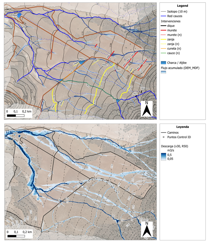
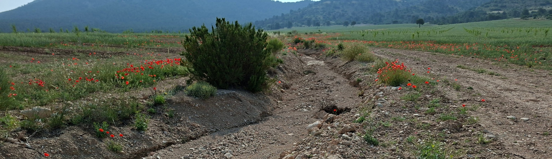
The ultimate goal of the project, launched in early 2025 and funded by a leading company in the sector, is to adapt the brand’s farmland to improve agro-environmental assets through the effective implementation of interventions able to conserve water and avoid soil losses caused typically during intense rainfall events. The project evaluated the effectiveness of several adaptation portfolios resting on the combination of low-impact hybrid and green solutions (e.g., infiltration trenches, stone bunds, biodiversity ponds, or island forests).
The demonstration study was carried out in a headwater catchment of the Guadalquivir River Basin located in the Alvelal region (SE Spain). The FutureWater’s recipe empowers the adoption of the best water management practices in the field based on pre-feasibility assessments which combine GIS and simulation tools able to identify and quantify hydrological risks across the landscape, and find the optimal location for the most cost-effective field interventions. The general framework offered to farmers provides analyses, guidelines and training for: (1) collecting and harmonizing spatial data and building their own QGIS projects, (2) identifying areas with high risk of water and soil loss, and (3) analyzing the hydraulic behavior of farmlands and their surroundings under intense rainfall, and the effectiveness of singular intervention or portfolios to reduce risks and improve environmental assets (Figure). To develop this pilot project and its components, free and open-source software tools were used, including QGIS, and hydrological-soil simulation models like SPHY and SIMWE.
The results of this pilot/demo exercise have proven promising and inspiring for strengthening rainfed regenerative agriculture initiatives in semi-arid environments, and highly useful for diagnosing vulnerabilities and risks, as well as planning resilient adaptation schemes that are both economically and environmentally sustainable.
Over the course of the project, which was successfully implemented in a 6-months period in a pilot area of 350 ha, several key outcomes were delivered including four technical reports, a QGIS project, and a comprehensive dataset with the outputs derived from the hydrological and hydraulic simulation exercises.
A second phase of the project is planned for next year, focusing on scaling-up of the approach across the whole farmland, transforming the simulation workflow into a user-friendly QGIS plugin, and training technical staff through courses and hands-on exercises with the project’s tools.
If you want to know more, please contact Sergio Contreras.