Twiga’ is the Swahili word for ‘giraffe’, a keen observer of the African landscape. TWIGA aims to provide actionable geo-information on weather, water, and climate in Africa through innovative combinations of new in situ sensors and satellite-based geo-data. With the foreseen new services, TWIGA expects to reach twelve million people within the four years of the project, based on sustainable business models.

Africa needs reliable geo-information to develop its human and natural resources. Sixty percent of all uncultivated arable land lies in Africa. At the same time Africa is extremely vulnerable to climate change. Unfortunately, the in situ observation networks for weather, water, and climate have been declining since the 1970s. As a result, rainfall predictions in Africa for tomorrow have the same accuracy as predictions in Europe, ten days ahead. To realize the tremendous potential of Africa while safeguarding the population against impacts of climate change, Earth observation must be enhanced and actionable geoinformation services must be developed for policy makers, businesses, and citizens. New in situ observations need to be developed that leverage the satellite information provided through GEOSS and Copernicus (Open data/information systems).

TWIGA covers the complete value chain, from sensor observation, to GEOSS data and actionable geoinformation services for the African market. The logic followed throughout is that in situ observation, combined with satellite observations and mathematical models, will result in products consisting of maps and time series of basic variables, such as atmospheric water vapour, soil moisture, or crop stage. These products are either produced within TWIGA, or are already available with the GEOSS and Copernicus information systems. These products of basic variables are then combined and processed to derive actionable geo-information, such as flash flood warnings, sowing dates, or infra-structural maintenance scheduling.

The TWIGA consortium comprises seven research organisations, nine SMEs and two government organisations. In addition it uses a network of 500 ground weather stations in Africa, providing ready-to-use technical infrastructure.

FutureWater’s main role in TWIGA is centered around the use of flying sensors to map crop conditons, flood extent, and energy fluxes, complementing and improving data from in situ sensors and satellites. Furthermore, FutureWater is involved in innovative app development.
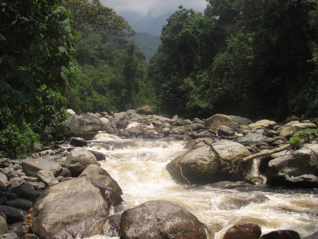
Climate change and variability affects countries’ economies and households through a variety of channels. Uganda’s 2010–2015 five-year National Development Plan (NDP) already recognizes that addressing the challenges of climate change is crucial to enhancing sustainable economic and social development. Most of the key economic sectors – such as forestry, energy and agriculture – will be affected by climate change and have recognized the importance of climate change and its effect on the national economy.

One of the key aims of the present study is to make an economic and social assessment of climate change impacts in Uganda covering a selection of the areas identified above, and to economically assess possible measures to adapt to these impacts to the period to 2050. The social and economic assessment will consist of the following steps:

  1. Preliminary sectoral studies characterizing the impacts of current climate variability and the medium to long-term probable impacts of climate change, on the basis of the climate change scenarios;
  2. An in-depth evaluation of the likely economic damages from climate change, building the analysis on downscaled climate scenarios, literature review and a broad consultations process;
  3. The costs of adaptation and other important factors that determine the ranking of potential adaptation measures (notably, concerns with equity and risk). Social impacts in terms of loss of income, loss of employment and morbidity will be estimated for those sectors where such effects are likely to occur.

2015-09-11 09.48.06The Rwenzori Mountains National Park (RMNP) is a key natural resource, safeguarding drinking water for around 2 million people, and supplying water for a variety of industrial users including several hydropower and mining companies. These are key economic growth engines and major employers in the region and beyond.
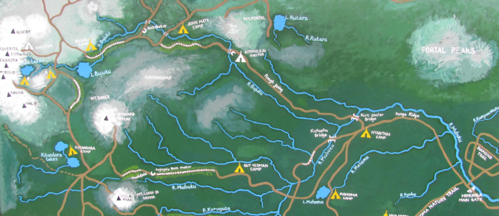
The watershed services of the RMNP are currently undervalued and under increasing threat from climate change and increasing intensity of land use. Current land use practices, dominated by small holder farmers, are leading to loss of soil and reduce water quality and water quantity. The erosion and variable water flows puts at risk the reliability of the downstream services (hydropower and mining) and water supply.

World Wide Fund for Nature (WWF) has in the recent years recognized the strong links between conservation and sustainable use of biological diversity, and the eradication of extreme poverty. Currently WWF Uganda is implementing “Sustainable Financing of the Rwenzori Mountains National Park (SFRMNP) Project” with funding from the European Union (EU) and the French Funds for Global Environment (FFEM).

This project pilots a Payment for Watershed Services (PWS) scheme that should engage large, downstream users (corporations and utilities) that willingly contribute to a water conservation scheme as a way of shoring up their business investments. The goal of the pilot is to study the feasibility of the PWS scheme in the watersheds of the Mubuku and Nyamwamba rivers and supporting nature conservation and a healthy watershed that improves the livelihoods of landowners and provides a sustainable supply of the critical quantity and quality of water to downstream water users, to local communities as well as to industrial users, including the hydropower and mining sector.

To understand the value of the resources and what interventions are required to protect these resources, a study is required to map the resources, stakeholders, and drivers to behaviour change and management change in the study area.

Captura

The Nile Basin Decision Support System (NBI-DSS) will provide the necessary knowledge base and analytical tools to support the planning of cooperative joint projects and the management of the shared Nile Basin water resources on an equitable, efficient and sustainable manner. FutureWater was asked to support this NBI-DSS and to undertake preliminary data collection and compilation.

Details

The developed data base has two main components: spatial data and point data. Regarding the spatial data the following data have been made available

  • Land cover
  • Soils
  • Vegetation Indices
  • Precipitation FEWS

These data are available over the entire Nile Basin and include a extensive set of attributes. Data have been quality controlled and is ready to apply in the DSS and can be used for various types of hydrological models.

The point data includes over 20 million records from various sources included global and local data sets. Data are stored in PostGreSQL. The data can be considered as the most complete hydro-meteorological dataset available for the Nile so far.

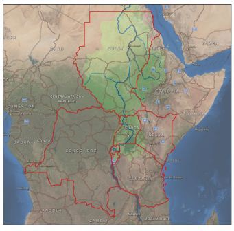
The countries included in the Nile Equatorial Lake sub-basins face an ever increasing pressure on land and water resources, together with rapid population growth. As a result, food production is one of the main concerns and priorities of policymakers in the area. Irrigation and improved water resources management have the potential to boost agricultural productivity in the area, currently almost entirely rainfed. Irrigated crop yields are much higher than rainfed yields, which means that there is a high potential to increase food production in the area.

FutureWater, in collaboration with WaterWatch, will assess the irrigation potential of seven Nile countries in order to fill gaps in the NBI and member country information based on agricultural use. This study consists of several consecutive steps, in which hydrological modelling, the use of remote sensed data, ArcGIS analyses, consultation workshops and meetings form the core of the project.

The specific objectives of this project are:

  • Determine the irrigation potential of the proposed countries considering the physical resources of ‘soil’ and ‘water’, combined with the irrigation water requirements as determined by the cropping patterns and climate
  • Provide a preliminary assessment of probable environmental and socio-economic constraints to be considered to ensure sustainable use of physical resources within the Nile basin
  • Indicate the required resources for the preparation and investment phase

NEL countries

Maps

The assessment of the Irrigation Potential study resulted in a irrigation suitability map. This map can be downloaded as jpeg or as GeoTIFF. Click on the links below to download the suitable format: