TWIGA aims to provide actionable geo-information on weather, water, and climate in Africa through innovative combinations of new in situ sensors and satellite-based geo-data. With the foreseen new services, TWIGA expects to reach twelve million people within the four years of the project, based on sustainable business models. The TWIGA consortium comprises seven research organisations, nine SMEs and two government organisations. In addition it uses a network of 500 ground weather stations in Africa, providing ready-to-use technical infrastructure. FutureWater's main role in TWIGA is centered around the use of flying sensors to map crop conditons, flood extent, and energy fluxes, complementing and improving data from in situ sensors and satellites. Furthermore, FutureWater is involved in innovative app development.
Twiga is the Swahili word for ‘giraffe’, a keen observer of the African landscape. TWIGA aims to provide actionable geo-information on weather, water, and climate in Africa through innovative combinations of new in situ sensors and satellite-based geo-data. With the foreseen new services, TWIGA expects to reach twelve million people within the four years of the project, based on sustainable business models.
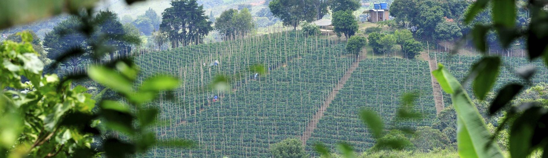
Africa needs reliable geo-information to develop its human and natural resources. Sixty percent of all uncultivated arable land lies in Africa. At the same time Africa is extremely vulnerable to climate change. Unfortunately, the in situ observation networks for weather, water, and climate have been declining since the 1970s. As a result, rainfall predictions in Africa for tomorrow have the same accuracy as predictions in Europe, ten days ahead. To realize the tremendous potential of Africa while safeguarding the population against impacts of climate change, Earth observation must be enhanced and actionable geoinformation services must be developed for policy makers, businesses, and citizens. New in situ observations need to be developed that leverage the satellite information provided through GEOSS and Copernicus (Open data/information systems).
TWIGA covers the complete value chain, from sensor observation, to GEOSS data and actionable geoinformation services for the African market. The logic followed throughout is that in situ observation, combined with satellite observations and mathematical models, will result in products consisting of maps and time series of basic variables, such as atmospheric water vapour, soil moisture, or crop stage. These products are either produced within TWIGA, or are already available with the GEOSS and Copernicus information systems. These products of basic variables are then combined and processed to derive actionable geo-information, such as flash flood warnings, sowing dates, or infra-structural maintenance scheduling.
The TWIGA consortium comprises seven research organisations, nine SMEs and two government organisations. In addition it uses a network of 500 ground weather stations in Africa, providing ready-to-use technical infrastructure.
FutureWater’s main role in TWIGA is centered around the use of flying sensors to map crop conditons, flood extent, and energy fluxes, complementing and improving data from in situ sensors and satellites. Furthermore, FutureWater is involved in innovative app development.
Related publications
2020 - Internship report
 Faassen, K., C. Nolet, S. Contreras. 2020. Internship Report: Determining the dryness index and evaporative fraction for satellite and drone images. Internship report.X
Determining the dryness index and evaporative fraction for satellite and drone images
Faassen, K., C. Nolet, S. Contreras
2020 - Internship Report
Koopmans, M. 2020. Internship Report: Enhancement of geodata: The assessment of a near-infrared UAV sensor and a performance study of a low-cost dual-frequency GNSS receiverXEnhancement of geodata: The assessment of a near-infrared UAV sensor and a performance study of a low-cost dual-frequency GNSS receiver
Koopmans, M.
2018 - FutureWater Report
Nolet, C., J. van Til, M. de Klerk. 2018. H2020 – TWIGA: WP3 Progress Report. FutureWater Report.X
H2020 – TWIGA: WP3 Progress Report
Nolet, C., J. van Til, M. de Klerk