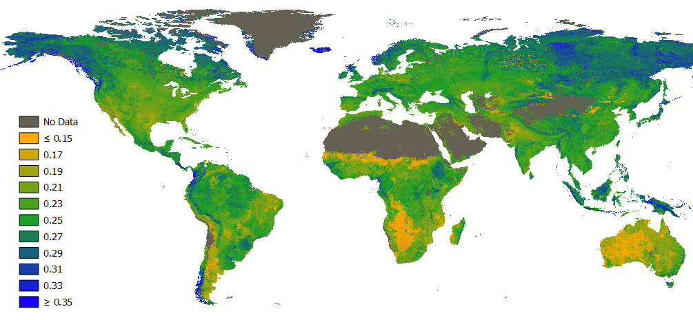
FutureWater has developed global maps of soil hydraulic properties to support hydrological modelling. The maps, at a resolution of 1 km world-wide, are now available. The maps are produced by combining the best soil information at global scale and most up-to-date pedo-transfer functions currently available.
Soil information is the basis for all environmental studies. Since local soil maps of good quality are often not available, global soil maps with a lower resolution are used. Furthermore, soil maps do not include information about soil hydraulic properties, which are of importance in, for example, hydrological modelling, erosion assessment and crop yield modelling. The developed global mapsa of soil hydraulic properties, referred to as HiHydroSoil, fill this data gap. HiHydroSoil includes the following data:
- Organic Matter Content
- Soil Texture Class
- Saturated Hydraulic Conductivity
- Mualem van Genuchten parameters Alfa and N
- Saturated Water Content
- Residual Water Content
- Water content at pF2, pF3 and pF4.2
- Hydrologic Soil Group (USDA)
The HiHydroSoil database is freely available and can be obtained from FutureWater.
