
Introduction
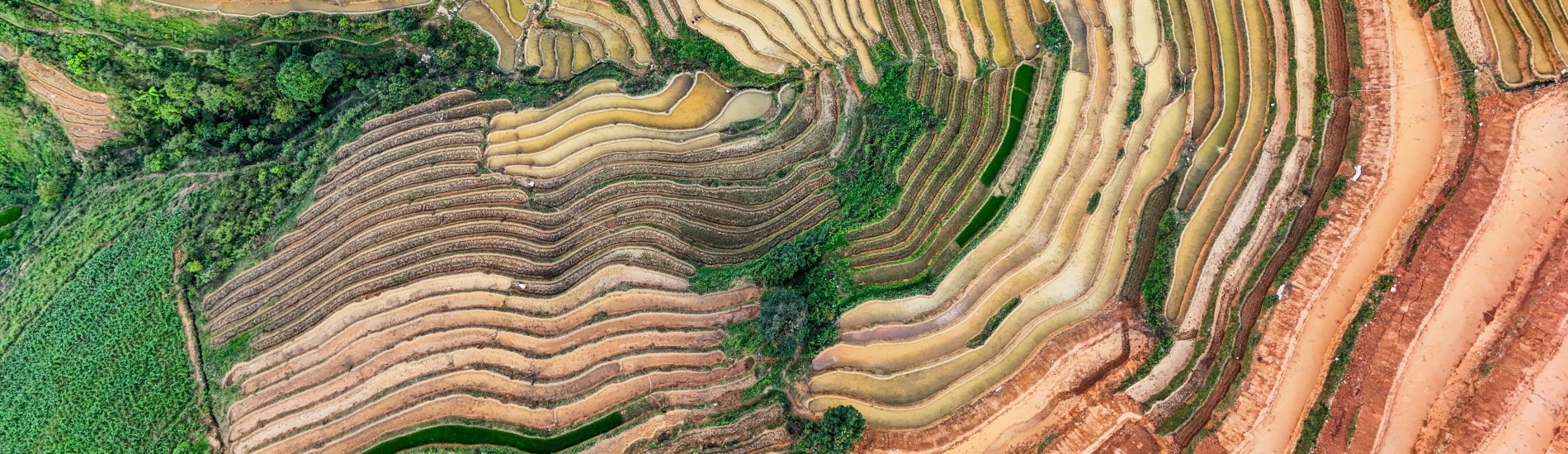
Soil information forms the foundation of all environmental studies and is an essential input for geospatial models. At the same time, the reliability and accessibility of such data have been limited over the past decades. Since high-quality local soil maps are often unavailable, global soil maps with lower resolution are commonly used. Moreover, these maps usually lack information on soil hydraulic properties, which are crucial for applications such as hydrological modeling, erosion assessment, and crop yield estimation.
In recent years, more soil data have become available and computational algorithms have improved, enabling ISRIC to develop the global gridded soil dataset SoilGrids250m, offering higher resolution and improved accuracy. As SoilGrids does not include hydraulic soil properties that are typically required for hydrological modeling, FutureWater developed a global dataset of soil hydraulic properties based on pedotransfer functions: HiHydroSoil. This database is freely available and widely used by research institutions, NGOs, and consultancy organizations around the world to improve access to soil hydraulic data. The dataset provides a comprehensive inventory of soil hydraulic variables in gridded format and is available globally with a spatial resolution of 250 meters.
Due to its gridded nature and relatively high level of detail, HiHydroSoil is frequently used in technical consultancy studies as well as academic projects. Between 2021 and 2025, the use of HiHydroSoil data has been cited in 107 scientific publications. Technical reports using HiHydroSoil include studies assessing ecosystem services, such as those conducted by NGOs like IUCN (Beatty et al., 2018) and WWF (Wolny et al., 2016). In addition, HiHydroSoil has been used as the default dataset for soil hydraulic information in Water Accounting reports published by FAO for multiple river basins worldwide.
The applications of HiHydroSoil can be grouped into three main categories:
- Stand-alone spatial analyses of soil hydraulic properties within a study area
- GIS-based suitability or opportunity mapping, integrating HiHydroSoil with other environmental variables
- Use as input for gridded quantitative simulation models such as Spatial Processes in Hydrology (SPHY) and the Integrated Valuation of Ecosystem Services and Tradeoffs (InVEST) suite
The InVEST documentation recommends HiHydroSoil as the data source for obtaining hydraulic conductivity and Hydrological Soil Group information.
Download HiHydroSoil v2.0
The HiHydroSoil v2.0 database is publicly available under the CC-BY 4.0 License and can be accessed after filling in the brief form below. A download link to the dataset will then be provided to you by email. The HiHydroSoil v2.0 dataset is organized in two folders, one containing the original data for each of the six depths, and one with the aggregated subsoil and topsoil data. All data layers are delivered in geotiff raster format.
Another option is to access the data through Google Earth Engine. The HiHydroSoil v2.0 data is available on Google Earth Engine using the following link.
Important! To avoid lengthy download times, the data layers originally consisting of float data type were multiplied by a factor of 10,000, and subsequently converted to integer type. It is therefore required to translate the data to the proper units by multiplying with 0.0001. These steps are also described in the readme file delivered with the data.
Related publications
-
2020 – FutureWater Report 213
 Simons, G.W.H., R. Koster, P. Droogers. 2020. HiHydroSoil v2.0 – A high resolution soil map of global hydraulic properties. FutureWater Report 213.X
HiHydroSoil v2.0 – High Resolution Soil Maps of Global Hydraulic Properties
Simons, G.W.H., R. Koster, P. Droogers
Related projects
-
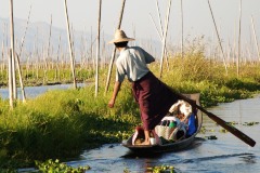
Boundary Demarcation and Ecosystem Services Mapping of Inle Lake Region, Myanmar
The assignment supports the newly established Inle Lake Management Authority (ILMA) by developing up-to-date, spatial datasets, which are to be included in the ILMA geodatabase. More specifically, the existing Inle Lake MAB boundary and zoning are confirmed and updated. Maps of land-use and different ecosystem services are produced and validated...
-
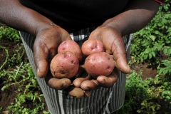
Remote Sensing for Land Suitability Assessment in Angola
The government of Angola considers the agricultural sector as an economic sector that offers great prospects and therefore aims to further develop the agricultural sector in order to diversify its economy. The potential for expanding the area under production is great. To support the effective planning of interventions that increase...
-
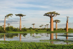
LAUREL: Land Use Planning for Enhanced Resilience of Landscapes
Deforestation, population growth, and climate change are only some of the challenges to sustainable landscape management in Madagascar. Severe impacts of land degradation on crop production, water availability and biodiversity are already observed and expected to exacerbate in the future. To address these challenges, the World Bank is supporting the...