Author: Martijn
1 July 2021
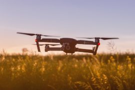
Using drones to attract youth into agribusiness and increase food production in Kenya
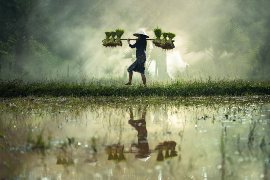
In Kenya, roughly 70% of the population is aged between 15-34. This age group is expected to double by the year 2050. Approximately 1 million young Kenyans enter the job market each year and only about 35% are absorbed into the formal job market. The remaining 65% end up unemployed or under employed. The agriculture...
24 June 2021
Climate stress test finalized for Land Use Plan of Panama Canal river basin
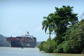
FutureWater and IDOM have delivered the final report titled “Prognosis: Trends and Scenarios” developed in project “Indicative Land Use Plan for (PIOTA) for the Panama Canal Basin (PCB)”. The PIOTA-CHCP project, which is led by the Panama Canal Authority (ACP) and funded by the Inter-American Development Bank (IDB), aims to produce the necessary strategic guidelines...
16 June 2021
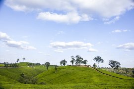
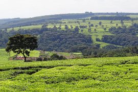
The eco.business Development Facility and ETG Fund FutureWater to Support Sustainable Kenyan Agribusinesses
The eco.business Fund, in partnership with FutureWater and Export Trading Group (ETG), one of the largest integrated agricultural supply chain managers and processors in sub-Saharan Africa, has launched a pilot project in Kenya for data-driven agricultural intensification. This project aims to improve farmer productivity and profitability whilst enhancing the environmental risk management and climate resilience...
15 June 2021
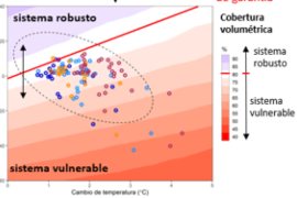
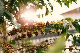
Press Release: EU Agricultural Imports Vulnerable to Future Climate Change
More than 44% of the European Union’s future agricultural imports, such as coffee, cocoa and soybean, could become highly vulnerable to drought by 2050 as a result of climate change, suggests a paper in Nature Communications. The findings highlight the increasing vulnerabilities of agricultural imports to climate change. The vulnerability of the agricultural sector to...
3 June 2021
HiHydroSoil v2.0 now available on Google Earth Engine
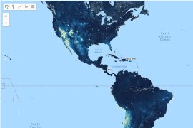
We are excited to announce that our high resolution dataset with global maps for Soil Hydraulic Properties HiHydroSoil v2.0 is now available on Google Earth Engine! It’s made available through the github page “Awesome GEE Community Datasets” by Samapriya Roy. A sample code on how to access the HiHydroSoil v2.0 dataset in Google Earth Engine...

20 May 2021
FutureWater and SEI launch the WEAP Erosion Plugin
Erosion plays a critical role in soil and water resource conservation projects. The WEAP model (Water Evaluation And Planning Tool) is widely used for water planning assessments, but an erosion module was lacking so far. The new WEAP Erosion Plugin (WEP) will fill this gap. The new plugin, referred to as WEP (WEAP Erosion Plugin)...
4 May 2021
FAO Water Report published featuring FutureWater’s work on Real Water Savings
We are proud to announce the publishing of the FAO Water Report No.46, which results from the work done in a FAO-funded FutureWater project on Real Water Savings. This publication provides clear and practical guidelines on realizing real water savings and selecting crop water productivity interventions. The approach for “following the water” is presented as...
23 March 2021
eTrainings in Kenya: Flying sensors and remote sensing for water management in agricultural systems
In March and April 2021 FutureWater, together with HiView, is conducting a series of online training courses on flying sensors (drones), agricultural applications, hands-on processing and interpretation of aerial imagery, setting up a drone unit, the use of WaPOR to access remotely sensed derived data, and real water savings in Kenya. In a comprehensive course, HiView...
10 March 2021
Training course on climate risk assessment for Panama Canal river basin started
This week a training to various experts in Panama has started on the use of the WEAP tool to assess climate risks and future water resources availability and demands. The training will focus on water users in the river basin belonging to the Panama Canal, including the water requirements for the operation of the canal...
23 February 2021
Kick-off eTraining on Flying Sensors for agricultural purposes in Jordan
On the 22nd of February we had the Kick-off event of the training on “Flying Sensors for agricultural purposes”. IHE Delft Institute for Water Education and the National Agricultural Research Center of Jordan (NARC) are collaborating with FutureWater and HiView in providing this tailor-made training. With a grand opening by both IHE Delft and NARC...
