Dr. Gijs Simons es experto en hidrología y teledetección con ocho años de experiencia en gestión y ejecución de proyectos internacionales en el ámbito de la gestión de recursos hídricos. Ha realizado trabajos en Camboya, China, Egipto, Etiopía, República Democrática Popular Laos, Madagascar, Mali, Marruecos, Mozambique, Myanmar, los Países Bajos, España, Sudán, Uganda y Vietnam.
Gijs posee habilidades avanzadas en modelización hidrológica, interpretación de imágenes de satélite, y análisis GIS mediante el empleo de una gran variedad de herramientas (ej. SPHY, SWAT, WEAP, ArcGIS, QGIS, PCRaster, Python, R, AquaCrop, Google Earth Engine) y abarcando varias escalas espaciales, desde el nivel de parcela hasta el de cuenca hidrológica. Gijs es el autor principal y coautor de un gran número de publicaciones incluyendo artículos científicos en revistas con referato e informes técnicos, a la vez que ha desarrollado y dirigido múltiples cursos de capacitación y talleres sobre teledetección, SIG y modelación hidrológica. Gijs es actualmente el director gerente de la oficina holandesa de FutureWater en Wageningen.
Actualmente es investigador de doctorado en la Universidad Tecnológica de Delft desarrollando una tesis sobre las posibilidades de la reutilización del agua en una cuenca hidrográfica a diferentes escalas espaciales.
Related projects
-
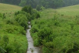
Assessment of the Water-Energy-Food-ecosystem Nexus in Selected River Basins in Southeast Asia
FutureWater is tailoring the REWEFe toolkit to support assessment of the WEFE Nexus by quantifying a set of indicators relevant to the key issues in seven selected river basins in Southeast Asia. This is part of a broader baseline assessment of competing uses and users of water in the current...
-
NbS for Drought Resilience in Latin America
Under this project, FutureWater supports the World Bank to fill an existing knowledge gap regarding the applicability and potential effectiveness of Nature-based Solutions to reduce risks of droughts, with a focus on Latin America. A set of NbS factsheets and an inventory of useful tools were compiled by exploring a...
-
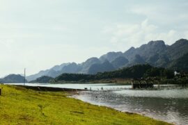
Model Development and Hydrological Assessments to Inform Ecosystem-based Adaptation Solutions in Lao PDR
The GCF project “Building resilience of urban populations with ecosystem-based solutions in Lao PDR” aims to test an alternative approach to flood control in urban Laos, moving away from a traditional focus on grey infrastructure, such as dams and concrete drainage systems, and towards Ecosystem-based Adaptation (EbA). A consortium led...
-

Climate Resilient Assessment and Investment Analysis in the Limpopo Basin
The primary objective of this study is to undertake a review of the water resources development scenarios considered in the Limpopo Scoping Study (2010) and the Limpopo Monograph (2013), to produce updated future development scenarios and evaluate these in terms of social, economic, and environmental benefits, including improved climate resilience...
-

Developing the CAREC Water Pillar: Climate Change Assessment for Georgia
The Central Asia Regional Economic Cooperation (CAREC) Program has initiated the development of a Water Pillar, an investment mechanism aimed at enhancing water infrastructure and capacity development to generate regional benefits. Expanding from the initial scoping study conducted for the five Central Asian countries in 2021, this project now shifts...
-
Capacity Building on Water Accounting Under the Water Scarcity Program for Asia-Pacific
Growing water scarcity continues to threaten the agricultural sector in Asia. In order to address this critical issue, FAO and partners have been developing a comprehensive Asia Pacific Water Scarcity Programme (WSP) since 2019. Under this program, a series of trainings on water accounting will be held in Indonesia, Vietnam...
-
Development of Environment and Climate Change Chapters of the Mekong State of the Basin Report 2023
As part of this assignment, FutureWater undertakes data analysis and is responsible for the presentation of each indicator and monitoring parameter of the Enviroment and Climate Change dimensions of the MRB-IF. Relevant supplementary data and information to illustrate basin conditions and trends are identified, and data gaps are addressed where...
-

Enhancing IWRM and Climate Resilience in Vulnerable Urban Areas of the Mekong River Basin
This project implements a set of measures that span across three key outputs: 1) Inclusive assessment of water-related climate risks completed in the priority river basins. 2) Enabling environment for gender-responsive climate risk-informed integrated water resources management developed. 3) Funding proposal for priority risk reduction measures developed To accomplish this,...
-
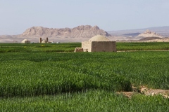
Tailor-made Training on Data-Driven Capacity for Ecosystem Services and Management in Iran
This tailor-made training, funded by Nuffic as part of the Mena Scholarship Programme and requested by The Center for Conservation and Development of Sustainable Ecosystems (ZIPAK) in Iran, focused on providing participants with relevant hands-on experience in tools and techniques to enhance their capacity to manage (protected) ecosystems in Iran.
-
Capacity Building on Water Accounting in Pakistan
The Food and Agriculture Organization of the United Nations (FAO) in Pakistan has recently secured Green Climate Fund (GCF) funds for increasing the climate resilience of agriculture and water management in the Indus Basin. Given the region’s climate vulnerability, it is critical to improve information services and build the country’s...
-
SOS-Water: Water Resources System Safe Operating Space in a Changing Climate and Society
The SOS-Water Project endeavours to set out the boundaries within which the Earth’s capacity to provide life-support systems for humanity is not endangered, and humanity’s capacity to adapt to environmental changes is not overburdened. Crossing such thresholds or tipping points in the complex Earth system could result in abrupt and...
-

Data Generation and Reporting to Support MRC Mekong State of the Basin Report 2023
The Mekong State Of the Basin Report (SOBR) is published by MRCS every five years. It provides information on the status and trends of water and related resources in the Mekong Basin, from an economic, social and environmental perspective. This project involves the hydrological and satellite-based analyses concerning spatiotemporal dynamics...
-
Identification of Land Degradation and Climate Change Hotspots
This projects entails a risk assessment of selected value chains in the context of progressing climate change which is expected to impact on degradation processes in dryland agriculture over the next decades. A global-scale assessment of the potential impact of climate change on land degradation is performed. Per-country estimates of...
-
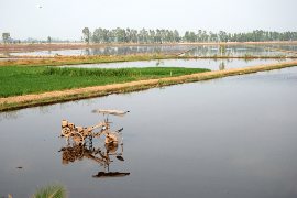
Follow the Water: Reuse of Water in Irrigated Systems
Reuse of water in irrigated systems is a key component in design and management of irrigation systems. FAO and FutureWater developed a Guidance document, a Tool and a Training package demand for a better understanding of the role of reuse of water in irrigated agriculture systems. Those outcomes will support...
-
Advancing the Monitoring of Water-Related SDGs in Myanmar: an Issue Brief
This assignment entails the write-up of an issue brief on SDG 6 monitoring in Myanmar with Earth Observation (EO) technologies. Based on the status of data availability in Myanmar and the potential of innovative technologies and datasets, examples are given of how current knowledge gaps can be addressed. In addition,...
-
Technical Annexes on Nature-based Solutions for Water Security
The Nature Conservancy (TNC) is producing technical modules and guidance documentation to enable water sector actors and their funders to invest in Nature-based Solutions for Water Security (NbS-WS). Part of the material being developed is a module on technical options, which will include annexes with key information for each of...
-
Evaluating the Extent of Salinity Intrusion and the Riverine, Estuarine and Coastal Habitat Conditions in the Lower Mekong Basin
Within this project, detailed methodologies are developed for periodical implementation of regional studies on the extent of salinity intrusion in the Mekong Delta; and the condition of riverine, estuarine, and coastal habitats in the Lower Mekong Basin. A literature review is conducted to identify successful approaches from the Mekong Region...
-
Tailor-made Training on River Morphology and Flood Risk using State-of-the-Art Open Satellite Data and Processing Tools
The main objective is to enhance the capacity of DWIR staff in using innovative data and tools to analyze water resources and support water management. The training is organized with a very practical approach and strongly built upon the ‘learning-by-doing’ principles. Participants use freely accessible satellite-derived data to gain insight...
-
Baseline Assessment for the Identification of Landscape Restoration Options in Kyrgyzstan
To identify and prioritize degraded lands in Kyrgyzstan for landscape restoration in order to reduce reservoir sedimentation and enhance sustainable water and energy resources. Remote sensing and data geospatial data analytics has been applied with an aim of prioritizing degraded areas of land in Kyrgyzstan and determining where restoration interventions...
-
HiHydroSoil v2.0: Global Maps of Soil Hydraulic Properties at 250m Resolution
In 2016, FutureWater released a new dataset: HiHydroSoil v1.2, containing global maps with a spatial resolution of 1 km of soil hydraulic properties to support hydrological modeling. Since then, the maps of the HiHydroSoil v1.2 database have been used a lot in hydrological modeling throughout the world in numerous (scientific) projects. A few examples of...
-
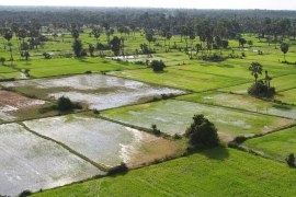
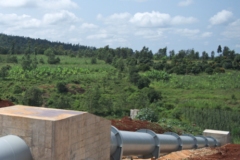
WAT4CAM: Mekong-Bassac Hydrological and Hydraulic Study
The WAT4CAM program aims to apply IWRM and ISWM principles towards achieving the strategies of the government of Cambodia. This project (WAT4CAM subcompoment 3.1) supports this objective by performing a detailed hydraulic and hydrological modelling study, of which the outcomes will be used in the implementation of Prek rehabilitation works....
-
Future Evapotranspiration in the Souss-Massa Basin
In this project, FutureWater used the outputs of the bias corrected "EuroCordex" RCM ensemble generated for IMWI in a previous work package. Using temperature and precipitation trends from this dataset for both past and future, an application of the Budyko methodology combined with the Modified Hargreaves approach was implemented to...
-
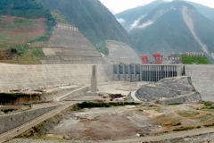
Hydrological Assessment for Hydropower in the Lukhra River
The objective was to develop a hydrological assessment for a planned run-of-river hydropower plant in the Lukhra river basin in Georgia. There is no observed river discharge data available. Hence, the assessment was developed based on hydrological simulations of the basin using the SPHY model (Terink et al., 2015) and...
-
Integrated Catchment Management in the Cagayan River Basin
The Ridge to Coast, Rain to Tap: Sustainable Water Supply Project (R2CR2T) is an integrated approach to addressing flooding in the Cagayan River basin on Mindanao in the Philippines. FutureWater was hired to support the R2CR2T project and their local team on the development and application of a Decision Support...
-
InfoSequia-4CAST: Forecasting and Quantifying Risks of Crop and Water Supply Failures Using Machine Learning and Remote Sensing
InfoSequia-4CAST combines historical and up-to-date observations of satellite-based meteorological and agricultural drought indices with climate variability indices, to generate seasonal outlooks of water supply and crop yield failure alerts. These impact-based indicators are computed using a simple, robust and easily understandable statistical forecasting-modelling framework. By making use of multi-sensor, state-of-the...
-
Flood Risk Assessment of a Water System Under a Future Climate
In 2009, the former Velt en Vecht Water Board (now part of the Vechtstromen Water Board) and in consultation with the municipalities of Emmen, Coevorden, Hardenberg and Ommen concluded an agreement in which agreements were made about the scope and interpretation of the development of storm water retention areas. This...
-
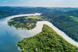
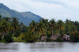
Boundary Demarcation and Ecosystem Services Mapping of Inle Lake Region, Myanmar
The assignment supports the newly established Inle Lake Management Authority (ILMA) by developing up-to-date, spatial datasets, which are to be included in the ILMA geodatabase. More specifically, the existing Inle Lake MAB boundary and zoning are confirmed and updated. Maps of land-use and different ecosystem services are produced and validated...
-
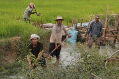
Transboundary water management between Thailand and Cambodia
Transboundary projects aid the development of effective water resource management (WRM) by helping to limit competition over resources and in creating a dialogue for the transferral of beneficial lessons between the countries. This project takes an integrated approach to support the development of a water resource management plan for a...
-
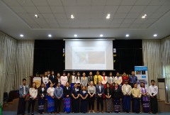
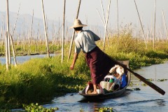
Tailor-Made Training for water professionals in Myanmar
This tailor-made training enhanced capacity of Yangon Technological University (YTU) educational staff in using Google Earth Engine to analyse water resources and support water management. Technical staff of Department of Meteorology and Hydrology (DMH) and the Department of Water resources and Improvement of River systems (DWIR) also participated to gain...
-
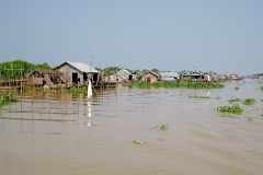
Water Resources and Eco-hydrological Assessments of Tonle Sap and Mekong Delta Basins
The overall project objective is to support MOWRAM to make more informed, evidence-based water resources management and irrigation investment decisions through better understanding of water resources and ecosystems of two river basin groups: the Tonle Sap and the Mekong Delta. The project concerns (i) rapid water resources assessment of the...
-
Satellite-based Monitoring of the Health Status of Grasslands at the Alagon Valley
This project is part of the technical-innovation support provided by FutureWater to ECOPRADERAS, an EIP-AGRI Operational Group which aims to improve the sustainable management of grasslands located at the Alagon Valley (Extremadura, Spain). Specific tasks included: the definition of a methodological framework for monitor the health of grasslands at the...
-
Improved catchment management for small hydropower
This study assessed the impacts of various investment portfolios for catchment management activities on the cost-benefits of small hydropower schemes, in two case study catchments in Kenya and Tanzania, and analyzes the return-on-investment for the hydropower developers. Catchment degradation trends, climate change impacts and socio-economic changes increasing competing water use...
-
SMART-WADI: SMART WAter Decisions for Iran
The SMART-WADI project (SMART Water Decisions for Iran), carried out by a consortium of FutureWater, IHE-Delft, and local partner EWERI, focuses on farmers who irrigate their crops with groundwater. The aim is to provide up-to-date information and advice on water productivity, irrigation and farm management. The project combines the latest...
-
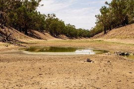
Agricultural Water Consumption in the Australian Border Rivers Catchment
FutureWater was hired to use satellite-derived data to provide a preliminary spatiotemporal assessment of water consumption across the Border Rivers catchment, one of the MDB catchments where excessive agricultural water use is an urgent issue. For relevant specific lots / properties, monthly water consumption dynamics were evaluated. This study is...
-
Remote Sensing Course in Angola
The project "Knowledge-to-Knowledge" (K2K), aims to strengthen and enhance the capacity of the main Angolan knowledge institutions in agricultural sciences, to establish a strong relate between knowledge and practice. FutureWater collaborates with Wageningen University on giving a training on remote sensing and GIS techniques in agricultural applications and services to...
-
MRC Mekong State of the Basin Report 2018: China and Myanmar
The Upper Mekong Basin has seen rapid economic development, radical land use changes and extensive hydropower development on the mainstream. FutureWater was hired by the Mekong River Commission to evaluate hydrological, environmental, economic and social indicators of the Upper Mekong Basin in China and Myanmar. Current status and trends in...
-
Remote Sensing for Land Suitability Assessment in Angola
The government of Angola considers the agricultural sector as an economic sector that offers great prospects and therefore aims to further develop the agricultural sector in order to diversify its economy. The potential for expanding the area under production is great. To support the effective planning of interventions that increase...
-
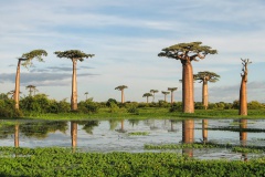
LAUREL: Land Use Planning for Enhanced Resilience of Landscapes
Deforestation, population growth, and climate change are only some of the challenges to sustainable landscape management in Madagascar. Severe impacts of land degradation on crop production, water availability and biodiversity are already observed and expected to exacerbate in the future. To address these challenges, the World Bank is supporting the...
-
Leapfrogging Delta Management: Showcase operational rainfall monitoring
Significant decisions are to be made to manage and engineer the water systems in Myanmar and to develop large structural and non-structural projects (e.g. hydropower dams, urban water use, industrial development, extension of irrigation capacity, operational quantity and quality management, etc.). The Myanmar and Dutch governments have agreed to cooperate...
-
DAISY2: Daring Applications and Innovations in Sensor sYstems
DAISY2 builds on the success of the DAISY project in which a compact and mobile sensor system was developed aimed at different socio-economic applications like e.g. security, life-sciences, transport, logistics, and agro-food. Within DAISY2 we aim to further develop this sensor system and explore the viability of this products for...
-
Hydropower Development Assessment for the Tamakoshi River Basin
The overall objective of this project is to improve the understanding of the expected impacts of climate change on water availability in the context of potential hydropower development in the Tamakoshi River Basin. Specifically, the project aims to (i) Understand the current baseline hydrological regime of the Tamakoshi River Basin,...
-
Inclusive Development Paths for Healthy Red River Landscapes
Rapid land use changes in the Red River Basin threaten water resources. This project will be working in the Day River Catchment, a Red River distributary important for Hanoi, where most of these problems are manifest. The project will develop equitable and economically viable pathways for the land and water...
-
Demonstration of Remote Sensing Information for Integrated Reservoir Management in the Red River Basin in Northern Vietnam
In 2011 the Vietnamese and Dutch government signed a Memorandum of Understanding on the establishment of a Government to Government (G2G) program for improved integrated planning and monitoring of water resources for transboundary water management and disaster risk management. This project was formulated as part of the G2G trajectory towards...
-
Online field-scale irrigation management for Romania
In this project a field-scale irrigation planning and management system was setup and tested. The basis for this system is formed by online in-situ ground data on soil moisture content and hydrological model calculations of the root zone and shallow subsoil. Weather stations and soil moisture sensors were installed at...
Related publications
-
2024 - FutureWater Technical Report

 Simons, G.W.H., E. Aparicio. 2024. Strengths and Limitations of Water Footprints: a Literature Review. FutureWater Technical Report 260.X
Strengths and Limitations of Water Footprints: a Literature Review
Simons, G.W.H., E. Aparicio
-
2024 - Technical report
Fernández-Rodríguez, A., S. Contreras, G. Simons. Satellite-based Water Productivity of dominant croplands in the Jucar River Basin (Spain) by local implementation of WaPOR algorithm. 2024.Technical report. XSatellite-based Water Productivity of dominant croplands in the Jucar River Basin (Spain) by local implementation of WaPOR algorithm
Fernández-Rodríguez, A., S. Contreras, G. Simons
-
2024 - ESA-Incubed Project Final Report (FREP)
Contreras, S., G.W.H. Simons, A. Fernández-Rodríguez. 2024. Infosequia-4CAST: Towards an Operational Satellite-based Drought Early Warning and Forecasting System for Quantifying Risks of Crop and Water Supply Failures. ESA-Incubed Project Final Report (FREP)XInfosequia-4CAST: Towards an Operational Satellite-based Drought Early Warning and Forecasting System for Quantifying Risks of Crop and Water Supply Failures
Contreras, S., G.W.H. Simons, A. Fernández-Rodríguez
-
2023 - Technical Report
Simons, G.W.H., C. Nolet. 2023. Climate Risk Assessment of Key Agricultural Supply Chains in the 3S and 4P Basins, Cambodia. FutureWater Report 247.X
Climate Risk Assessment of Key Agricultural Supply Chains in the 3S and 4P Basins, Cambodia
Simons, G.W.H., C. Nolet
-
2023 - FutureWater Report 234
Contreras, S., A. Fernández, J.E. Hunink, G.W.H. Simons. 2023. InfoSequia-4CAST: Water Supply Pilot Case. FutureWater Report 234.XInfoSequia-4CAST: Water Supply Pilot Case
Contreras, S., A. Fernández, J.E. Hunink, G.W.H. Simons
-
2023 - FutureWater Report 235
Contreras, S., A. Fernández, A. Grudnowska, M. Wens, G.W.H. Simons. 2023. InfoSequia-4CAST: Crop Yield Pilot Case. FutureWater Report 235.XInfoSequia-4CAST: Crop Yield Pilot Case
Contreras, S., A. Fernández, A. Grudnowska, M. Wens, G.W.H. Simons
-
2023 - World Bank Report
Beard, J.E., B. D'Haeyer, G.W.H. Simons. Landscape Restoration Opportunities in the Naryn River Basin, the Kyrgyz Republic : Restoration Opportunities Assessment Methodology (ROAM) Report (English). World Bank Group. Washington, D.C.XLandscape Restoration Opportunities in the Naryn River Basin, the Kyrgyz Republic: Restoration Opportunities Assessment Methodology (ROAM) Report
Beard, J.E., B. D'Haeyer, G.W.H. Simons
-
2022 - FutureWater Report 234
Contreras, S., G. Guimarães, A. Fernández, S. Khanal, G.W.H. Simons. 2022. InfoSequia-4CAST: Report on InfoSequia-4CAST Development. FutureWater Report 234. XInfoSequia-4CAST: Report on InfoSequia-4CAST Development
Contreras, S., G. Guimarães, A. Fernández, S. Khanal, G.W.H. Simons
-
2022 - FutureWater Report 235
Contreras, S., C. Nolet, S. Khanal, A. Fernández, G.W.H. Simons. 2022. InfoSequia-4CAST: Report on InfoSequia Monitor Upgrading. FutureWater Report 235. XInfoSequia-4CAST: Report on InfoSequia Monitor Upgrading
Contreras, S., C. Nolet, S. Khanal, A. Fernández, G.W.H. Simons
-
2022 - FutureWater Report 237
D'Haeyer, B., J. van Opstal, L. Verschuren, G. Simons, M. de Klerk, B. de Vries. SOSIA: Small-Scale Open Source Satellite-based Irrigation Advice. FutureWater Report 237.XSOSIA: Small-Scale Open Source Satellite-based Irrigation Advice. Report Phase 1.
D'Haeyer, B., J. van Opstal, L. Verschuren, G.W.H. Simons, M. de Klerk, B. de Vries
-
2022 - Technical report
Simons, G.W.H. 2022. Climate Change and Land Degradation: Identification of High-Risk Value Chains. Technical report.XClimate Change and Land Degradation: Identification of High-Risk Value Chains
Simons, G.W.H.
-
2022 - Technical Report
Simons, G.W.H., A. Green TL. 2022. WAT4CAM: Mekong-Bassac Hydrological and Hydraulic Study. Final Report.XWAT4CAM: Mekong-Bassac Hydrological and Hydraulic Study. Final Report.
Simons, G.W.H., A. Green TL
-
2021 - FutureWater Report 230
Contreras, S., G.W.H. Simons, A. Fernández. 2021. InfoSequia-4CAST: Risk Assessment and Mitigation Plan. FutureWater Report 230. XInfoSequia-4CAST: Risk Assessment and Mitigation Plan
Contreras, S., G.W.H. Simons, A. Fernández
-
2021 - FutureWater Report 229
Contreras, S., A. Fernández, G. Guimarães, G.W.H. Simons. 2021. InfoSequia-4CAST: Action Plan for Developing and Testing. FutureWater Report 229. XInfoSequia-4CAST: Action Plan for Developing and Testing
Contreras, S., A. Fernández, G. Guimarães, G.W.H. Simons
-
2021 - FutureWater Report 228
Contreras, S., G. Guimarães, G.W.H. Simons, C. Nolet, J.Beard, S. Khanal, A. Fernández. 2021. InfoSequia-4CAST: Baseline Design Report. FutureWater Report 228. XInfoSequia-4CAST: Baseline Design Report
Contreras, S., G. Guimarães, G.W.H. Simons, C. Nolet, J.Beard, S. Khanal, A. Fernández
-
2021 - FutureWater Report 225
Koster, R., G.W.H. Simons, J.E. Hunink, R. Hamed. 2021. Rainfall radar for soil moisture forecasts in the Netherlands: Development and testing of climate service DroogteNL. FutureWater Report 225.XRainfall radar for soil moisture forecasts in the Netherlands
Koster, R., G.W.H. Simons, J.E. Hunink, R. Hamed
-
2021 - JBA Consulting Report
JBA Consulting, Mekong Modelling Associates, FutureWater, Stockholm Environmental Insitute. 2021. Transboundary Water Management between Thailand and Cambodia as part of the adaptation of the agricultural sector in North-Western Cambodia to Climate Change. JBA Consulting Report.XTransboundary Water Management between Thailand and Cambodia as part of the adaptation of the agricultural sector in North-Western Cambodia to Climate Change
JBA Consulting, Mekong Modelling Associates, FutureWater, Stockholm Environmental Insitute
-
2020 - FutureWater Report 217
Simons, G.W.H., A.T. Moe. 2020. Ecosystem services mapping of Inle Lake Protected Area, Myanmar. FutureWater Report 217XEcosystem services mapping of Inle Lake Protected Area, Myanmar
Simons, G.W.H., A.T. Moe
-
2020 - FutureWater Report 216
Simons, G.W.H., P. Droogers, 2020. The impact of enhancing storage capacity on water shortages in North-western Cambodia under a changing climate. FutureWater Report 216XThe impact of enhancing storage capacity on water shortages in North-western Cambodia under a changing climate
Simons, G.W.H., P. Droogers
-
2020 - FutureWater Report 213
Simons, G.W.H., R. Koster, P. Droogers. 2020. HiHydroSoil v2.0 - A high resolution soil map of global hydraulic properties. FutureWater Report 213.XHiHydroSoil v2.0 – High Resolution Soil Maps of Global Hydraulic Properties
Simons, G.W.H., R. Koster, P. Droogers
-
2020 - FutureWater Report 212
 Contreras, S., C. Nolet, G.W.H. Simons, 2020. Monitor Ecopraderas: Seguimiento del estado de las praderas de la Vega del Alagón mediante indicadores de satélite. FutureWater Report 212X
Monitor Ecopraderas: Seguimiento del estado de las praderas de la Vega del Alagón mediante indicadores de satélite
Contreras, S., C. Nolet, G.W.H. Simons
-
2020 - Water 2020
Simons, G.W.H, P. Droogers, S. Contreras, J. Sieber, W. Bastiaanssen 1. 2020. Virtual Tracers to Detect Sources of Water and Track Water Reuse across a River Basin. Water 2020, 12, 2315; doi:10.3390/w12082315XVirtual Tracers to Detect Sources of Water and Track Water Reuse across a River Basin
Simons, G.W.H, P. Droogers, S. Contreras, J. Sieber, W. Bastiaanssen 1
-
2020 - International Water Power & Dam Construction Magazine
Hunink, J.E., G.W.H. Simons, C. Mor, A. Oliver, 2020. Revenue sharing in small
hydropower: is it worth it? International Water Power & Dam Construction Magazine. July 2020. 24-27XRevenue sharing in small hydropower: is it worth it?
Hunink, J.E., G.W.H. Simons, C. Mor, A. Oliver
-
2020 - FutureWater Report 209
Koster, R., G.W.H. Simons. 2020. Evaluation of PAGDP plans in Madagascar with the LANDSIM-R prototype. FutureWater Report 209.XEvaluation of PAGDP plans in Madagascar with the LANDSIM-R prototype
Koster, R., G.W.H. Simons
-
2020 - Agricultural Water Management
Simons, G.W.H., W.G.M. Bastiaanssen, M.J.M. Cheema, B. Ahmad, W.W. Immerzeel. 2020. A novel method to quantify consumed fractions and non-consumptive use of irrigation water: Application to the Indus Basin Irrigation System of Pakistan, Agricultural Water Management, Volume 236, 106174, ISSN 0378-3774,
https://doi.org/10.1016/j.agwat.2020.106174.XA novel method to quantify consumed fractions and non-consumptive use of irrigation water: Application to the Indus Basin Irrigation System of Pakistan
Simons, G.W.H., W.G.M. Bastiaanssen, M.J.M. Cheema, B. Ahmad, W.W. Immerzeel
-
2019 - FutureWater Report 205
Droogers, P., A. Green, G.W.H. Simons, I. Brownhall, C. Oeurng, T. Bonvongsar, J.E. Hunink. 2019. Rapid Assessment of the State of Water Resources for the Tonle Sap River Basin and Mekong Delta River Basin, Cambodia. FutureWater Report 205XRapid Assessment of the State of Water Resources for the Tonle Sap River Basin and Mekong Delta River Basin, Cambodia
Droogers, P., A. Green, G.W.H. Simons, I. Brownhall, C. Oeurng, T. Bonvongsar, J.E. Hunink
-
2019 - FutureWater Report 206
Green, A., K.G. Hortle, W. Giese, B. van Balen, D. Yem, J. Mills, I. Brownhall, P. Droogers, G.W.H. Simons, J.E. Hunink, C. Oeurng, T. Bonvongsar. 2019. Rapid Assessment of Eco-Hydrology for the Tonle Sap River Basin and Mekong Delta River Basin, Cambodia. FutureWater Report 206XRapid Assessment of Eco-Hydrology for the Tonle Sap River Basin and Mekong Delta River Basin, Cambodia
Green, A., K.G. Hortle, W. Giese, B. van Balen, D. Yem, J. Mills, I. Brownhall, P. Droogers, G.W.H. Simons, J.E. Hunink, C. Oeurng, T. Bonvongsar
-
2019 - FutureWater Report 207
Green, A., P. Droogers, G.W.H. Simons, B. van Balen, K. Hortle, C. Oeurng, T. Bonvongsar, D. Yem, J.E. Hunink. 2019. Detailed Surface Water Resources Assessment for the Tonle Sap and Mekong Delta River Basins, Cambodia. FutureWater Report 207XDetailed Surface Water Resources Assessment for the Tonle Sap and Mekong Delta River Basins, Cambodia
Green, A., P. Droogers, G.W.H. Simons, B. van Balen, K. Hortle, C. Oeurng, T. Bonvongsar, D. Yem, J.E. Hunink
-
2019 - FutureWater Report 208
Nolet, C., J. Beard, A. Green, J.E. Hunink, G.W.H. Simons. 2019. Climate Risk Screening for the Tonle Sap River Basin and the Mekong Delta River Basin, Cambodia. FutureWater Report 208XClimate Risk Screening for the Tonle Sap River Basin and the Mekong Delta River Basin, Cambodia
Nolet, C., J. Beard, A. Green, J.E. Hunink, G.W.H. Simons
-
2019 - STOWA Report 2019-32
Simons, G.W.H., M. de Klerk. 2019. Kennisbehoefte meteorologische en klimatologische informatie. STOWA Rapport 2019-32.XKennisbehoefte meteorologische en klimatologische informatie
Simons, G.W.H., M. de Klerk
-
2019 - FutureWater Report 185
Kaune, A., G.W.H. Simons, S. Pareeth, P. Karimi, M. Shaffei. 2019. SMART-WADI: SMART WAter Decisions for Iran. FutureWater Report 185XSMART-WADI: SMART WAter Decisions for Iran
Kaune, A., G.W.H. Simons, S. Pareeth, P. Karimi, M. Shaffei
-
2019 - Internship Report
Tiwari, S., 2019. Historical climate analysis of the Third Pole Region between 1979-2018. Internship ReportXHistorical climate analysis of the Third Pole Region between 1979-2018
Tiwari, S.
-
2019 - Water
Hunink, J.E, G.W.H. Simons, S. Suárez-Almiñana, A. Solera, J. Andreu, M. Giuliani, P. Zamberletti, M. Grillakis, A. Koutroulis, I. Tsanis, F. Schasfoort, S. Contreras, E. Ercin, W. Bastiaanssen. 2019. A Simplified Water Accounting Procedure to Assess Climate Change Impact on Water Resources for Agriculture across Different European River Basins. Water 2019, 11, 1976. doi:10.3390/w11101976XA Simplified Water Accounting Procedure to Assess Climate Change Impact on Water Resources for Agriculture across Different European River Basins
Hunink, J.E, G.W.H. Simons, S. Suárez-Almiñana, A. Solera, J. Andreu, M. Giuliani, P. Zamberletti, M. Grillakis, A. Koutroulis, I. Tsanis, F. Schasfoort, S. Contreras, E. Ercin, W. Bastiaanssen
-
2019 - IWMI Research Report
McCartney, M., S. Foudi, L. Muthuwatta, A. Sood, G.W.H. Simons, J.E. Hunink, K. Vercruysse, C. Omuombo. 2019. Quantifying the services of natural and built infrastructure in the context of climate change: the case of the Tana River Basin, Kenya. IWMI Research Report 174.XQuantifying the services of natural and built infrastructure in the context of climate change: the case of the Tana River Basin, Kenya
McCartney, M., S. Foudi, L. Muthuwatta, A. Sood, G.W.H. Simons, J.E. Hunink, K. Vercruysse, C. Omuombo
-
2019 - FutureWater Report 181
Simons, G.W.H., K. Viergever, A. Kaune. 2019. Remote Sensing for Land Suitability Assessment in Angola. FutureWater Report 181.
XRemote Sensing for Land Suitability Assessment in Angola
Simons, G.W.H., K. Viergever, A. Kaune
-
2019 - FutureWater Report 194
Hunink, J.E., J.P.C. Eekhout, J. de Vente, S. Contreras, G.W.H. Simons. 2019. Satellite-based altimetry data for hydrological assessments: two case studies Report 194XSatellite-based altimetry data for hydrological assessments: two case studies
Hunink, J.E., J.P.C. Eekhout, J. de Vente, S. Contreras, G.W.H. Simons
-
2018 - FutureWater Report 183
Simons, G.W.H., J.E. Hunink. 2018. The business case for small hydropower schemes to invest in catchment management: two case studies in Kenya and Tanzania. FutureWater Report 183.XThe business case for small hydropower schemes to invest in catchment management: two case studies in Kenya and Tanzania
Simons, G.W.H., J.E. Hunink
-
2018 - Climate Risk Management
Amarnatha, G., G.W.H. Simons, N. Alahacoon, V. Smakhtin, B. Sharma, Y. Gismalla, Y. Mohammed, M.C.M. Andriessen. 2018. Using smart ICT to provide weather and water information to smallholders in Africa: The case of the Gash River Basin, Sudan. Climate Risk Management, 22, 52-66.XUsing smart ICT to provide weather and water information to smallholders in Africa: The case of the Gash River Basin, Sudan
Amarnatha, G., G.W.H. Simons, N. Alahacoon, V. Smakhtin, B. Sharma, Y. Gismalla, Y. Mohammed, M.C.M. Andriessen
-
2018 - FutureWater Report 177
Simons, G.W.H., M. Kruisheer. 2018. Agricultural Water Consumption in the Australian Border Rivers Catchment: a Preliminary Assessment. FutureWater Report 177.XAgricultural Water Consumption in the Australian Border Rivers Catchment: a Preliminary Assessment
Simons, G.W.H., M. Kruisheer
-
2017 - FutureWater Report 172
Den Besten, N.I., J.E. Hunink, G.W.H. Simons. 2017. Water Productivity assessment using Flying Sensors and Crop Modelling: Pilot study for Maize in Mozambique. FutureWater Report 172.XWater Productivity assessment using Flying Sensors and Crop Modelling: Pilot study for Maize in Mozambique
Den Besten, N.I., J.E. Hunink, G.W.H. Simons
-
2017 - FutureWater Report 170
Simons, G.W.H., N.I. den Besten, P. Droogers. 2017. A First-Order Water Productivity Assessment for the APROVALE Project, Mozambique. FutureWater Report 170.XA First-Order Water Productivity Assessment for the APROVALE Project, Mozambique
Simons, G.W.H., N.I. den Besten, P. Droogers
-
2017 - FutureWater Report 169
Droogers, P., G.W.H. Simons, N.I. den Besten, J. van Til, M. de Klerk. 2017. Monitoring Water Productivity: Demonstration Case for ThirdEye Mozambique. FutureWater Report 169.XMonitoring Water Productivity: Demonstration Case for ThirdEye Mozambique
Droogers, P., G.W.H. Simons, N.I. den Besten, J. van Til, M. de Klerk
-
2017 - White paper
Simons, G.W.H., A. Poortinga, W. Bastiaanssen, D. Saah, A. Troy, J.E. Hunink, M. de Klerk, M. Rutten, P. Cutter, L. Rebelo, L. Thanh Ha, V. Phuong Nam, T. Hessels, M. Fenn, B. Bean, D. Ganz, P. Droogers, T. Erickson, N. Clinton. 2017. On Spatially Distributed Hydrological Ecosystem Services - Bridging the Quantitative Information Gap using Remote Sensing and Hydrological Models. White paper published by FutureWater.XOn Spatially Distributed Hydrological Ecosystem Services – Bridging the Quantitative Information Gap using Remote Sensing and Hydrological Models
Simons, G.W.H., A. Poortinga, W.G.M. Bastiaanssen, D. Saah, A. Troy, J.E. Hunink, M. de Klerk, M. Rutten, P. Cutter, L. Rebelo, L. Thanh Ha, V. Phuong Nam, T. Hessels, M. Fenn, B. Bean, D. Ganz, P. Droogers, T. Erickson, N. Clinton
-
2017 - FutureWater Report 166
De Klerk, M., P. Droogers, G.W.H. Simons, J. van Til. 2017. Change in Water Productivity as a Result of ThirdEye Services in Mozambique. FutureWater Report 166.XChange in Water Productivity as a Result of ThirdEye Services in Mozambique
De Klerk, M., P. Droogers, G.W.H. Simons, J. van Til
-
2017 - FutureWater Report 163
De Boer, F.S., M. de Klerk, G. Simons, P. Droogers. 2017. Pilot optimalisatie waterverdeling Hunze en Aa’s. FutureWater Report 163.XPilot optimalisatie waterverdeling Hunze en Aa’s
De Boer, F.S., M. de Klerk, G. Simons, P. Droogers
-
2017 - eLEAF Report
Andriessen, M., G.W.H. Simons, R. Kassies, W. Terink. 2017. Slimme modelkoppeling voor betere actuele verdampingsschatting. eLEAF Report.XSlimme modelkoppeling voor betere actuele verdampingsschatting
Andriessen, M., G.W.H. Simons, R. Kassies, W. Terink
-
2017 - FutureWater Report 167
Hunink, J.E., S. Contreras, G.W.H. Simons, P. Droogers. 2017. Hydrological Evaluation and Ecosystem Valuation of the Lukanga Swamps. FutureWater Report 167.XHydrological Evaluation and Ecosystem Valuation of the Lukanga Swamps
Hunink, J.E., S. Contreras, G.W.H. Simons, P. Droogers
-
2017 - FutureWater Report 161
Simons, G.W.H., J. Buitink, P. Droogers, J.E. Hunink. 2017. Impacts of climate change on water and sediment flows in the Upper Tana Basin, Kenya. FutureWater Report 161.XImpacts of climate change on water and sediment flows in the Upper Tana Basin, Kenya
Simons, G.W.H., J. Buitink, P. Droogers, J.E. Hunink
-
2017 - Remote Sensing
Poortinga, A., W. Bastiaanssen, G. Simons, D. Saah, G. Senay, M. Fenn, B. Bean, J. Kadyszewski. 2017. A Self-Calibrating Runoff and Streamflow Remote Sensing Model for Ungauged Basins Using Open-Access Earth Observation Data. Remote Sens., 9, 86, doi:10.3390/rs9010086XA Self-Calibrating Runoff and Streamflow Remote Sensing Model for Ungauged Basins Using Open-Access Earth Observation Data
Poortinga, A., W. Bastiaanssen, G. Simons, D. Saah, G. Senay, M. Fenn, B. Bean, J. Kadyszewski
-
2016 - FutureWater Report 159
Simons, G.W.H., F. Heuff, P. Droogers, F. Witte. 2016. Ontwikkeling en demonstratie van een prototype informatieproduct voor natuurbrandbeheersing (SVIPE-W). FutureWater Report 159.XOntwikkeling en demonstratie van een prototype informatieproduct voor natuurbrandbeheersing (SVIPE-W)
Simons, G.W.H., F. Heuff, P. Droogers, F. Witte
-
2016 - FutureWater Report 153
Simons, G.W.H., F. Witte, P. Droogers. 2016. Satellietdatagebruik bij natuurbrandbeheersing: haalbaarheidsstudie naar de ontwikkeling van SWIPE. FutureWater Report 153.XSatellietdatagebruik bij natuurbrandbeheersing: haalbaarheidsstudie naar de ontwikkeling van SWIPE
Simons, G.W.H., F. Witte, P. Droogers
-
2016 - FutureWater Report 152
Simons, G.W.H., P. Droogers. 2016. Verkenning van remote sensing producten voor het waterbeheer. FutureWater Report 152.XVerkenning van remote sensing producten voor het waterbeheer
Simons, G.W.H., P. Droogers
-
2016 - STOWA Report
Simons, G.W.H., P. Droogers. 2016. Verkenning van remote sensing producten voor het waterbeheer. STOWA Report 2016-17.XVerkenning van remote sensing producten voor het waterbeheer
Simons, G.W.H., P. Droogers
-
2016 - Remote Sensing
Simons, G.W.H., W.G.M. Bastiaanssen, L.A. Ngô, C.R. Hain, M.C. Anderson, G.B. Senay, 2016. Integrating Global Satellite-Derived Data Products as a Pre-Analysis for Hydrological Modelling Studies: A Case Study for the Red River Basin. Remote Sensing 8(4):279-306XIntegrating Global Satellite-Derived Data Products as a Pre-Analysis for Hydrological Modelling Studies: A Case Study for the Red River Basin
Simons, G.W.H., W.G.M. Bastiaanssen, L.A. Ngô, C.R. Hain, M.C. Anderson, G.B. Senay
-
2015 - FutureWater Report 144
Terink, W., A.F. Lutz, G.W.H. Simons, W.W. Immerzeel. 2015. SPHY: Spatial Processes in HYdrology. Case-studies for training. FutureWater Report 144XSPHY: Spatial Processes in HYdrology. Case-studies for training.
Terink, W., A.F. Lutz, G.W.H. Simons, W.W. Immerzeel
-
2015 - FutureWater Report 140
Droogers, P., F.S. de Boer, M. de Klerk, G.W.H. Simons. 2015. Water Resources Model for Kenneti Basin South-Sudan. FutureWater Report 140XWater Resources Model for Kenneti Basin South-Sudan
Droogers, P., F.S. de Boer, M. de Klerk, G.W.H. Simons
-
2015 - FutureWater Report 137
Simons, G.W.H., G.A.P.M. Van den Eertwegh, P. Droogers. 2015. Online Parcel-scale Irrigation management in Romania: spatio-temporal soil moisture modeling using SPHY. FutureWater Report 137XOnline Parcel-scale Irrigation management in Romania: spatio-temporal soil moisture modeling using SPHY
Simons, G.W.H., G.A.P.M. Van den Eertwegh, P. Droogers
-
2015 - Geoscientific Model Development
Terink, W., A.F. Lutz, G.W.H. Simons, W.W. Immerzeel, P. Droogers. 2015. SPHY v2.0: Spatial Processes in HYdrology. Geoscientific Model Development 8: 2009-2034XSPHY v2.0: Spatial Processes in HYdrology
Terink, W., A.F. Lutz, G.W.H. Simons, W.W. Immerzeel, P. Droogers
-
2015 - KWR Report
Bartholomeus, R.P., G.W.H. Simons, G.A.P.H. van den Eertwegh. 2015. Anticipating on amplifying water stress: Optimal crop production supported by climate-adaptive water management. KWR Report 2015.062. June 2015.XAnticipating on amplifying water stress: Optimal crop production supported by climate-adaptive water management
Bartholomeus, R.P., G.W.H. Simons, G.A.P.H. van den Eertwegh
-
2015 - Report
Van Den Eertwegh, G., F. Witte, G. Simons, P. Hoefsloot, P. Droogers. 2015. Van SWIMM-methode naar NatuurVerdrogingsmonitor, Pilot voor drie Natte Natuur Parels in Noord-Brabant. XVan SWIMM-methode naar NatuurVerdrogingsmonitor
Van Den Eertwegh, G., F. Witte, G. Simons, P. Hoefsloot, P. Droogers
-
2015 - Geoscientific Model Development Discussions
Terink, W., A.F. Lutz, G.W.H. Simons, W.W. Immerzeel, P. Droogers. 2015. SPHY v2.0: Spatial Processes in Hydrology. Geoscientific Model Development Discussions 8: 1687-1748XSPHY v2.0: Spatial Processes in Hydrology
Terink, W., A.F. Lutz, G.W.H. Simons, W.W. Immerzeel, P. Droogers
-
2015 - Journal of Hydrology
Simons, G.W.H., W.G.M. Bastiaanssen, W.W. Immerzeel. 2015. Water reuse in river basins with multiple users: A literature review. Journal of Hydrology 522: 558-571XWater reuse in river basins with multiple users: A literature review
Simons, G.W.H., W.G.M. Bastiaanssen, W.W. Immerzeel
-
2014 - Bachelor Thesis
Wehling, M., P. Droogers, W. Terink, G. Simons, S. Eeman. 2014. ONLine parcel oriented irrigation advice Romania. Optimization of agricultural water resource management by using the SPHY model. Bachelor Thesis Land and water management, Hydrology, Van Hall Larenstein University of Applied SciencesXONLine parcel oriented irrigation advice Romania. Optimization of agricultural water resource management by using the SPHY model
Wehling, M., P. Droogers, W. Terink, G. Simons, S. Eeman
-
2013 - Advances in Data Mining, Workshop Proceedings
Terink, W., P. Droogers, J. van Dam, G. Simons, M. Voogt, A. Ines. 2013. Satellite based data mining to support Egypt's agriculture. Advances in Data Mining, Workshop Proceedings, ICDM 2013, pp. 171-180. ISSN 1164 - 9734. ISBN 978-3-942952-23-1XSatellite based data mining to support Egypt’s agriculture
Terink, W., P. Droogers, J. van Dam, G. Simons, M. Voogt, A. Ines
-
2012 - FutureWater Report 116
Terink, W., P. Droogers, J. van Dam, G. Simons, M. Voogt. 2012. The added value of high-resolution above coarse-resolution remote sensing images in crop yield forecasting: a case study in the Egyptian Nile Delta. FutureWater Report 116XThe added value of high-resolution above coarse-resolution remote sensing images in crop yield forecasting: a case study in the Egyptian Nile Delta
Terink, W., P. Droogers, J. van Dam, G. Simons, M. Voogt
-
2012 - FutureWater Report
Simons, G.W.H., W. Terink, H. Badawy, G.A.P.H. van den Eertwegh, W.G.M. Bastiaanssen. 2012. Egypt: Assessing the Effects of Farm-Level Irrigation Modernization on Water Availability and Crop Yields. XEgypt: Assessing the Effects of Farm-Level Irrigation Modernization on Water Availability and Crop Yields
Simons, G.W.H., W. Terink, H. Badawy, G.A.P.H. van den Eertwegh, W.G.M. Bastiaanssen