Water and food security are at risk in many places in the world: now and most likely even more in the future, having large economic and humanitarian consequences. Risk managers and decision-makers, such as water management authorities and humanitarian-aid agencies/NGOs, can prevent harmful consequences more efficiently if information is available on-time on (1) the impact on the system, economy or society, and also (2) the probabilities for a failure in the system. EO information has proven to be extremely useful for (1). For looking into the future, considering the uncertainties, novel machine learning techniques are becoming available.

The proposed development is incorporated into an existing solution for providing Drought and Early Warning Systems (DEWS), called InfoSequia. InfoSequia is a modular and flexible toolbox for the operational assessment of drought patterns and drought severity. Currently, the InfoSequia toolbox provides a comprehensive picture of current drought status, based mainly on EO data, through its InfoSequia-MONITOR module. The proposed additional module, called InfoSequia-4CAST, is a major extension of current InfoSequia capabilities, responding to needs that have been assessed in several previous experiences.

InfoSequia-4CAST provides the user with timely, future outlooks of drought impacts on crop yield and water supply. These forecasts are provided on the seasonal scale, i.e. 3-6 months ahead. Seasonal outlooks are computed by a novel state-of-the-art Machine Learning technique. This technique has already been tested for applications related to crop production forecasting and agricultural drought risk financing. The FFTrees algorithm uses predictor datasets (in this case, a range of climate variability indices alongside other climatic and vegetative indices) to generate FFTs predicting a binary outcome – crop yields or water supply-demand balance above or below a given threshold (failure: yes/no).

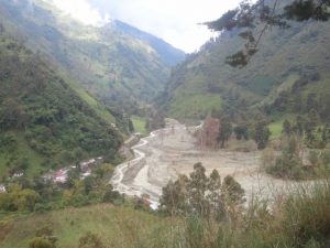
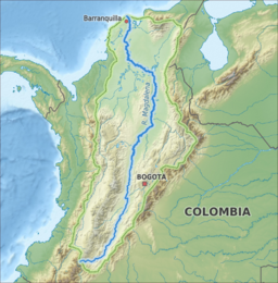
The activity includes intensive collaboration with stakeholders in Spain, Colombia and Mozambique, in order to establish user requirements, inform system design, and achieve pilot implementation of the system in the second project year. Generic machine learning procedures for training the required FFTs will be developed, and configured for these pilot areas. An intuitive user interface is developed for disseminating the output information to the end users. In addition to development of the forecasting functionality, InfoSequia-MONITOR will be upgraded by integrating state-of-the art ESA satellite data and creating multi-sensor blended drought indices.

The Sierra Nevada de Santa Marta, a UNESCO-declared Biosphere Reserve, is an isolated mountain complex encompassing approximately 17,000 km², set apart from the Andes chain that runs through Colombia. The Sierra Nevada has the world’s highest coastal peak (5,775 m above sea level) just 42 kilometres from the Caribbean coast. The Sierra Nevada is the source of 36 basins, making it the major regional ‘water factory’ supplying 1.5 million inhabitants as well as vast farming areas in the surrounding plains used mainly for the cultivation of banana and oil palm. The main problems to be solved in these basins are: i) Declining availability of water for irrigation, ii) Declining availability and quality of water for human consumption, iii) Increasing salinization of ground water and soils, iv) Increasing incidence of floods.

This is a feasibility study on the adoption of more efficient irrigation techniques by oil palm farmers in the Sevilla basin (713 km²), one of the key basins in the Sierra Nevada. The general objective is to identify the local environment at basin scale, the limiting factors and suitable field interventions in oil palm areas to improve the water use. A preparation and implementation phase was developed including an initial baseline assessment of the basin on climate, water availability, drought hazard, soil characteristics, land use, and topography. The agronomy (e.g. cultivars) and current field practices (e.g. nutrient management and irrigation practices) of the oil palm areas were characterized, and the crop water requirements determined. In addition, costs and benefits associated to the implementation of efficient irrigation technologies such as fertigation and water harvesting were assessed. Potential locations, risks and opportunities for water harvesting were evaluated with the idea to store water in the wet season to be able to use the resource in an efficient way in the dry season. A range of GIS and satellite-based datasets (e.g. CHIRPS, MODIS-ET, MODIS-NDVI, HiHydroSoil) were used to evaluate the environmental conditions, and local data and information was provided by local partners Cenipalma and Solidaridad to generate a comprehensive assessment at basin and field scale. The expectation is that fertigation and water harvesting techniques can be adopted in the Sevilla basin, but also in other basins in the Sierra Nevada de Santa Marta to reduce the environmental impact of oil palm production.

To support a sustainable and equitable management of increasingly pressurised water resources, water authorities need to have access to up-to-date information on the availability and use of those resources. However, such information is often scarce, or may at best be only available as static data in reports. This may lead to sub-optimal decisions, particularly during critical situations such as droughts, may diminish water security, slow down economic and social development, and even lead to disputes and conflicts on water allocation.

HERMANA aims to foster the development of an integrated water management decision support system (DSS) that supports daily, tactical and strategic decision-making related to water resources in Colombia, and specifically in the Cauca Valley Basin. The HERMANA tool will be a comprehensive system able to provide valuable, relevant, and reliable groundwater and surface water data, and information to high level decision makers and specific users, to an appropriate level of detail and at the time that it is required. HERMANA, which is based on the example of such integrated real-time decision support systems recently developed at selected Water Boards in the Netherlands, it will be executed by a solid team of experts in water resources, DSS, operational, tactical, and strategic water management and governance, that can work together to support water managers and governments around the world.

Objectives

The main objective of this project is to develop an integrated water management decision support system, HERMANA, which will enable CVC to make more informed decisions related to water management in the Cauca Valley. This project will contribute primarily to better informed and more transparent decision-making in managing water resources, in particular through the incorporation of the dynamic nature of groundwater resources and use, considering these as an integral part of the water resources in a river basin. This will contribute to a more balanced management of surface and groundwater resources and lead to improved water security. The goal is that this system will foster IWRM, as well as improving water use and efficiency.

Concretely, the goals of this project are to:

  • Provide CVC with an instrument to communicate with stakeholders;
  • Advance in the process of involving stakeholders in water-related decision-making;
  • Progress in the co-design of integrated water resources management tools and evaluate the lessons learned that can also be applied in the Netherlands;
  • Strengthen the cooperation between the consortium partners for future collaboration;
  • Develop a product to support IWRM that combines the complementary expertise of the Dutch water sector, including businesses (HydroLogic, FutureWater), a knowledge institute (Deltares), and public authorities (DWA), which can be replicated elsewhere; and
  • Develop a business case to show the viability of this system so that it can be implemented in other river basins in Colombia and elsewhere around the world.

Role of FutureWater

In this project, FutureWater has the mission to bridge the gap between scientific knowledge and practical applications for drought monitoring and sustainable water management. FutureWater will configurate and implement the InfoSequia drought monitoring system (www.infosequia.es) as part of HERMANA, and will contribute to the definition of scenarios and strategies for water management in the Cauca Valley region, and to the overall evaluation of existing tools and models available in HERMANA.

In 2011 Colombia, and especially the Magdelena river, was severely hit by large floodings. At the same time drought was experienced in other parts of the river basin. This triggered the Colombian government and water institutions to enforce the attention given to water security and dike safety and opened opportunities for the Dutch government and companies to support the country.

The main project objective is to improve the capacities of Colombia for adaptation of water management to climate change, by:

  • Quantifying the impact of climate change on flood risk and water availability.
  • Identifying critical thresholds in the water system and its management (adaptation tipping points) and sketch future options (pathways) for adaptation.
  • Providing tools/approaches that support water resources (adaptation) planning processes in dealing with uncertainties of climate change and other future developments in small and large river basins.
  • Demonstrating the above for a small (Coello-Combeima) and large (Magdalena) pilot basin and organizing capacity building activities.
  • Exploring opportunities for upscaling within Colombia and other countries in Latin America.

The activities in this pilot project include analysis of historical climate from observations and future climate with downscaled General Circulation Models (GCMs). Historical flood extents and land use is analyzed with space borne radar imagery. A hydrological model is developed to assess climate impacts on water availability and flood frequency and extent. A water allocation model is developed in the Water Evaluation and Planning tool (WEAP) to analyse how current and future water supply relate to sectorial water demands. Adaptation tipping points are determined and effects of different adaptation pathways are evaluated using the models. Results are presented in Colombia during stake holder events.

The projects support the elaboration of the National Adaptation Strategy of Colombia to be elaborated in 2013 and expected to be finished in 2014. As well, between September and November 2014 the National Development Plan will be developed, which defines the plans and investments for a next 4-year period. The National Planning Department of Colombia expects that the presented project goals, and approaches, will enrich these policy strategies and plans.

The consortium for this project is led by Deltares. Other consortium partners besides FutureWater are SarVision and UNESCO-IHE. Local partners are the Instituto de Hidrología, Meteorología y Estudios Ambientales de Colombia (IDEAM), Departamento Nacional de Planeación Colombia (DNP), Corporación Autónoma Regional del Río Grande de la Magdalena (CORMAGDALENA), and Corporación Autónoma Regional del Tolima (CORTOLIMA).

The project is funded by the consortium partners and a grant from the Dutch Government under the “Partners voor Water” scheme.