
Concept
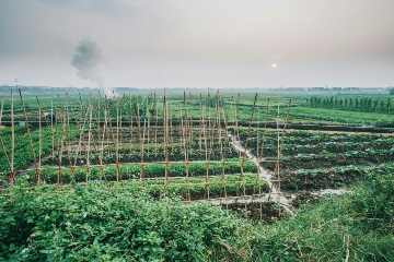
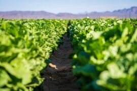
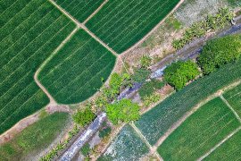
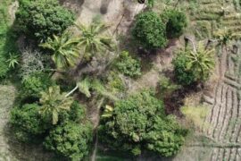
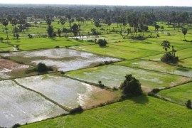
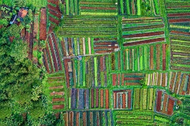
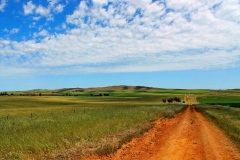
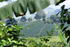
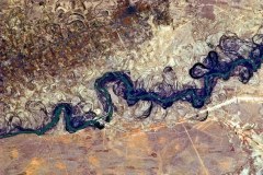
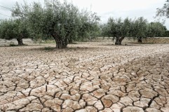
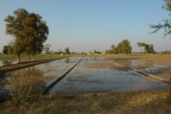
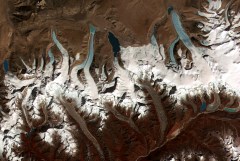
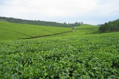
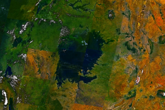
As technology progresses, satellites increasingly offer a reliable source of spatially distributed information on a variety of environmental variables. By using the reflective properties of the earth’s surface and atmosphere, it is possible to monitor (among others) vegetative cover, rainfall, snow cover, land surface temperature and actual evapotranspiration through time. Sensors like Landsat ETM, MODIS, PROBA-V and Sentinel offer a range of options on different spatial and temporal scales. FutureWater makes use of open-access datasets in consultancy studies, for operational decision support systems, and for feeding, calibrating and validating hydrological models.
Satellites now provide an archive of imagery that covers multiple decades. These historical records allow us to identify trends and spatial patterns in different factors associated with water resource management, such as water supply, water consumption and crop growth. Land cover changes, such as deforestation and agricultural expansion, can be mapped and quantified in assessments of ecosystem services and land degradation. By using state-of-the-art tools like the Google Earth Engine, we analyze these trends and patterns to support policy makers in identifying appropriate measures at different locations in their area of interest. In addition, FutureWater sees satellite-derived datasets as essential in maximizing the quality of output of simulation models to support decision makers, particularly in data-scarce areas.
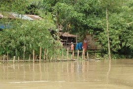
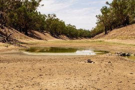
Although satellites can only provide information on the past situation, a smart combination of remote sensing and simulation modeling provides an integrated outlook on historical, current and future water availability. Governments, basin authorities, farmers and hydropower companies are interested in anticipating on future events by taking timely and targeted measures. Feeding hydrological models with the most recent satellite images in an operational context allows the construction of short-term forecast based on the actual current conditions. A number of satellites pass over quite frequently, making their data especially useful for operational decision support systems. We collect these data as soon as they become available, process them using our models, and disseminate the resulting information to the end user of the system. Up-to-date satellite-derived images provide insight in the actual conditions related to water resources and vegetation, without having to visit the field.
FutureWater applications
In most of our projects, FutureWater makes use of satellite remote sensing for one or more of the purposes described above. Some examples are given below.
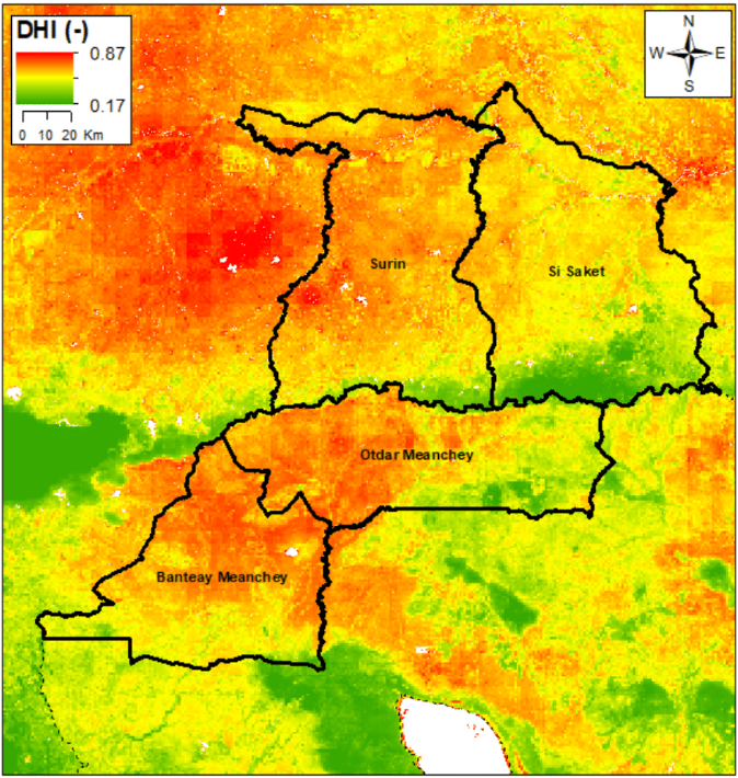
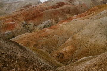
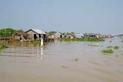
FutureWater has developed the Drought Monitoring and Impact Assessment Toolbox (DMIAT) for characterizing drought-prone areas in terms of drought hazard, vulnerability, and risk, as well as evaluating impacts of a specific drought event. The image presents the integrated Drought Hazard Index for two provinces in Cambodia and two in Thailand; the result of an extensive remote sensing-based analysis involving spatial rainfall statistics, vegetation cover statistics, and land surface temperature. More information on the project can be found here.
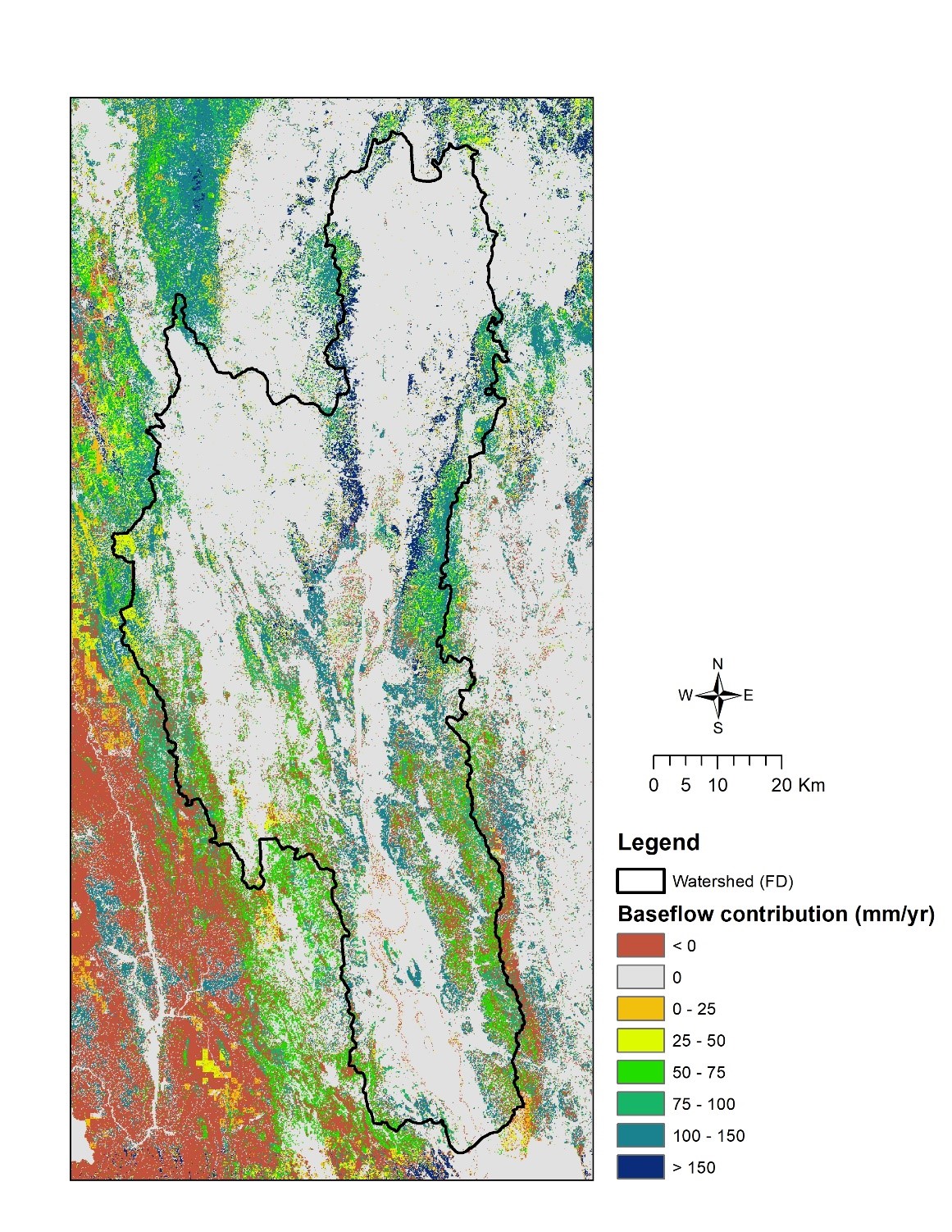
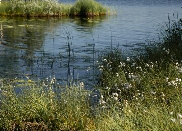
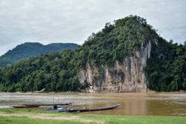
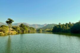
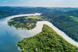
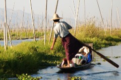
FutureWater uses remote sensing in assessments of ecosystem services, particularly those related to water (see the white paper on this topic led by FutureWater). Satellite data can be integrated with simulation models to quantify ecosystem services, such as the contribution of water during the dry season. The map shows the watershed of Inle Lake in Myanmar, an area where dry season water supply is highly important to maintain lake levels, provide water for domestic and agricultural consumption, and support production of hydropower. By integrating different sources of satellite data and the InVEST ecosystem services model, FutureWater mapped the ecosystem services in the Inle Lake region to support decision making on nature conservation policies by a newly created basin management authority. More information on the project can be found here.
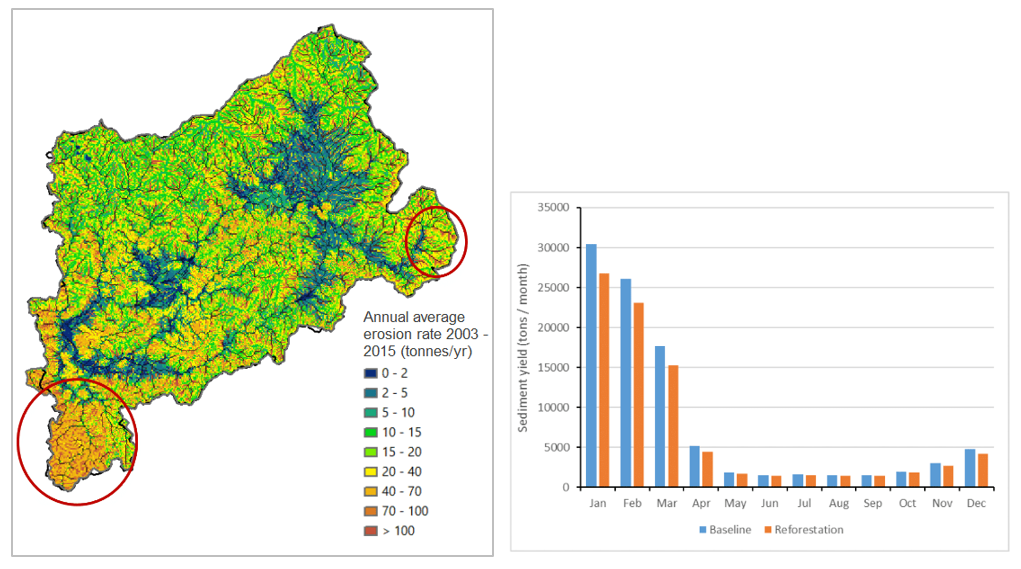
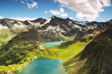
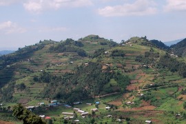
Combining remote sensing data with simulation models can also support Sustainable Land Management (SLM) strategies. In areas with scarcely available field data, satellites are often the only available source to provide up-to-date, spatially disaggregated data. The map on the left shows the annual average erosion rate for the Bealanana catchment in Madagascar as produced on a daily basis by the SPHY model. The high level of spatial detail of this map is made possible by the integration of satellite-derived datasets on vegetation dynamics, land cover and terrain. With a reliable simulation model, validated among others by satellite-derived evapotranspiration data, it is possible to run differen SLM scenarios and evaluate the impact on erosion and sediment yield of e.g. reforestation, agroforestry, and terracing measures. More information on the project can be found here.
Our In-House Tools & Services
InfoSequia: Drought Monitoring and Forecasting
InfoSequia is a powerful tool for proactive drought monitoring and forecasting. By integrating satellite data, machine learning, and real-time analytics, it delivers precise, impact-based insights to help decision-makers mitigate water scarcity and agricultural risks effectively.
SOSIA: Satellite-based Irrigation Advice
SOSIA is a cutting-edge irrigation advisory tool that empowers smallholder farmers with precise, location-specific guidance. By integrating satellite data and real-time rainfall insights, SOSIA delivers tailored irrigation schedules via daily messages, ensuring optimal water use and improved crop yields.

Croptimal: Crop-Specific Climate Suitability
Meet Croptimal, our smart tool that optimizes planting decisions with data-driven insights. Using satellite data and machine learning, it guides farmers on what, where, and when to plant for higher yields and sustainability.
Related projects
-
Drought Forecasting Model for Somalia/Somaliland
This project aims to strengthen drought preparedness and response in Somalia and Somaliland by enhancing the technical and operational capacities of the Somali Disaster Management Agency (SODMA) and Somaliland’s National Disaster Preparedness and Food Reserve Authority (NADFOR). Led by the World Food Programme (WFP), FutureWater and Galayr will work on...
-
Assessment of the Water-Energy-Food-ecosystem Nexus in Selected River Basins in Southeast Asia
FutureWater is tailoring the REWEFe toolkit to support assessment of the WEFE Nexus by quantifying a set of indicators relevant to the key issues in seven selected river basins in Southeast Asia. This is part of a broader baseline assessment of competing uses and users of water in the current...
-
BUCRA: Building Unity for Climate Resilient Agriculture
The BUCRA project empowers smallholder farmers in Egypt’s Nile Delta with climate-smart agricultural practices and advanced digital tools. Using FutureWater’s Croptimal and SOSIA, the project optimizes crop selection and irrigation efficiency, addressing water scarcity and climate change. Demonstration plots and tailored training drive sustainable, resilient farming.
-
Water Accounting in Mongolia
Water Accounting offers data-driven insights into water availability, use, and allocation, helping policymakers balance demands across sectors like agriculture, industry, and urban development. It supports sustainable growth by ensuring efficient water use while protecting resources for the future. By accounting for different interventions and projections, it offers climate-resilient water resources...
-
Water Allocation for Biodiversity Conservation in the Lower Amu Darya
The objective is to increase water supply to ecosystems upstream in the Amu Darya delta, upstream of the Aral Sea. The project consists of water allocation analysis and develop water supply scenarios for irrigated agriculture and biodiversity conservation, through consultations and water allocation modelling.
-
Climate Risk and Adaptation Assessment for the Electricity Distribution Infrastructure in Pakistan
The project aims to strengthen the existing power transmission and distribution (T&D) system in Pakistan by rehabilitating infrastructure as the country is currently struggling with deteriorating and climate-vulnerable grid infrastructure. As part of the ‘Power Distribution Strengthening Project’, ADB is assisting the government of Pakistan in rehabilitating and modernizing the...
-

Climate Risk Assessment for wastewater treatment plants in Kazakhstan
The proposed Kazakhstan Urban Infrastructure Modernization Program – Wastewater Treatment Project aims to construct / reconstruct climate-resilient wastewater treatment plants operationalized in four cities. FutureWater supported ADB by assessing the climate risk and adaptation options for this investment to enhance the wastewater treatment plants climate resilience and secure the proposed...
-
Monapo Catchment Water Allocation Model in Support of ARA-Norte in Mozambique
The aim of this project is to advance water system analysis for ARA-Norte, the regional water administration authority in Mozambique, focusing on the Monapo Catchment. In collaboration with ARA-Norte's hydrologists, we're crafting a Water Allocation Model employing the Water Evaluation And Planning (WEAP) system.
-

Climate Change Adaptation Scoping Assessment for Turkmenistan
The project aims to facilitate the identification and conceptualization of projects focused on climate adaptation, particularly enhancing resilience in Turkmenistan's water and agriculture sectors. This involves creating maps of climate-related hazards to engage with government and development partners. The mapped climate risks will serve as a foundation for discussions on...
-
Model Development and Hydrological Assessments to Inform Ecosystem-based Adaptation Solutions in Lao PDR
The GCF project “Building resilience of urban populations with ecosystem-based solutions in Lao PDR” aims to test an alternative approach to flood control in urban Laos, moving away from a traditional focus on grey infrastructure, such as dams and concrete drainage systems, and towards Ecosystem-based Adaptation (EbA). A consortium led...
-

Climate Risk Assessment: Golovnaya Hydropower Plant, Tajikistan
The Asian Development Bank (ADB) is supporting the rehabilitation of the 240-MW Golovnaya Hydropower Plant in Tajikistan, aiming to increase renewable energy supply from 743 GWh to 1,130 GWh. The project includes refurbishing the generation units. FutureWater supported ADB by assessing the climate risk and adaptation options for this investment...
-

Springshed Management in the Indian Himalayas
Springs in the Hindu Kush Himalaya (HKH) region are essential for water security, agriculture, economic activities, ecosystem services, biodiversity, and cultural heritage. They sustain nearly 240 million people, including 50 million in India who depend directly on these springs for their water needs. However, almost half of the perennial springs...
-

Climate Resilient Assessment and Investment Analysis in the Limpopo Basin
The primary objective of this study is to undertake a review of the water resources development scenarios considered in the Limpopo Scoping Study (2010) and the Limpopo Monograph (2013), to produce updated future development scenarios and evaluate these in terms of social, economic, and environmental benefits, including improved climate resilience...
-

Capacity Building on Water Accounting Under the Water Scarcity Program in Lao PDR
The capacity-building program on water accounting in Lao PDR focuses on enhancing participants' understanding of the status of water resources in the Nam Ngum pilot basin and enabling them to quantify the fluxes using various tools, including remote sensing.
-
Megadroughts in Europe’s Watertowers – From Process Understanding to Strategies for Management and Adaptation
Megadroughts are rare and poorly understood hazards. They are defined as exceptionally severe, multi-year, prolonged (>5 years) periods of drought that impact severely large areas and different sectors of the economy and the environment (Cook et al., 2022). They are generally caused by the concurrence of extreme events of dryness...
-

Catchment Assessment for Water Stewardship Plan
Highly productive berry farms and water scarcity are causing conflicts with the environmental assets and values of the Doñana National Park, Spain. There is growing interest in the agricultural sector to reverse this situation by implementing a water stewardship program. A catchment assessment is needed to produce baseline information to...
-
Nature-based Solutions in the Black Volta Basin: Pre-Feasibility Study
In this project, an analysis is being elaborated that will showcase the potential impact and associated costs of (Nature-based Solutions) NbS to enable effective design and implementation and will support the establishment of sustainable funding mechanisms based on leveraging local beneficiaries.
-
Increasing Investments in Early Warning Systems to Strengthen Climate and Disaster Resilience
This project aims to support the development of a new multi-hazard Early Warning System (EWS) facility, addressing the significant exposure of countries in Asia and the Pacific region to disaster risks. The enhancement of EWS aligns with global commitments, such as the Paris Agreement, Nationally Determined Contributions (NDCs), Sustainable Development...
-
Pre-Feasibility Work to Identify Nature-based Solutions for Multiple Catchments in Nigeria
This project will involve working across two fee-for-service engagements with the Coca Cola Corporation and Diageo in Nigeria. The identification and prioritisation of NbS for implementation will be achieved through the development of three key products: two prefeasibility analyses for Ogun and Oshun catchments, and a high-level country-wide strategic assessment...
-
RoSPro: Roadside Spring Protection to Improve Water Security in Nepal
The mid and high-altitude areas of the Himalayas face a critical water scarcity issue, making them one of the most vulnerable regions in the world. Springs are essential lifelines for millions of mountain communities, serving as the primary source of domestic water and local food security. Unfortunately, the flow regimes...
-
Capacity Building on Water Accounting Under the Water Scarcity Program for Asia-Pacific
Growing water scarcity continues to threaten the agricultural sector in Asia. In order to address this critical issue, FAO and partners have been developing a comprehensive Asia Pacific Water Scarcity Programme (WSP) since 2019. Under this program, a series of trainings on water accounting will be held in Indonesia, Vietnam...
-
Development of Environment and Climate Change Chapters of the Mekong State of the Basin Report 2023
As part of this assignment, FutureWater undertakes data analysis and is responsible for the presentation of each indicator and monitoring parameter of the Enviroment and Climate Change dimensions of the MRB-IF. Relevant supplementary data and information to illustrate basin conditions and trends are identified, and data gaps are addressed where...
-

Integrated Water Resources Management in Tajikistan
Given the abundant freshwater resources in Tajikistan, water plays a crucial role in the country's socioeconomic development. However, the rising population, economic growth, and the growing impacts of climate change pose significant challenges to ensure water availability and accessibility. This project aims to address the aforementioned information gap by improving...
-
GLOW: Global Water Availability Forecasting Service to Support Water Security
The GLOW project aims to pilot an operational service that provides timely and easy access to current and forecasted water availability and demand across the entire Maputo River and the Black Umbeluzi River Basins.
-
WE-ACT: Water Efficient Allocation in a Central Asian Transboundary River Basin
The WE-ACT project’s overall goal is to demonstrate a Decision Support System (DSS) for water allocation in a Central Asian transboundary river to increase shared benefits and foster the adaptation of water resources management and planning to climate change.
-
Climate Risk and Adaptation Assessment for Hydropower Project in Nepal
Climate risk and adaptation (CRA) assessment is required for the 635 MW Dudhkoshi hydroelectric project (DKSHEP) to ensure the project addresses climate change mitigation and adaptation in accordance with ADB’s requirements. The initial Climate Risk Assessment (CRA) by FutureWater in 2021 suggested the project is likely to be affected by...
-
SOSIA+: Climate Smart Irrigation Services in Ghana
Earlier this year FutureWater finished a very first draft of the irrigation advisory application SOSIA, with promising results in Rwanda and Zambia. The SOSIA Irrigation Advisory Tool was based on satellite data only. For this project, the SOSIA+ tool will be developed. SOSIA+ will also include real-time local ground data...
-
MAGDA: Meteorological Assimilation from Galileo and Drones for Agriculture
The MAGDA project aims at providing an integrated – but modular – system to provide severe weather forecasts and irrigation advisories enhanced by means of various satellite-borne, drone-borne and ground-based weather-observing technologies. The main applications will be in providing both warnings about severe weather that could affect crops and irrigation...
-
Climate Risk and Adaptation Assessment of the Energy Transmission System in Uzbekistan
The project aims to strengthen the existing power transmission system in Uzbekistan by expanding, rehabilitating, and constructing transmission lines and substations as the country is currently struggling with a weakening and climate-vulnerable grid infrastructure. To address this issue, ADB, in collaboration with FutureWater, is directing its efforts towards enhancing the...
-
Tailor-made Training on Data-Driven Capacity for Ecosystem Services and Management in Iran
This tailor-made training, funded by Nuffic as part of the Mena Scholarship Programme and requested by The Center for Conservation and Development of Sustainable Ecosystems (ZIPAK) in Iran, focused on providing participants with relevant hands-on experience in tools and techniques to enhance their capacity to manage (protected) ecosystems in Iran.
-
Strategic Climate Adaptation Planning for the Amu Darya Basin in Uzbekistan
Uzbekistan's water resources depend to a large extent on those provided by the transboundary Amu Darya river which are fully allocated and highly sensitive to climate change and water demand and management changes. Especially the agricultural sector, but also the energy and urban water supply sector need to transform into...
-

Capacity Building on Water Accounting in Pakistan
The Food and Agriculture Organization of the United Nations (FAO) in Pakistan has recently secured Green Climate Fund (GCF) funds for increasing the climate resilience of agriculture and water management in the Indus Basin. Given the region’s climate vulnerability, it is critical to improve information services and build the country’s...
-
SOS-Water: Water Resources System Safe Operating Space in a Changing Climate and Society
The SOS-Water Project endeavours to set out the boundaries within which the Earth’s capacity to provide life-support systems for humanity is not endangered, and humanity’s capacity to adapt to environmental changes is not overburdened. Crossing such thresholds or tipping points in the complex Earth system could result in abrupt and...
-
SOSIA: Small-Scale Open Source Satellite-based Irrigation Advice
FutureWater currently furthers the development of the SOSIA tool: an irrigation advice for small-scale food producers. Due to the lack of local weather station data, virtual weather stations derived from open-source satellite data are established, and combined with crop stage, and projected and historical precipitation data. The SOSIA tool allows...
-
Tailor-made Training on Geo-spatial Data Skills Development in Zambia
This tailor-made training, funded by Nuffic and requested by the staff of the The Ministry of Agriculture of the Government of the Republic of Zambia (GRZ), aims to help improving soil water management and crop productivity at the national level. The training focuses on building capacity of participants in accessing...
-

Data Generation and Reporting to Support MRC Mekong State of the Basin Report 2023
The Mekong State Of the Basin Report (SOBR) is published by MRCS every five years. It provides information on the status and trends of water and related resources in the Mekong Basin, from an economic, social and environmental perspective. This project involves the hydrological and satellite-based analyses concerning spatiotemporal dynamics...
-
Identification of Land Degradation and Climate Change Hotspots
This projects entails a risk assessment of selected value chains in the context of progressing climate change which is expected to impact on degradation processes in dryland agriculture over the next decades. A global-scale assessment of the potential impact of climate change on land degradation is performed. Per-country estimates of...
-
Groundwater Recharge in the Campo de Cartagena Quaternary Aquifer
This project (1) provides a critical review of previous results generated, and a SWOT analysis of hydrological simulation tools used in the area. (2) improve and update the quantification of the main water balance components, including vertical and lateral fluxes, at the basin scale in recent times (2000-2020 period) through...
-
Advancing the Monitoring of Water-Related SDGs in Myanmar: an Issue Brief
This assignment entails the write-up of an issue brief on SDG 6 monitoring in Myanmar with Earth Observation (EO) technologies. Based on the status of data availability in Myanmar and the potential of innovative technologies and datasets, examples are given of how current knowledge gaps can be addressed. In addition,...
-
Evaluating the Extent of Salinity Intrusion and the Riverine, Estuarine and Coastal Habitat Conditions in the Lower Mekong Basin
Within this project, detailed methodologies are developed for periodical implementation of regional studies on the extent of salinity intrusion in the Mekong Delta; and the condition of riverine, estuarine, and coastal habitats in the Lower Mekong Basin. A literature review is conducted to identify successful approaches from the Mekong Region...
-
Tailor-made Training on Climate Smart Irrigation Strategies to Improve Salinity Control and Enhance Agricultural Production
This tailor-made training, funded by Nuffic and requested by the staff of the college of Agriculture of Basra University, aims to help mitigate soil and water salinization problems hampering agricultural production in Iraq. The training focuses on accessing and using innovative data and tools in the public domain, to gain...
-
A Practical Farmers’ Toolkit – Geodata for Climate Smart Agriculture in Egypt
The 'Farmers Toolkit' as presented in this project contains various geodata tools applicable for farmers to assist their decision-making and adopt climate smart agricultural practices. This project launches a training program on these tools, which are: Flying Sensors, irrigation advisory services (IrriWatch portal), WaPOR and Google Earthengine Apps, and Climate...
-

Bio-Physical Assessment and Hydrological Analysis for Mukungwa and Akagera Lower catchments in Rwanda
FutureWater will conduct the bio-physical assessment and hydrological analysis for the Mukungwa and Akagera Lower Catchments in Rwanda. The project will be the basis for two catchment plans to be developed through the “EIWRM Project”, funded by the Government of the Netherlands and implemented by a consortium led by the...
-

Development of a Glacio-Hydrological Model and IWRM Plan for the Uttarakhand subbasin in India
The Swiss Agency for Development and Cooperation’s (SDCs) Global Programme Climate Change and Environment (GP CCE) India is supporting the operationalization of climate change adaptation actions in the mountain states of Uttarakhand, Sikkim and Himachal Pradesh through the phase two of the “Strengthening State Strategies for Climate Action” (3SCA) project...
-
Tailor-made Training on River Morphology and Flood Risk using State-of-the-Art Open Satellite Data and Processing Tools
The main objective is to enhance the capacity of DWIR staff in using innovative data and tools to analyze water resources and support water management. The training is organized with a very practical approach and strongly built upon the ‘learning-by-doing’ principles. Participants use freely accessible satellite-derived data to gain insight...
-
Baseline Assessment for the Identification of Landscape Restoration Options in Kyrgyzstan
To identify and prioritize degraded lands in Kyrgyzstan for landscape restoration in order to reduce reservoir sedimentation and enhance sustainable water and energy resources. Remote sensing and data geospatial data analytics has been applied with an aim of prioritizing degraded areas of land in Kyrgyzstan and determining where restoration interventions...
-
Tailor Made Training for the Rwanda Water Resources Board (RWB) on Water Allocation Modelling and Remote Sensing Analysis
FutureWater will provide a Tailor Made Training to water professionals at the Rwanda Water Resources Board (RWB) on Water Allocation Modeling and Remote Sensing Analysis. About 20 participants of the RWB are thought to work with the Water Evaluation And Planning model WEAP and the Remote Sensing platform of Google...
-
Cadastre Mapping with Flying Sensor Imagery in Mozambique
In this project TerraFirma hired FutureWater, HiView and ThirdEye Limitada (Chimoio, Mozambique) to acquire flying sensor imagery over a pilot area near Quelimane, Mozambique. The objective of this pilot project is to determine the suitability of using flying sensor imagery for cadastre mapping in an area of small-scale agriculture in...
-
WAT4CAM: Mekong-Bassac Hydrological and Hydraulic Study
The WAT4CAM program aims to apply IWRM and ISWM principles towards achieving the strategies of the government of Cambodia. This project (WAT4CAM subcompoment 3.1) supports this objective by performing a detailed hydraulic and hydrological modelling study, of which the outcomes will be used in the implementation of Prek rehabilitation works....
-
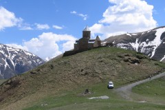
Hydrological Assessment for Hydropower in the Lukhra River
The objective was to develop a hydrological assessment for a planned run-of-river hydropower plant in the Lukhra river basin in Georgia. There is no observed river discharge data available. Hence, the assessment was developed based on hydrological simulations of the basin using the SPHY model (Terink et al., 2015) and...
-
Efficient Irrigation of Oil Palms in Colombia
This is a feasibility study on the adoption of more efficient irrigation techniques by oil palm farmers in the Sevilla basin, one of the key basins in the Sierra Nevada, Colombia. The general objective is to identify the local environment at basin scale, the limiting factors and suitable field interventions...
-
Tailor-Made Training on Crop Models and Remote Sensing for Water Management in Agricultural Systems
FutureWater, HiView and ThirdEye Kenya have partnered with Egerton University (Crops, Horticulture & Soils Department) to conduct a tailor-made training on 'Crop models and remote sensing for water management in agricultural systems'. This training project is funded by the NUFFIC - TMT program.
-

Determining biomass potential with Lidar point cloud of the Netherlands
This MIT feasibility project investigates the opportunities of an innovation project for determining the biomass potential from local nature management and green maintenance using the publicly available Lidar point cloud of the Netherlands. If the results are positive, this may lead to an innovative logistics support service where producers and...
-
InfoSequia-4CAST: Forecasting and Quantifying Risks of Crop and Water Supply Failures Using Machine Learning and Remote Sensing
InfoSequia-4CAST combines historical and up-to-date observations of satellite-based meteorological and agricultural drought indices with climate variability indices, to generate seasonal outlooks of water supply and crop yield failure alerts. These impact-based indicators are computed using a simple, robust and easily understandable statistical forecasting-modelling framework. By making use of multi-sensor, state-of-the...
-
G3P: Development of a Global Gravity-based Groundwater Product
Groundwater is one of the most important freshwater resources for mankind and for ecosystems, and has been declared as an Essential Climate Variable (ECV) by GCOS, the Global Climate Observing System. However, the Copernicus Services do not yet deliver data on this fundamental resource, nor is there any other data...
-
Climate Risk Assessment of Irrigation and Drainage Modernization Projects
The ADB supports Tajikistan in modernizing tow Irrigation and Drainage projects in the Lower Vaksh river basin in Tajikistan. A holistic feasibility study and project design for the system (38,000 ha), as well as advanced designs and bidding documents for selected works are prepared. FutureWater prepares the Climate Risk and...
-
Boundary Demarcation and Ecosystem Services Mapping of Inle Lake Region, Myanmar
The assignment supports the newly established Inle Lake Management Authority (ILMA) by developing up-to-date, spatial datasets, which are to be included in the ILMA geodatabase. More specifically, the existing Inle Lake MAB boundary and zoning are confirmed and updated. Maps of land-use and different ecosystem services are produced and validated...
-
Detection of On-farm Reservoirs in Irrigated Areas
The detection of on-site farm reservoirs and ponds in large areas is a complex task that can be addressed through the combination of visual inspection of orthophotos and the application of automatic pixel classification algorithms. This analysis performs a general workflow based on the usage of a Random Forest classifier...
-
Climate Adaptive Water Resources Management in Uzbekistan
The project undertakes a long-term and knowledge-based approach to deliver climate adaptive solutions for water resources management in Uzbekistan. The purpose is to modernize outdated irrigation and drainage systems that are currently highly vulnerable to climate change and to changes in inter-state agreements on water resources sharing. For two areas,...
-
Supporting Ambitious Climate Action in Central Asia
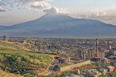
This project aimed to support Armenia, Georgia and Uzbekistan in targeting their Nationally Determined Contribution (NDC) spending to help adapt to the impacts of Climate Change at three spatial levels: National, Provincial and Urban. This involved performing detailed assessments of past and future climate trends and assessing climate related risk...
-
Climate Risk Assessment East-West Highway Road Project, Georgia
The government of Georgia has requested the assistance of the Asian Development Bank (ADB) to improve the Shorapani–Argveta Road Section F4 of the E60 East-West Highway. The proposed section improvement requires the construction of 12 tunnels (6 double tubes), 14 bridges, 4 interchanges and several deep cuttings and high embankments...
-
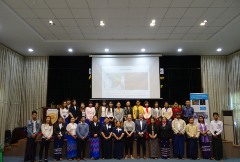
Tailor-Made Training for water professionals in Myanmar
This tailor-made training enhanced capacity of Yangon Technological University (YTU) educational staff in using Google Earth Engine to analyse water resources and support water management. Technical staff of Department of Meteorology and Hydrology (DMH) and the Department of Water resources and Improvement of River systems (DWIR) also participated to gain...
-

Mavo Diami: Services on Land-crop Suitability Mapping and Operational Irrigation Advice in Angola
The overall project goal is to improve sustainable food and income security for >100,000 smallholder farmers in Angola, by accelerating their agri-business performance through informed decisions supported by the Mavo Diami services built on weather, soil and crop signals and other relevant data and indicators. Ensuring the services are offered...
-
Climate Risk Assessment CAREC Road Project, Tajikistan
The Obigarm–Nurobod road section of the existing M41 highway, which carries about 3000 vehicles per day, will be inundated once the Rogun HPP reservoir has filled to operating levels. The government of Tajikistan has requested the assistance of the Asian Development Bank (ADB) to construct a 72 km long road...
-
Climate Risk Assessment Energy Distribution Network Modernization Program, Uzbekistan
In consultation with ADB and the project engineers, a rapid climate change assessment for the proposed investment program has been carried out so that the findings of the assessment can be integrated in the project design. The climate assessment focuses on the following issues: (i) screening of natural hazards in...
-
Water Resources and Eco-hydrological Assessments of Tonle Sap and Mekong Delta Basins
The overall project objective is to support MOWRAM to make more informed, evidence-based water resources management and irrigation investment decisions through better understanding of water resources and ecosystems of two river basin groups: the Tonle Sap and the Mekong Delta. The project concerns (i) rapid water resources assessment of the...
-
Climate Risk Assessment North-South Corridor Road Project, Georgia
The government of Georgia has requested the assistance of the Asian Development Bank (ADB) and the European Bank for Reconstruction and Development (EBRD) to progressively improve the North–South Corridor by (i) constructing a 23-km two-lane bypass road, (ii) providing adequate safety features and improving geometric alignment and (iii) providing well-designed...
-
Satellite-based Monitoring of the Health Status of Grasslands at the Alagon Valley
This project is part of the technical-innovation support provided by FutureWater to ECOPRADERAS, an EIP-AGRI Operational Group which aims to improve the sustainable management of grasslands located at the Alagon Valley (Extremadura, Spain). Specific tasks included: the definition of a methodological framework for monitor the health of grasslands at the...
-

Glacio-hydrological Assessment for Hydropower in the Nakhra River
The objective was to develop a glacio-hydrological assessment for planned run-of-river hydropower plant locations in the Nakhraa river basin in Georgia. The availability of observed river flow data is limited. Hence the assessment was developed based on hydrological simulations of the basin using the SPHY model (Terink et al., 2015)....
-

Training on Using Open Source Platforms for Hydrological Modelling of Data Sparse Regions in Nepal
This training was attended by sixteen researchers (seven female and nine male) from IOF, Department of Hydrology and Meteorology (DHM), Central Department of Hydrology and Meteorology (CDHM), Department of Forests and Soil Conservation and the Institute of Engineering (IOE). The overall objective of this training was to ensure the use...
-
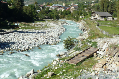
Glacio-hydrological assessment for hydropower, Mestiachala river, Georgia
The objective of this project was to develop a hydrological assessment for two potential hydropower plant locations in the Mestiachala basin in Georgia. The availability of observed river discharge data is limited. Hence the assessment was developed based on hydrological simulations of the basin using the SPHY model (Terink et...
-
Improved catchment management for small hydropower
This study assessed the impacts of various investment portfolios for catchment management activities on the cost-benefits of small hydropower schemes, in two case study catchments in Kenya and Tanzania, and analyzes the return-on-investment for the hydropower developers. Catchment degradation trends, climate change impacts and socio-economic changes increasing competing water use...
-

Pan-TPE: Changes in the Pan-Third Pole Water Tower
The proposed research targets changes in climate, water supply and demand, and suitable adaptation measures for green development of the Silk Road Economic Belt (SREB) in the river basins crossed by the SREB transect. Given the strong role of large scale hydrology in the proposed research activities, the spatial domain...
-
AgriSeasonal: Seasonal Climate Services for Agriculture
Future climatic and hydrologic conditions have significant impacts for selecting crops varieties, planning the growing season and ensuring water supply during the irrigation period. To the present day, monthly to yearly decisions in agriculture rely on past climate observations. This practice is going to fail more frequently in the context...
-
Climate Risk Assessment: Yanji City China
Jilin Yanji Low-Carbon Climate-Resilient Urban Development in China is supported by the Asian Development Bank. In the context of this investment project FutureWater will undertake a Climate Risk Assessment (CRA). The CRA will be based on the bottom-up approach where climate models (GCMs) are not the guiding boundary conditions, but...
-
SMART-WADI: SMART WAter Decisions for Iran
The SMART-WADI project (SMART Water Decisions for Iran), carried out by a consortium of FutureWater, IHE-Delft, and local partner EWERI, focuses on farmers who irrigate their crops with groundwater. The aim is to provide up-to-date information and advice on water productivity, irrigation and farm management. The project combines the latest...
-
Agricultural Water Consumption in the Australian Border Rivers Catchment
FutureWater was hired to use satellite-derived data to provide a preliminary spatiotemporal assessment of water consumption across the Border Rivers catchment, one of the MDB catchments where excessive agricultural water use is an urgent issue. For relevant specific lots / properties, monthly water consumption dynamics were evaluated. This study is...
-
Remote Sensing Course in Angola
The project "Knowledge-to-Knowledge" (K2K), aims to strengthen and enhance the capacity of the main Angolan knowledge institutions in agricultural sciences, to establish a strong relate between knowledge and practice. FutureWater collaborates with Wageningen University on giving a training on remote sensing and GIS techniques in agricultural applications and services to...
-
Climate Projections and Risk Assessment for eThekwini Municipality
C40 is supporting a small set of pilot cities develop and update their climate action planning (mitigation and adaptation) to ensure it meets 1.5°C Paris agreement level of ambition. The City of Durban (eThekwini Municipality) is one of the cities participating in the pilot. Climate Adapatation Services and FutureWater together...
-
MRC Mekong State of the Basin Report 2018: China and Myanmar
The Upper Mekong Basin has seen rapid economic development, radical land use changes and extensive hydropower development on the mainstream. FutureWater was hired by the Mekong River Commission to evaluate hydrological, environmental, economic and social indicators of the Upper Mekong Basin in China and Myanmar. Current status and trends in...
-

NL-RIA: Satellite-based altimetry data for hydrological assessments
A Dutch consortium has joined in the project “Dutch network on small spaceborne radar instruments and applications (NL-RIA)”, led by TU Delft. The objective is to bundle the radar-related knowhow available in The Netherlands, and fill the knowledge gaps, in order to boost SmallSat radar-based Earth Observation technology. The task...
-
TWIGA: Transforming Weather Water data into value-added Information services for sustainable Growth in Africa
TWIGA aims to provide actionable geo-information on weather, water, and climate in Africa through innovative combinations of new in situ sensors and satellite-based geo-data. With the foreseen new services, TWIGA expects to reach twelve million people within the four years of the project, based on sustainable business models. The TWIGA...
-
Remote Sensing for Land Suitability Assessment in Angola
The government of Angola considers the agricultural sector as an economic sector that offers great prospects and therefore aims to further develop the agricultural sector in order to diversify its economy. The potential for expanding the area under production is great. To support the effective planning of interventions that increase...
-
LAUREL: Land Use Planning for Enhanced Resilience of Landscapes
Deforestation, population growth, and climate change are only some of the challenges to sustainable landscape management in Madagascar. Severe impacts of land degradation on crop production, water availability and biodiversity are already observed and expected to exacerbate in the future. To address these challenges, the World Bank is supporting the...
-
Climate Risk and Vulnerability Assessment of Irrigation in Kazakhstan
The government of Kazakhstan with financial support of the Asian Development Bank (ADB) is planning to upgrade and rehabilitate its irrigation sector. A detailed Climate Risk and Vulnerability Assessment (CRVA) has been undertaken by a consortium led by FutureWater in 2017. The team collected all available data on the project...
-
Climate Resilient Water Supply System for Uzbekistan
Uzbekistan is upgrading and further developing its domestic water supply system in the western part of the country (Republic of Karakalpakstan). Tthe water supply system must be full climate proof in design and operations. The Green Climate Fund (through the Asian Development Bank) will be asked to finance the climate...
-
Leapfrogging Delta Management: Showcase operational rainfall monitoring
Significant decisions are to be made to manage and engineer the water systems in Myanmar and to develop large structural and non-structural projects (e.g. hydropower dams, urban water use, industrial development, extension of irrigation capacity, operational quantity and quality management, etc.). The Myanmar and Dutch governments have agreed to cooperate...
-
DAISY2: Daring Applications and Innovations in Sensor sYstems
DAISY2 builds on the success of the DAISY project in which a compact and mobile sensor system was developed aimed at different socio-economic applications like e.g. security, life-sciences, transport, logistics, and agro-food. Within DAISY2 we aim to further develop this sensor system and explore the viability of this products for...
-
Hydropower Development Assessment for the Tamakoshi River Basin
The overall objective of this project is to improve the understanding of the expected impacts of climate change on water availability in the context of potential hydropower development in the Tamakoshi River Basin. Specifically, the project aims to (i) Understand the current baseline hydrological regime of the Tamakoshi River Basin,...
-
IMPREX: IMproving PRedictions and management of hydrological EXtremes
FutureWater leads the coordination of the “Agriculture and Drought” sectoral Work Package of IMPREX. This WP specifically aims to study and evaluate the use of IMPREX weather forecasts and predictions, climate variability, and drought indicators to assess agricultural drought risk and impacts over four case studies and at the pan-European...
-

Review Climate Change Hindu-Kush-Himalaya
FutureWater provided a comprehensive review study on climate change and the impacts on cryosphere, hydrological regimes and glacier lakes in the Indus, Ganges, and Brahmaputra river basins. This review study was done in the context of future hydropower development in the region.
-
Demonstration of Remote Sensing Information for Integrated Reservoir Management in the Red River Basin in Northern Vietnam
In 2011 the Vietnamese and Dutch government signed a Memorandum of Understanding on the establishment of a Government to Government (G2G) program for improved integrated planning and monitoring of water resources for transboundary water management and disaster risk management. This project was formulated as part of the G2G trajectory towards...
-

HI-AWARE: Himalayan Adaptation, Water and Resilience
HI-AWARE aims to contribute to enhanced adaptive capacities and climate resilience of the poor and vulnerable women, men, and children living in the mountains and flood plains of the Indus, Ganges, and Brahmaputra river basins. Research, including modeling, scoping studies, action research, and randomized control trials, is conducted at 12...
-
Central Asia Regional Risk Assessment for Water Related Energy Sector Impacts
The objective of this study was to support the “Central Asia Regional Energy Sector Vulnerability Study” led by Industrial Economics (IEc) and funded by the World Bank, by carrying out an expanded risk assessment for water availability and water related energy sector impacts in Central Asia. The work built on...
-
OWASIS-UK: Observatory of Water Availability – System of Integrated Services
The main objective of this study is to explore the potential to combine optical and gravity data from Earth Observation with meteorological data, together with innovative in situ sensors, hydrological modelling and crowd sourcing technologies, and the advanced visualization of the information through situation awareness platforms and decision support tools,...
-
Gridded Meteorological Datasets and Hydrological Modelling in the Upper Indus Basin
Understanding of the hydrological regimes in the mountainous Upper Indus basin (UIB) is essential for water resources management in the region. High-resolution gridded meteorological datasets, which capture the spatial variability of precipitation, are critical for modelling the hydrology of high-mountain regions. Improvements to existing gridded datasets using high-elevation station data...
-
Online field-scale irrigation management for Romania
In this project a field-scale irrigation planning and management system was setup and tested. The basis for this system is formed by online in-situ ground data on soil moisture content and hydrological model calculations of the root zone and shallow subsoil. Weather stations and soil moisture sensors were installed at...
-
Mainstream Climate Change Adaptation and Mitigation Into Agriculture in the Southern Caucasus
This study contributes to the agriculture sector climate change impact assessment and adaptation and mitigation strategy identification and evaluation. The study encompasses the three countries of the Southern Caucasus region: Armenia, Azerbaijan, and Georgia. The project also includes components for capacity building among in-country staff, and support of the World...
-
Monitoring of Glacier, Climate and Runoff in the Hindu – Kush Himalayan Mountains
For this project a review was conducted of current state of knowledge in (i) climate change datasets and downscaling used for glacier and high mountain modelling, (ii) glacier and snow contribution to river runoff in the Hindu – Kush Himalayan (HKH) region, (iii) hydrological modelling studies used for glacier and...
-
Assessment of the Irrigation Potential in Nile Countries in Central Africa
In order to fill gaps in the Nile Basin Initiative and member country information bases on agricultural water use the irrigation potential of seven Nile countries was assessed. This project consisted of several consecutive steps, in which hydrological modelling, the use of remote sensed data, ArcGIS analyses, consultation workshops and...
-
Irrigation Potential Lake Victoria, Tanzania
A study was undertaken to evaluate and rank five potential irrigation schemes in the Tanzania part of the Lake Victoria Basin. The study focused on the following five thematic areas: (i) land suitability, (ii) water resources assessment, (iii) water requirements, (iv) environmental considerations, and (v) institutional aspects.
-
Remote Sensing and Hydrological Modelling of the Rio Bravo, Aguascalientes and Central Northern Valleys
The project has shown how modern analytical tools such Remote Sensing, GIS and simulation models can help to swiftly obtain data to support the water management decision making process. A diagnosis of the Rio Bravo and Northern Central Aquifers has been made to demonstrate management options as well as how...
-
Adaptation to Climate Change for Agriculture in The Gambia
Methodology Development of adaptation benefit-cost framework: The framework was developed in a manner to make it possible to isolate development- and climate-related benefits and costs of individual projects and to assess the sensitivity of adaptation benefits and costs to the uncertainty inherent in regional climate change scenarios. Development of analytical tools and procedures: The project...