Challenge
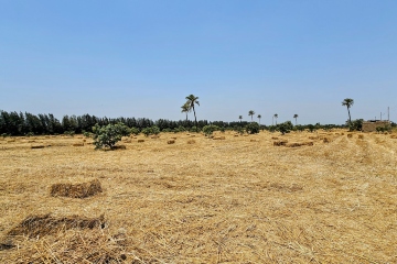
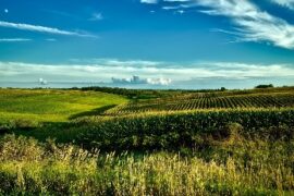
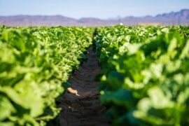
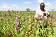
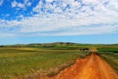
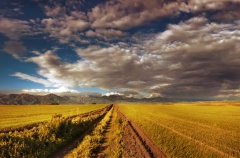
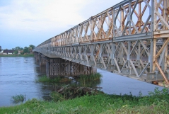
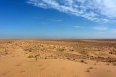
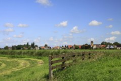
Meeting the food and fibre demands of a growing global population is a considerable challenge. To date, irrigated agriculture has been responsible for 40% of the total food and fiber production whilst using only 18% of world’s arable land (Schultz et al., 2009). Irrigation requirements, however, account for nearly 70% of the world’s total freshwater withdrawals (FAO, 2013) and have significantly altered hydrological and environmental conditions in both surface and subsurface water resources (Döll et al., 2009; Kirby et al., 2014; Restrepo and Kettner, 2012; Zeng and Cai, 2014). This has generated criticism and debate about the (un)sustainability of irrigated agriculture. Irrigation managers must often justify the use, efficiency and productivity of water in competition and comparison with other uses and users. The challenge is to enhance water allocation decisions to reduce negative environmental impacts, whilst continuing to satisfy food and fibred demands. Research and investments have been oriented towards applying cost effective technology, precision agriculture, and environmentally friendly techniques to pursue sustainable water use in agricultural development (Baumüller, 2018; Chuchra, 2016; Far and Rezaei-Moghaddam, 2018; King, 2017; Nikouei et al., 2012; Pareeth et al., 2019). Such a trend has been supported by several interlinked goals in the 2030 Agenda for Sustainable Development, in particular Sustainable Development Goal (SDG) 6: Ensure availability and sustainable water management; SDG 2: End hunger, achieve food security, improve nutrition and promote sustainable agriculture and SDG 13: Take action to combat climate change and its impacts. The big challenge is to improve local irrigated agriculture in order to achieve the interlinked SDG goals. The right balance between increasing agricultural production and reducing environmental impacts has to be implemented in order to safely maintain our water resources and satisfy growing food and fibred demands.
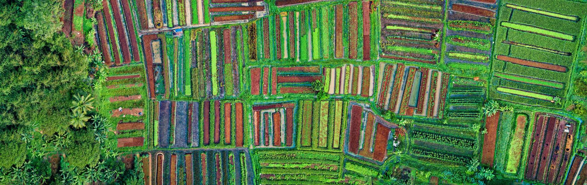
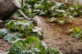
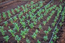
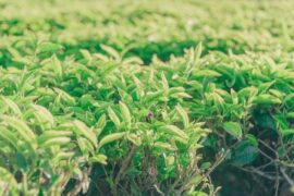
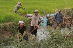
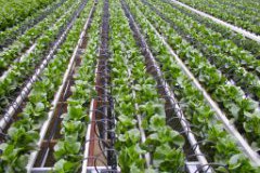
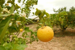
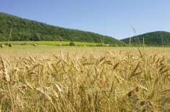
The agricultural sector aims to meet growing food demands whilst reducing associated water consumption, which is essential for regions coping with (severe) water scarcity. Both food production and water are integrated in the indicator ‘water productivity’ also commonly referred to as ‘water use efficiency’. This term provides information on the amount of agricultural production achieved with the water consumed through evapotranspiration. Water productivity is used as a performance indicator for various purposes, these include (amongst others): quantifying improvements made through implementing good practices; identifying locations of high water productivity; and determining the potential for improvement through yield gap analysis. The challenge for this rapidly growing field is 1) to develop high-quality spatial data on water productivity and 2) translate this information into practical applications for supporting the agricultural sector in their decision-making.
FutureWater approach
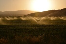
FutureWater aims to provide research and consultancy to help improve water resources management around the world through the application of novel tools and technology. Particularly in irrigation projects, the approach is to integrate hydro-meteorological datasets from ground stations and remote sensing, and simulations from hydrological and crop models to enhance the assessment of water availability and the demand placed on irrigated areas. Additional hydro-meteorological datasets from satellites and flying sensors are also used to support water allocation decisions and deliver timely water resource assessments in large regions, but also at farm level. Advice can therefore be provided on irrigation scheduling, crop suitability, and irrigation area planning based on impact scenarios considering climate variability and climate change. Thanks to the use of state-of-the-art geographical information systems and models, it is possible to obtain spatially distributed information for different levels of advice (e.g. farm level, irrigation district, or basin level). Through these tools FutureWater provides successful irrigation advice in many areas of the world, helping to contribute to achieving the SDG goals. These tools can also be employed for technical due diligence studies, assessing the agronomic and hydrological conditions of a particular site.
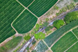
The approach adopted at FutureWater for calculating Water Productivity is through the integration of remote sensing imagery and crop modelling. Remote sensing imagery gives spatial observations of the surface, either obtained through satellite platforms or flying sensors (UAV’s). The type of imagery is selected depending on the required spatial resolution and temporal frequency of observations (time intervals). Subsequently, the imagery is combined with field observations and crop modelling to make a calculation of the crop yield, water balance, and ultimately water productivity. Supplemental to this approach, analyses are performed using open access databases providing spatial information on water productivity, water consumption, or land cover classification. Ultimately, results are presented for practical use such as in field or basin maps indicating the spatial variation, graphs and other illustrations for monitoring trends, or embedded in (smartphone/tablet) apps to aid farmer extension work. Water productivity as a monitoring tool and advisory service can be applied at different spatial scales and for various stakeholders: distribution over the agricultural areas in a river basin, SDG (6.4) monitoring at country scale, irrigation districts, commercial, and smallholder farmers.
Our Solutions

Satellite Remote Sensing
We use satellite data to track various environmental variables such as vegetation, rainfall and land surface temperature. This data helps understand water resources, identify trends and support decision making. Satellite images are combined with models to gain insight into the past, present and future availability of water. We apply this approach in projects focused on drought, ecosystem services and sustainable land management.
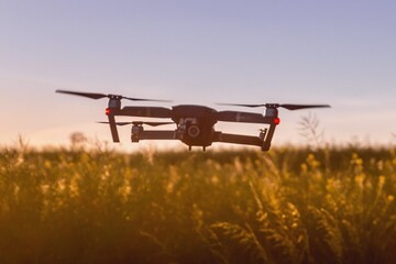
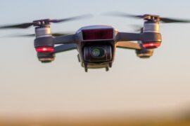
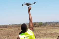
Flying Sensors
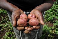
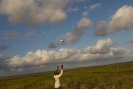
We provide farmers in developing countries with valuable information through affordable drones. These drones provide ultra-high resolution images that enable farmers to detect crop stress and make decisions about irrigation, fertilization and pesticides. This service currently operates in Kenya and Mozambique and uses local operators and agronomists.
Crop Growth Models
Crop growth models can be applied in different ways, depending on the underlying equations and the desired goal. We use models such as SWAP, SWAT and AquaCrop to predict crop development and growth. These models are enhanced by using satellite and drone data, resulting in more accurate assessments of crop development and water productivity.
Related projects
-
Safe Sowing Windows for Horticulture in Ghana
How do farmers know when to plant their seeds? In Europe, farmers rely on high-quality weather data to determine optimal planting dates. In Africa, however, weather stations are scarce, resulting in poor rainfall predictions. This is particularly problematic for farmers in tropical regions, where start of the rainy season determines...
-
BUCRA: Building Unity for Climate Resilient Agriculture
The BUCRA project empowers smallholder farmers in Egypt’s Nile Delta with climate-smart agricultural practices and advanced digital tools. Using FutureWater’s Croptimal and SOSIA, the project optimizes crop selection and irrigation efficiency, addressing water scarcity and climate change. Demonstration plots and tailored training drive sustainable, resilient farming.
-
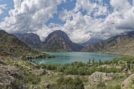
Water Allocation for Biodiversity Conservation in the Lower Amu Darya
The objective is to increase water supply to ecosystems upstream in the Amu Darya delta, upstream of the Aral Sea. The project consists of water allocation analysis and develop water supply scenarios for irrigated agriculture and biodiversity conservation, through consultations and water allocation modelling.
-

Climate Trends and Projections for Olive Production, Andalucia, Spain
The primary goal of this research is to examine the climatic changes projected for two key regions in Andalucia, Spain, which are deemed crucial for olive production. The study analyzes trends and future projections concerning rainfall, temperature, river flows, and evapotranspiration rates, discussing their potential impacts on both the micro...
-

Climate Resilient Assessment and Investment Analysis in the Limpopo Basin
The primary objective of this study is to undertake a review of the water resources development scenarios considered in the Limpopo Scoping Study (2010) and the Limpopo Monograph (2013), to produce updated future development scenarios and evaluate these in terms of social, economic, and environmental benefits, including improved climate resilience...
-
Capacity Building on Water Accounting Under the Water Scarcity Program for Asia-Pacific
Growing water scarcity continues to threaten the agricultural sector in Asia. In order to address this critical issue, FAO and partners have been developing a comprehensive Asia Pacific Water Scarcity Programme (WSP) since 2019. Under this program, a series of trainings on water accounting will be held in Indonesia, Vietnam...
-
SOSIA+: Climate Smart Irrigation Services in Ghana
Earlier this year FutureWater finished a very first draft of the irrigation advisory application SOSIA, with promising results in Rwanda and Zambia. The SOSIA Irrigation Advisory Tool was based on satellite data only. For this project, the SOSIA+ tool will be developed. SOSIA+ will also include real-time local ground data...
-
MAGDA: Meteorological Assimilation from Galileo and Drones for Agriculture
The MAGDA project aims at providing an integrated – but modular – system to provide severe weather forecasts and irrigation advisories enhanced by means of various satellite-borne, drone-borne and ground-based weather-observing technologies. The main applications will be in providing both warnings about severe weather that could affect crops and irrigation...
-
Strategic Climate Adaptation Planning for the Amu Darya Basin in Uzbekistan
Uzbekistan's water resources depend to a large extent on those provided by the transboundary Amu Darya river which are fully allocated and highly sensitive to climate change and water demand and management changes. Especially the agricultural sector, but also the energy and urban water supply sector need to transform into...
-
Capacity Building on Water Accounting in Pakistan
The Food and Agriculture Organization of the United Nations (FAO) in Pakistan has recently secured Green Climate Fund (GCF) funds for increasing the climate resilience of agriculture and water management in the Indus Basin. Given the region’s climate vulnerability, it is critical to improve information services and build the country’s...
-
SOS-Water: Water Resources System Safe Operating Space in a Changing Climate and Society
The SOS-Water Project endeavours to set out the boundaries within which the Earth’s capacity to provide life-support systems for humanity is not endangered, and humanity’s capacity to adapt to environmental changes is not overburdened. Crossing such thresholds or tipping points in the complex Earth system could result in abrupt and...
-
SOSIA: Small-Scale Open Source Satellite-based Irrigation Advice
FutureWater currently furthers the development of the SOSIA tool: an irrigation advice for small-scale food producers. Due to the lack of local weather station data, virtual weather stations derived from open-source satellite data are established, and combined with crop stage, and projected and historical precipitation data. The SOSIA tool allows...
-
BONEX: Boosting Nexus Framework Implementation in the Mediterranean
BONEX is a project funded by the PRIMA-EU Foundation specifically for the Mediterranean Region. This region faces several challenges to ensure future food and water security, whilst preserving ecosystems. BONEX explores and develops specific solutions promoting the linking of governance with practice to overcome barriers to WEFE (water, energy, food,...
-
Identification of Land Degradation and Climate Change Hotspots
This projects entails a risk assessment of selected value chains in the context of progressing climate change which is expected to impact on degradation processes in dryland agriculture over the next decades. A global-scale assessment of the potential impact of climate change on land degradation is performed. Per-country estimates of...
-
Follow the Water: Reuse of Water in Irrigated Systems
Reuse of water in irrigated systems is a key component in design and management of irrigation systems. FAO and FutureWater developed a Guidance document, a Tool and a Training package demand for a better understanding of the role of reuse of water in irrigated agriculture systems. Those outcomes will support...
-
Groundwater Recharge in the Campo de Cartagena Quaternary Aquifer
This project (1) provides a critical review of previous results generated, and a SWOT analysis of hydrological simulation tools used in the area. (2) improve and update the quantification of the main water balance components, including vertical and lateral fluxes, at the basin scale in recent times (2000-2020 period) through...
-
Training on Real Water Savings for FAO’s Regional Water Scarcity Program
The Regional Office for Asia and the Pacific (RAP) of the Food and Agriculture Organization of the United Nations (FAO) has recently secured funds to continue a program of training on ReWaS, which is a simple tool to estimate the potential for generating real water savings from various agronomic, water...
-

Water Risk Assessment for Private Farming in North Spain
This project aims to support a due diligence processs by reviewing and auditing water-related factors of risk for orchard fruit farming in including availibility and access, climate change impact, water quality, and potential conflicts and competence among water-demand users.
-
Tailor-made Training on Climate Smart Irrigation Strategies to Improve Salinity Control and Enhance Agricultural Production
This tailor-made training, funded by Nuffic and requested by the staff of the college of Agriculture of Basra University, aims to help mitigate soil and water salinization problems hampering agricultural production in Iraq. The training focuses on accessing and using innovative data and tools in the public domain, to gain...
-
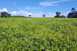
HiFarm: Data Driven Agricultural Intensification Pilot Program for Maize, Coffee and Tea Farmers in Kenya
The eco.business Fund, in partnership with FutureWater and Export Trading Group (ETG), one of the largest integrated agricultural supply chain managers and processors in sub-Saharan Africa, has launched a pilot project in Kenya for data-driven agricultural intensification. This project aims to improve farmer productivity and profitability whilst enhancing the environmental...
-
A Practical Farmers’ Toolkit – Geodata for Climate Smart Agriculture in Egypt
The 'Farmers Toolkit' as presented in this project contains various geodata tools applicable for farmers to assist their decision-making and adopt climate smart agricultural practices. This project launches a training program on these tools, which are: Flying Sensors, irrigation advisory services (IrriWatch portal), WaPOR and Google Earthengine Apps, and Climate...
-
Tailor-made Advice and Training on Flying Sensors for Agriculture in Jordan
This online training was provided over a period of 8 weeks for 25 participants selected by NARC (National Agricultural Research Centre) Jordan. The online training consisted of self-paced exercises and regular live (video) sessions provided through the OpenCourseWare website of IHE Delft. The four modules provided in this training will...
-
Cadastre Mapping with Flying Sensor Imagery in Mozambique
In this project TerraFirma hired FutureWater, HiView and ThirdEye Limitada (Chimoio, Mozambique) to acquire flying sensor imagery over a pilot area near Quelimane, Mozambique. The objective of this pilot project is to determine the suitability of using flying sensor imagery for cadastre mapping in an area of small-scale agriculture in...
-
WAT4CAM: Mekong-Bassac Hydrological and Hydraulic Study
The WAT4CAM program aims to apply IWRM and ISWM principles towards achieving the strategies of the government of Cambodia. This project (WAT4CAM subcompoment 3.1) supports this objective by performing a detailed hydraulic and hydrological modelling study, of which the outcomes will be used in the implementation of Prek rehabilitation works....
-
CAREC: Developing the Water Pillar for Central Asia
For the Central Asia Regional Economic Cooperation (CAREC) Program, a scoping study was commissioned to develop a framework for the Water Pillar: an investment vehicle for water infrastructure and capacity development that generate regional benefits. The objective of the study is to develop the scope of the Water Pillar Framework...
-
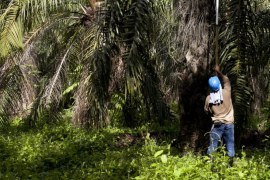
Efficient Irrigation of Oil Palms in Colombia
This is a feasibility study on the adoption of more efficient irrigation techniques by oil palm farmers in the Sevilla basin, one of the key basins in the Sierra Nevada, Colombia. The general objective is to identify the local environment at basin scale, the limiting factors and suitable field interventions...
-
Tailor-Made Training on Crop Models and Remote Sensing for Water Management in Agricultural Systems
FutureWater, HiView and ThirdEye Kenya have partnered with Egerton University (Crops, Horticulture & Soils Department) to conduct a tailor-made training on 'Crop models and remote sensing for water management in agricultural systems'. This training project is funded by the NUFFIC - TMT program.
-
Climate Risk Assessment of Irrigation and Drainage Modernization Projects
The ADB supports Tajikistan in modernizing tow Irrigation and Drainage projects in the Lower Vaksh river basin in Tajikistan. A holistic feasibility study and project design for the system (38,000 ha), as well as advanced designs and bidding documents for selected works are prepared. FutureWater prepares the Climate Risk and...
-
Transboundary water management between Thailand and Cambodia
Transboundary projects aid the development of effective water resource management (WRM) by helping to limit competition over resources and in creating a dialogue for the transferral of beneficial lessons between the countries. This project takes an integrated approach to support the development of a water resource management plan for a...
-
Detection of On-farm Reservoirs in Irrigated Areas
The detection of on-site farm reservoirs and ponds in large areas is a complex task that can be addressed through the combination of visual inspection of orthophotos and the application of automatic pixel classification algorithms. This analysis performs a general workflow based on the usage of a Random Forest classifier...
-
Climate Adaptive Water Resources Management in Uzbekistan
The project undertakes a long-term and knowledge-based approach to deliver climate adaptive solutions for water resources management in Uzbekistan. The purpose is to modernize outdated irrigation and drainage systems that are currently highly vulnerable to climate change and to changes in inter-state agreements on water resources sharing. For two areas,...
-
Incorporating Flying Sensors to Increase Agricultural Productivity in Central Mozambique
The PROMAC II project is an ongoing project of NCBA Clusa introducing conservation farming practices to various locations in the Manica, Tete and Zambezia provinces, with the objective to increase agricultural productivity. This project incorporates flying sensor activities in the PROMAC II project as a M&E indicator of the practices...
-
Mavo Diami: Services on Land-crop Suitability Mapping and Operational Irrigation Advice in Angola
The overall project goal is to improve sustainable food and income security for >100,000 smallholder farmers in Angola, by accelerating their agri-business performance through informed decisions supported by the Mavo Diami services built on weather, soil and crop signals and other relevant data and indicators. Ensuring the services are offered...
-
Training Package and Technical Guidance for Water Productivity and Real Water Savings
The overall project objective is to compile an inventory of agricultural field interventions and develop a training package to evaluate Real Water Savings from irrigated fields, to systems and basins. A guidance document is developed for agricultural field interventions by compiling a literature database containing published experiences and results of...
-
Water Resources and Eco-hydrological Assessments of Tonle Sap and Mekong Delta Basins
The overall project objective is to support MOWRAM to make more informed, evidence-based water resources management and irrigation investment decisions through better understanding of water resources and ecosystems of two river basin groups: the Tonle Sap and the Mekong Delta. The project concerns (i) rapid water resources assessment of the...
-
Satellite-based Monitoring of the Health Status of Grasslands at the Alagon Valley
This project is part of the technical-innovation support provided by FutureWater to ECOPRADERAS, an EIP-AGRI Operational Group which aims to improve the sustainable management of grasslands located at the Alagon Valley (Extremadura, Spain). Specific tasks included: the definition of a methodological framework for monitor the health of grasslands at the...
-
APSAN-Vale: Piloting Innovations to Increase Water Productivity and Food Security in Mozambique
The project has as its overall aim to increase climate resilient agricultural productivity and food security, with a specific objective to increase the water productivity and profitability of smallholder farmers in Mozambique, prioritizing small (family sector) farmers to increase food and nutritional security. This project will demonstrate what the best...
-
AgriSeasonal: Seasonal Climate Services for Agriculture
Future climatic and hydrologic conditions have significant impacts for selecting crops varieties, planning the growing season and ensuring water supply during the irrigation period. To the present day, monthly to yearly decisions in agriculture rely on past climate observations. This practice is going to fail more frequently in the context...
-
Climate Risk Assessment Using the Decision Tree Framework
The novel methodology that is piloted by the World Bank for assessing climate risks versus other risks on water resource projects, called the Decision Tree Framework (DTF), is applied to two two planned investments: (1) flood protection infrastructure and irrigated cropland expansion on the Nzoia river, Kenya; and (2) the...
-
SMART-WADI: SMART WAter Decisions for Iran
The SMART-WADI project (SMART Water Decisions for Iran), carried out by a consortium of FutureWater, IHE-Delft, and local partner EWERI, focuses on farmers who irrigate their crops with groundwater. The aim is to provide up-to-date information and advice on water productivity, irrigation and farm management. The project combines the latest...
-
Agricultural Water Consumption in the Australian Border Rivers Catchment
FutureWater was hired to use satellite-derived data to provide a preliminary spatiotemporal assessment of water consumption across the Border Rivers catchment, one of the MDB catchments where excessive agricultural water use is an urgent issue. For relevant specific lots / properties, monthly water consumption dynamics were evaluated. This study is...
-
Remote Sensing Course in Angola
The project "Knowledge-to-Knowledge" (K2K), aims to strengthen and enhance the capacity of the main Angolan knowledge institutions in agricultural sciences, to establish a strong relate between knowledge and practice. FutureWater collaborates with Wageningen University on giving a training on remote sensing and GIS techniques in agricultural applications and services to...
-
TWIGA: Transforming Weather Water data into value-added Information services for sustainable Growth in Africa
TWIGA aims to provide actionable geo-information on weather, water, and climate in Africa through innovative combinations of new in situ sensors and satellite-based geo-data. With the foreseen new services, TWIGA expects to reach twelve million people within the four years of the project, based on sustainable business models. The TWIGA...
-
Remote Sensing for Land Suitability Assessment in Angola
The government of Angola considers the agricultural sector as an economic sector that offers great prospects and therefore aims to further develop the agricultural sector in order to diversify its economy. The potential for expanding the area under production is great. To support the effective planning of interventions that increase...
-

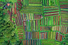
Water Productivity mapping using Flying Sensors and Crop Modeling
The objective of this pilot study was to achieve plot-level maps of water productivity and yield to test a methodology to assess the performance of different farmers in order to provide them with recommendations to improve water productivity. More specifically, this pilot study combined high-resolution imagery from Flying Sensors with...
-
Climate Risk and Vulnerability Assessment of Irrigation in Kazakhstan
The government of Kazakhstan with financial support of the Asian Development Bank (ADB) is planning to upgrade and rehabilitate its irrigation sector. A detailed Climate Risk and Vulnerability Assessment (CRVA) has been undertaken by a consortium led by FutureWater in 2017. The team collected all available data on the project...
-
DAISY2: Daring Applications and Innovations in Sensor sYstems
DAISY2 builds on the success of the DAISY project in which a compact and mobile sensor system was developed aimed at different socio-economic applications like e.g. security, life-sciences, transport, logistics, and agro-food. Within DAISY2 we aim to further develop this sensor system and explore the viability of this products for...
-
BRIGAID: BRIdging the GAp for Innovations in Disaster resilience
BRIGAID (BRIdges the GAp for Innovations in Disaster resilience) aims at developing a new tools to bring climate adaptive innovations to the market. FutureWater contributes in two ways: it coordinates the work package on Droughts which performs and extensive stocktaking, testing, and business development process for a large number of...
-
IMPREX: IMproving PRedictions and management of hydrological EXtremes
FutureWater leads the coordination of the “Agriculture and Drought” sectoral Work Package of IMPREX. This WP specifically aims to study and evaluate the use of IMPREX weather forecasts and predictions, climate variability, and drought indicators to assess agricultural drought risk and impacts over four case studies and at the pan-European...
-
Water Resources Model for the Kenate Basin in South-Sudan
As there is an urgent need for informed decision making in ongoing and upcoming land and water resource development plans, the governments of South Sudan and the Netherlands (GoN) initiated a program for the Water Sector in Eastern Equatoria State (ProWasEES). The overall objective of this program is that “Kenate...
-
CITRUSFLUX: Water and carbon balances in irrigated Citrus agrosystems
During 5 years, the Agroforestry Engineering department of the Polytechnic University of Cartagena (UPCT) measured the water and carbon fluxes in three Citrus commercial farms located in the Campo de Cartagena (Murcia, Spain) using a combination of field and Eddy-covariance measurements and satellite observations. FutureWater supported this project and carried...
-
Inclusive Development Paths for Healthy Red River Landscapes
Rapid land use changes in the Red River Basin threaten water resources. This project will be working in the Day River Catchment, a Red River distributary important for Hanoi, where most of these problems are manifest. The project will develop equitable and economically viable pathways for the land and water...
-
Fresh Water Options Optimization
This project identified opportunities for innovative solutions that decrease local fresh water shortages in economic vulnerable regions under increasing water stress (droughts, salinization). The project demonstrated the business potential of fresh water solutions for a case study area with intensive agriculture within the Valencia region, Spain. FutureWater’s role in this...
-
ThirdEye: Flying Sensors to Support Farmers’ Decision Making
The ThirdEye project supports farmers in Mozambique and Kenya with their decision making in farm and crop management by setting up a network of flying sensors operators. Our innovation is a major transformation in farmers’ decision making regarding the application of limited resources such as water, seeds, fertilizer and labor....
-
Online field-scale irrigation management for Romania
In this project a field-scale irrigation planning and management system was setup and tested. The basis for this system is formed by online in-situ ground data on soil moisture content and hydrological model calculations of the root zone and shallow subsoil. Weather stations and soil moisture sensors were installed at...
-
Water Planning Tools to Support Water Governance
ARA-Centro is one of the five regional water management organizations in Mozambique and has to advise on the water availability and the required number of reservoirs that are needed to make the envisioned economic developments possible. For this advisory role, tools are needed like a water allocation model that can...
-
Review of the First Hydroponic Greenhouses Project at Barka, Oman
In 2012 two Spanish agricultural companies were developing a 12-hectare hydroponic greenhouse project in Barka, Oman. Specific expertise on greenhouses of the FutureWater team was required to review the technical design specifications of the greenhouses. The work highlighted the strong and weaker points of the technical document and suggested modifications...
-
Green Water Credits demonstration project Algeria
In cooperation with Algerian partners the “La Mina” basin was selected to demonstrate the potential for Green Water Credits (GWC) in Algeria. GWC can be seen as an investment mechanism for upstream farmers to practice soil and water management activities that generate benefits for downstream water users, which are currently...
-
High-resolution versus coarse-resolution remote sensing images in crop yield forecasting
The objective of this project was to evaluate the added value of high-resolution above coarse-resolution remote sensing images in crop yield forecasting. This is especially relevant if the focus is on small-scale farming where the distribution of crop types is often extremely heterogeneous. For this study the Soil-Water-Atmosphere-Plant (SWAP) model...
-
Assessing the effects of farm-level irrigation modernization on water availability and crop yields
Egypt is modernizing its irrigation systems and management practices from supply-based to demand-based irrigation water supply. The expected result is that farmers will take in less irrigation water, as they are assured that water is continuously available. During this project, the consequence of changing from supply-based irrigation to demand-based irrigation...
-
Mainstream Climate Change Adaptation and Mitigation Into Agriculture in the Southern Caucasus
This study contributes to the agriculture sector climate change impact assessment and adaptation and mitigation strategy identification and evaluation. The study encompasses the three countries of the Southern Caucasus region: Armenia, Azerbaijan, and Georgia. The project also includes components for capacity building among in-country staff, and support of the World...
-
DAISY: Daring Applications & Innovations in sensor SYstems
This project aimed at the development of a new sensor system, to be built by the end of 2014. This development process was run parallel to the exploration of new applications in the field of agribusiness, food business, and the environment that become possible through the new sensor system. The...
-
SIRRIMED: Sustainable Use of Irrigation Water in the Mediterranean Region
SIRRIMED project addressed issues related to sustainable use of water in Mediterranean irrigated agricultural systems, with the overall aim of optimizing irrigation water use. In this project FutureWater was actively involved in the development of a District Information System (DIS) and a Watershed Information System (WIS) for the Campo de...
-
Assessment of the Irrigation Potential in Nile Countries in Central Africa
In order to fill gaps in the Nile Basin Initiative and member country information bases on agricultural water use the irrigation potential of seven Nile countries was assessed. This project consisted of several consecutive steps, in which hydrological modelling, the use of remote sensed data, ArcGIS analyses, consultation workshops and...
-
REDSIM: Farm information and advisory systems for deficit irrigation management
REDSIM was a pilot project carried out within the framework of the “Halting Desertification in Europe” program of the European Commission. REDSIM addressed the topics “Water savings/water efficiency measures’ and ‘alternative forms of irrigation’. The full project title is “Remote-sensing based DSS for Sustainable drought-adapted Irrigation Management” (REDSIM). The target...
-
Impacts of Global Climate Change on the Water Resources of the Bunyala plains, Kenya
In this project an Integrated Water Resource Management Planning Tool for improved planning and management of sustainable food and sustainable livelihoods for the Bunyala flood plains of western Kenya was developed together with training materials for technical support in the maintenance and implementation of the planning tool and the facilitation...
-
Scenario Based Water Resources Model to Support Policy Making
Appropriate planning in water resources, and more specifically in irrigation, is becoming increasingly important. However, policy makers and planners are often constrained by insufficient knowledge and tools to evaluate the consequences of alternative interventions. To illuminate these issues, a scenario-based policy oriented demonstration model was developed. The model focuses on...
-
Irrigation Potential Lake Victoria, Tanzania
A study was undertaken to evaluate and rank five potential irrigation schemes in the Tanzania part of the Lake Victoria Basin. The study focused on the following five thematic areas: (i) land suitability, (ii) water resources assessment, (iii) water requirements, (iv) environmental considerations, and (v) institutional aspects.
-
Remote Sensing and Hydrological Modelling of the Rio Bravo, Aguascalientes and Central Northern Valleys
The project has shown how modern analytical tools such Remote Sensing, GIS and simulation models can help to swiftly obtain data to support the water management decision making process. A diagnosis of the Rio Bravo and Northern Central Aquifers has been made to demonstrate management options as well as how...
-
Adaptation to Climate Change for Agriculture in The Gambia
Methodology Development of adaptation benefit-cost framework: The framework was developed in a manner to make it possible to isolate development- and climate-related benefits and costs of individual projects and to assess the sensitivity of adaptation benefits and costs to the uncertainty inherent in regional climate change scenarios. Development of analytical tools and procedures: The project...